Last year I set out to complete the John Muir Trail (JMT) with a twist. I’d hike it barefoot. Why? Barefoot is simple. Natural. Intense. Every step is an adventure. But the terrain was more difficult than I expected. Out of the JMT’s total distance of 211 miles, I completed 150 miles barefoot, or about 70%.
This year I came back determined to do the whole thing.
The following is an account of what happened, written with three audiences in mind. First, of course, hardcore barefoot hikers looking for a challenge. Second, conventional hikers. Presumably these people do not wear boots to the beach, so therefore I thought they might enjoy going barefoot where the trails are soft and sandy, putting on shoes when rocks appear. Call it a hybrid approach. Third, I had in mind the woman I encountered last year, descending from Donahue Pass (11,066 feet). She said her feet were so sensitive she couldn’t tolerate going barefoot in the bathroom. She won’t try it, but I thought she might be curious what it’s like.
Day 1 – August 6
I’m striding briskly along the gray sandy trail, carrying on a spirited conversation with a bootshod hiker a few steps ahead. The sand is fine-grained granite dust, soft as silk. Then we hit a patch of gravel and I lag behind. Later I catch up, when he stops to set up camp. It’s late afternoon, and the fierce Sierra sun has swung low in the sky. I’ve taken off my sunshirt to enjoy the breeze across chest and shoulders. He laughs — “No shoes, no shirt, no service!”
I started on the JMT from Red’s Meadow, heading south. 12.8 miles in 8 hours. A good start. (Went to bed early.)
Day 2 – August 7
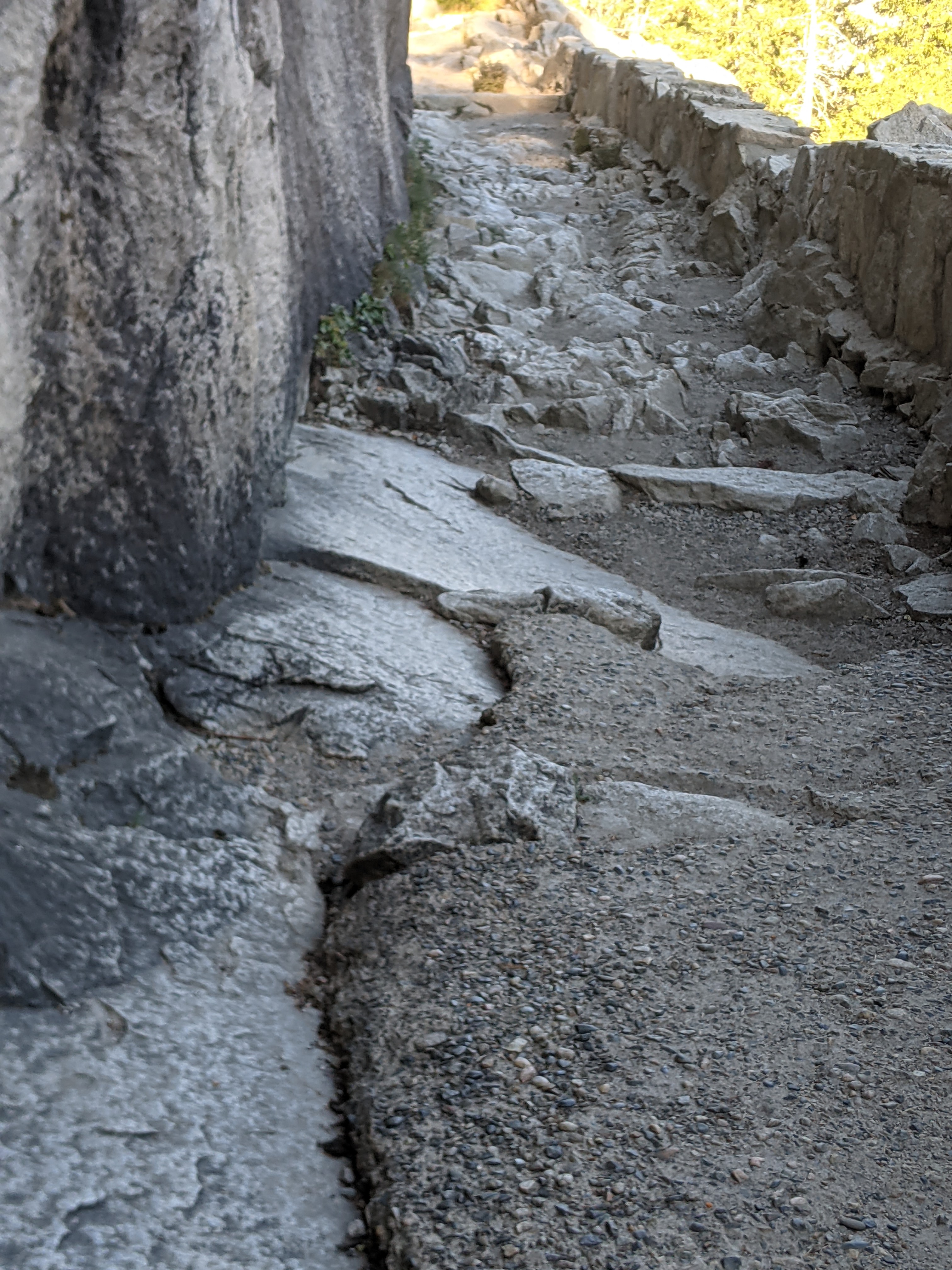
A terrible day. The terrain changed abruptly, from sand to non-stop gravel, stones, rocky shards, fragments of meta-volcanic debris. Which I somehow didn’t remember from last year. Another problem — to keep my pack weight to a minimum, I set off without carrying water (1/2 liter weighs 1.1 pounds). The map showed plenty of streams and lakes along the way, but somehow I walk past them. One lake is too far off trail, and I can’t be bothered. Another is not quite where I expected and somehow I pass by unseeing. Now it’s the heat of the day. It’s like an oven. I haven’t had a sip of water in hours. The trail is burning hot underfoot. So many rocks. Am practically in tears.
11.3 miles. Took. All. Day.
Day 3 – August 8
I encounter three young women hiking together. They mention a hiker named Bubbles, whom they saw walking barefoot. Bubbles told them she met a barefoot hiker, who said it was like walking on the beach. She wanted to try that.
I guess that was me.
Bubbles, I want to know — what did you think?
11.4 miles. 3 miles ahead of plan.
Day 4 – August 9
Last year it was the descent from Senger Creek to Muir Trail Ranch that broke me. A steep slope with a southern aspect, which means it gets the full brunt of the midday sun. A mix of hot sand, with plenty of gravel and rocky fragments. The slope’s covered in manzanita brush, with few trees, and very little shade. I made it part way down, but it was too slow, too painful — I gave up and pulled on shoes.
This time, however, I know what to expect. I move patiently down the switchbacks, making it from one tree (and spot of shade) to the next. Taking plenty of breaks to cool my feet. Finally reach an intersection, where the trail enters a dusty forest of ponderosa and juniper. I’m excited to be near the end! Then the path plunges down a cascade of broken rocks. The torture will not end. I reach Muir Trail Ranch at 5:30 pm, wore out.
Along the way, I met Hippy Chick and Party Girl, who took my picture. Then Dan from Phoenix who’s into ultra’s and Ironmen triathlons. Camped next to Trinia and Dave, who stayed up late reading The Hobbit.
10 miles — a short day. But what a triumph to overcome the obstacle that defeated me last year.
Day 5 — August 10
Last year I’d flown up the switchbacks to Evolution Basin, barely noticing the steep climb (I’d been wearing shoes). This year, barefoot, the climb is a challenge. I know the trail will cross Evolution Creek. But it takes forever to get there. Once again I’m out of water and broiling under the noonday sun.
Up top, finally, I encounter Matt from San Jose. Matt tells me he used to go barefoot. He would hike all over Yosemite without shoes. Until one day he hurt his heel in a climbing accident. Since then, he’s worn shoes with orthotic inserts. Matt pauses and looks me in the eye, as if anticipating a question (before the thought even occurs to me) — “I guess I conformed.”
11.4 miles.
Day 6 – August 11
This will be a short day. My strategy is to get in position below the John Muir Pass. I’ll cross it early tomorrow morning. I recall this pass from last year — endless piles of rocks with splashes of red and orange — churning gray skies — then thunder and bits of hail — and a steep descent through psychedelic volcanic debris.
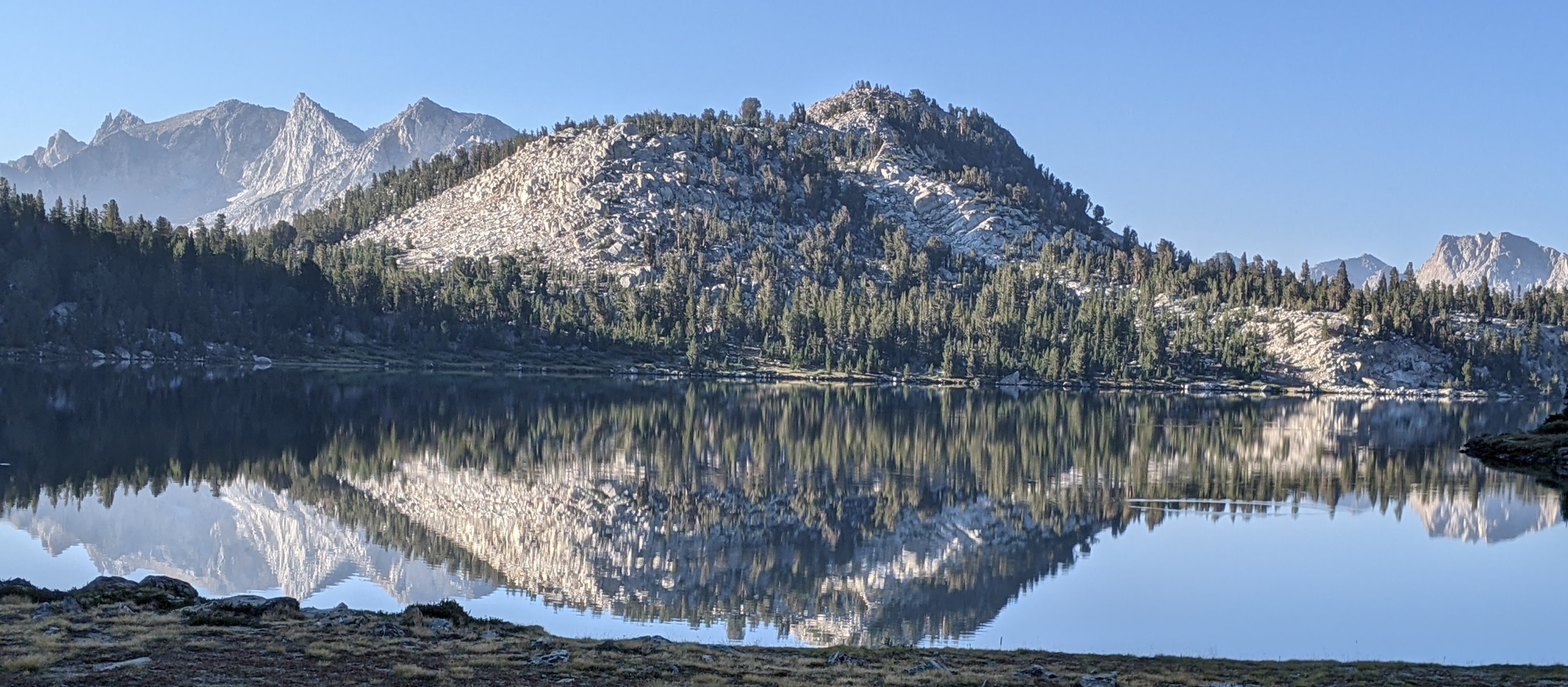
But that’s tomorrow’s business. Today I’m walking through a lovely basin with soothing creek and meadows glowing green and gold under mellow skies. I pass Evolution Lake and become captivated by the deep blue color in the center and the rippling translucent water along the shore. A sudden thought — could the Greeks have gotten Narcissus wrong? They thought he fell in love with his image, reflected in a pool. But let’s be honest — didn’t all the Greeks love their images? They sculpted the naked human body with such care, competed in the nude, celebrated the heroic in their myths, articulated the importance of the self in their philosophies. Maybe Narcissus was not a narcissist. Maybe he was enchanted by an alpine tarn. Maybe he fell in love with the colors of nature.
I camp at Lake Wanda, named for one of Muir’s daughters. To the south, an ominous sharp-edged slanting peak, which looks like a boxer’s busted nose, with a face as dark as night. This is the Black Giant, which guards the far side of Muir Pass.
8.7 miles. Tomorrow will be make-or-break.
Day 7 – August 12
I strike camp at 2:00 am. I brought a lightweight headlamp, which saved me 3 ounces compared to a more durable light, but it isn’t very bright — I hold it in my hand so it’s beam can reach the ground. Even so it’s hard to see the path. I creep along. I reach the the top at 4:00 am. There’s a stone hut here, built to offer refuge for travelers caught in storms. I pan my feeble light around. Someone forgot to latch the door.
On the descent, the trail is filled with fist-sized “rock cobbles.” I place each step with care, aiming ball of foot or heel at flat surfaces.
The descent becomes more difficult as the sun rises and heats the trail. The cobbles are gone, but the trail is full of gravel (unavoidable sharp jabs).
I stop at 5 pm, with 10 miles complete. This has been a long day. But how nice to get Muir Pass done.
Day 8 – August 13
An easier day, with progress more fluid, and a mix of conditions. A long steep rocky climb into the Palisade Basin, up the Golden Staircase, and once again without water, but mercifully some cloudy haze shields me from the sun. Once up top, it takes forever to reach Palisade Lake. Then I find I’ve misread the map — my campsite is not along the shore, but half-way up a mountain wall. Thunder sounds in the next valley over. There’s a spatter of rain. I pull on Goretex, study the map, scan the steep barren slope. Another peal of thunder. Nearly at wits’ end, I stumble upon a seep, filter the dripping water into a bottle, set up tent.
A wrangler comes by leading a pack of horses, warns me they’ll come back this way during the middle of the night. They are so graceful, jogging easily over the rocky trail.
Day 9 — August 14
It’s 3 or 4 am. The horses come trotting by, bells jangling.
On the long climb to Mather Pass, I encounter three women who appear to be in their early sixties. They want to know what happened to my shoes.
“Do you want to know the real honest truth — no lie?” They nod.
“I took off my shoes while eating lunch, and when I looked up a bear cub had grabbed them and was running off. I was chasing it up the path, swinging my trekking pole over my head, when it’s mom appeared — as a big as house. So I let the cub keep my shoes.”
They seem to accept this explanation. Although one of the women gives me a strange look. Later on she offers me a pair of neoprene water socks to protect my naked feet, which I decline. I look in her face and see pain. She is an experienced hiker (she is careful to point out), and has trained diligently for this trek, but for whatever reason her feet have developed terrible blisters. She has to dress them morning and night. She can’t wait for the JMT to end.
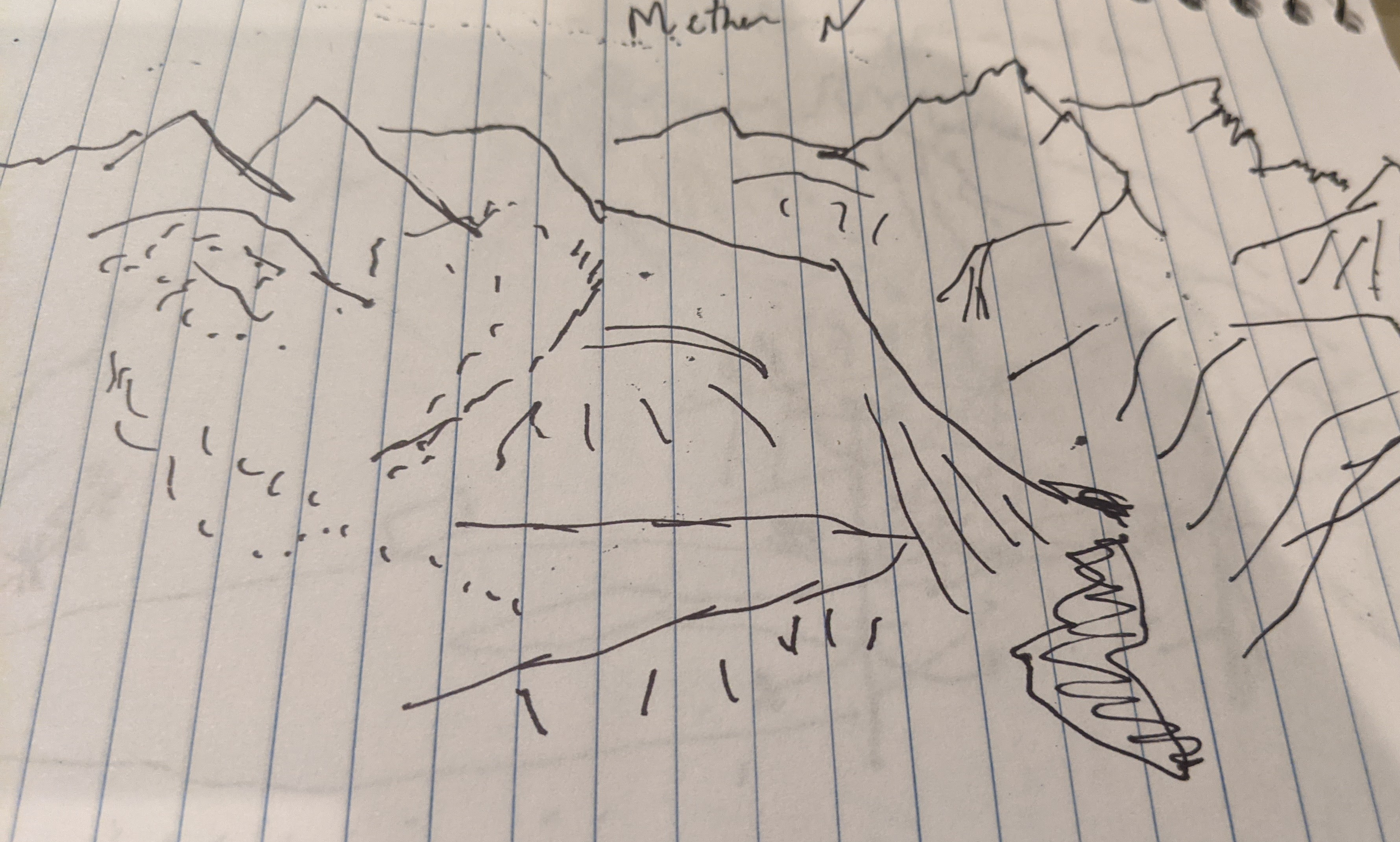
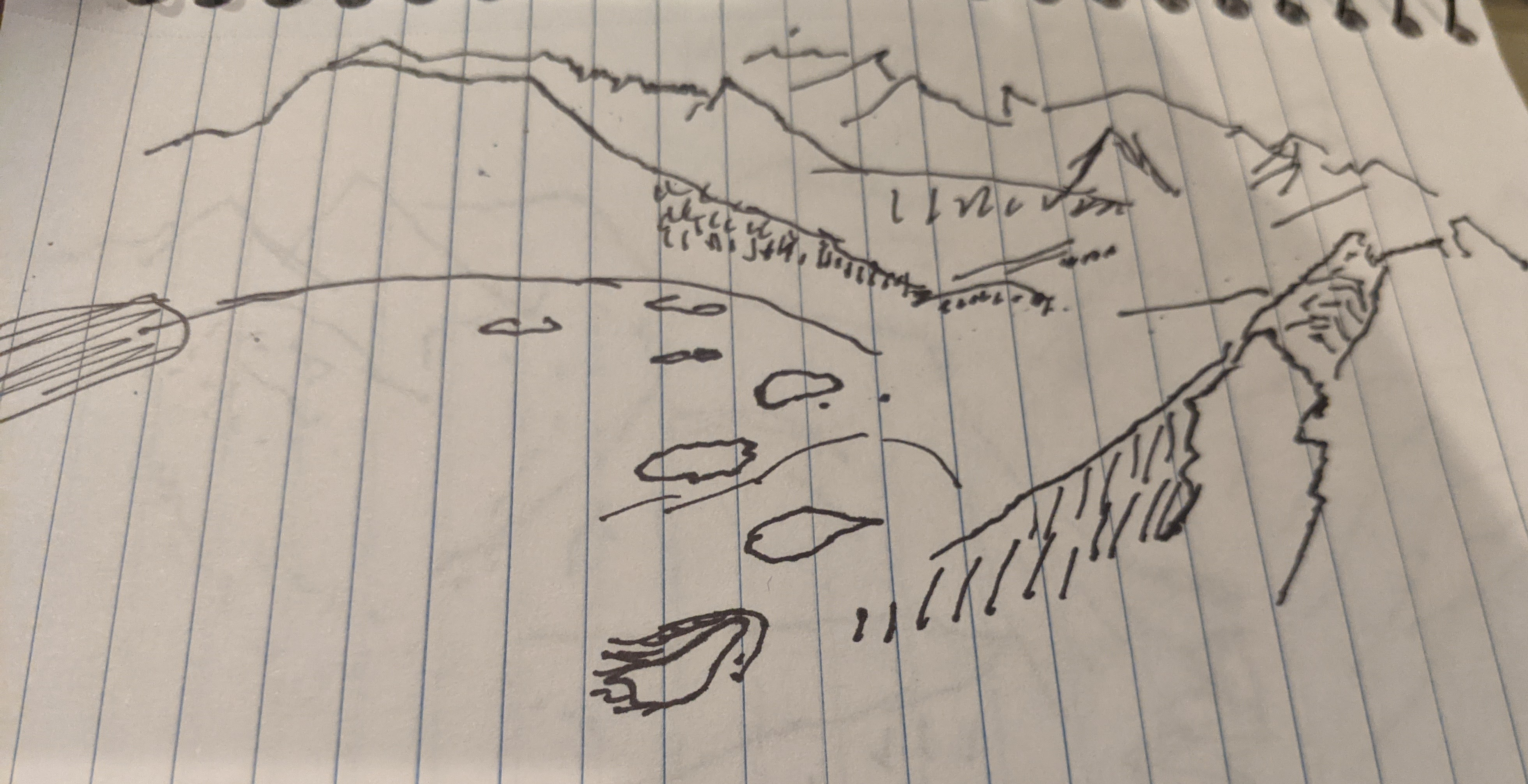
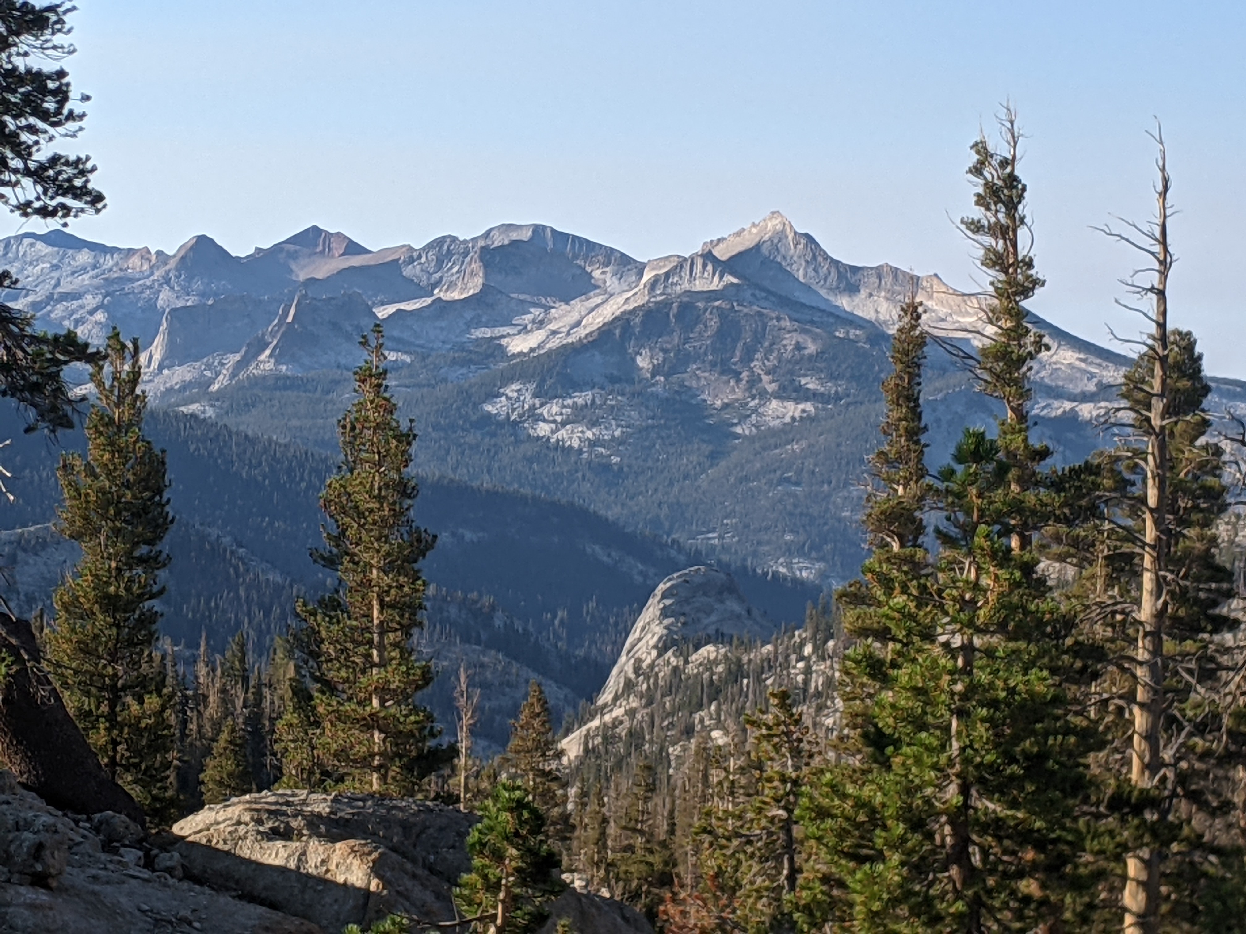
Mather Pass seems like a harder climb than last year, but the views are just as beautiful as I remember. Did I mention my phone died? I carry an extra battery pack, but in the last-minute chaos of getting ready, I brought the wrong cable. So at the top of the pass, instead of taking a thousand pictures, I make a sketch with a Sharpie pen. So many crenellated ridges, so much talus spilling down into deep canons. So many colors — of granite in gray and beige and volcanic rocks in red, green, black, and ocher — of pine forests shading into dusty slate — of cold deep lakes shining navy blue and shallow tarns glowing like emeralds.

Day 10 — August 15
The climb seemed like it would never end, but eventually I made it up Pinchot Pass. While hanging out at the top, I saw some runners and overheard them talking with a hiker. One of the runners said he was trying to complete a fastest-known-time. I watched him and a pacer trotting down the switchbacks and heading off into the distance. They looked quite strong. Afterwards, I read that Rod Farvard successfully ran the trail from north to south in a new record of 3 days and 10 hours.
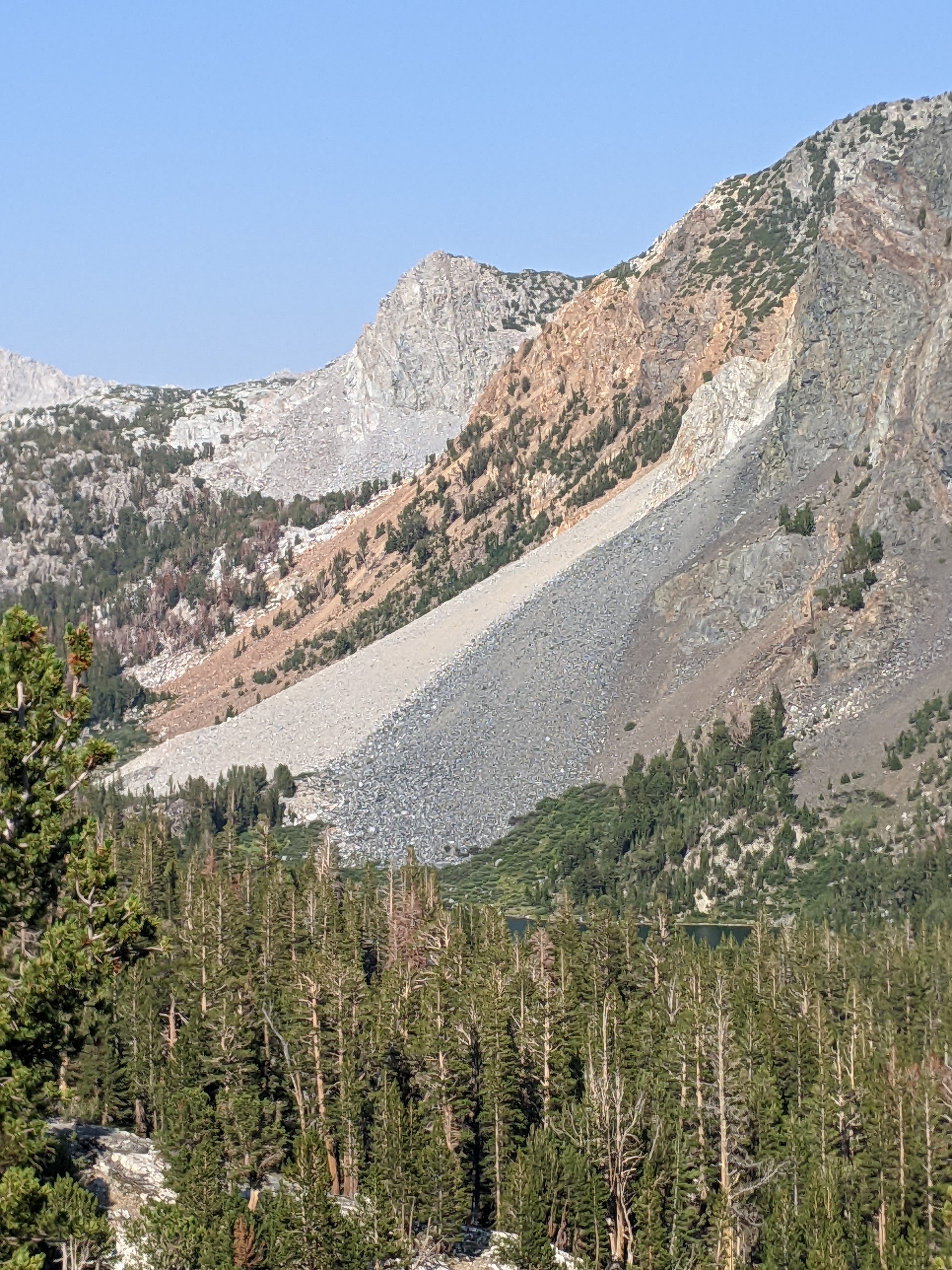
Then it was time for me to descend. After a series of switchbacks, the trail proceeded into a wide basin that was totally exposed — no trees at all. The sand was hot and full of gravel, and so was the crusty black dirt and yellowed grass on either side. It was rocky everywhere. There was no choice but to limp forward, one baby step at a time. I could feel my face twisting into a grimace. Made it all of 6 miles before giving up, and now I’ve fallen behind plan, which means my goal is at risk.
Day 11 — August 16
Up early, on the trail at 5:45 am, determined to make up lost ground. The trails are easier, and I’m making good progress, until I realize I’ve left my map by the side of a creek where I stopped to filter water (I took it out of my pocket to prevent it getting wet). I drop pack, grab shoes, run back 1.5 miles to retrieve it. Today’s total was 12.5 miles, or 15.5 miles, if you include the extra back-and-forth. I am still behind plan.
Along the way I see Matt again. He was hiking with a friend, but they’ve become separated. After heading out alone, the friend did not show up at their agreed-upon meeting point. Matt is hiking to the nearest ranger station, to make sure someone knows.
Day 12 — August 17
1:00 am. A desperate early start.
I see lights in the distance. They are stars reflecting in a lake. Although whether the water is 3 feet below the trail or 300, is hard to tell.
I worry about getting turned around. With no visible reference points, and with my GPS-enabled phone out of batteries, there’s no way to be sure I’m heading the right way. To stay oriented I keep my eye on a bright orange star hanging above the horizon. (Probably Jupiter, according to an astronomer I happen to meet the next day.)
The climb to Glen Pass is full of big granite steps and rock cobbles. When barefoot, every step must be precise. No lunging, stumbling, or wavering can be tolerated. The big steps are tough on my knees, so I focus on alignment. Climbing with perfect form minimizes stress on feet and joints, but it’s hard work.
It’s 5:00 am and a sudden wave of hunger brings me to a halt. I wolf down beef jerky, pistachios, dried apricots. I have instant oatmeal, but am finding I can no longer stomach the taste or smell or texture of this highly-processed stuff.
Dawn breaks. I’m at the top. Below me, a narrow col filled with a flat gray pond. It looks like a giant toilet bowl. Or maybe a giant blender, where granite chunks roll down, splash into the water, get tumbled round until the rock is ground into fine gray dust.
I stumble down the far side, hardly able to walk. Here is Matt again. He’s filed a report with the ranger. There’s nothing else to do. He encourages me to stick with my quest. And disappears down the trail.
There’s a steep 500-foot descent to the level of the lake. I breathe a sigh of relief as I totter down and reach this point. Then discover there’s another 1,000 feet to go. The clock is ticking. I am behind plan and falling further back with every passing minute. And hardly moving.
I’ve set a time hack of 11:00 am to reach the bottom of the valley, otherwise I won’t make my resupply, and then the whole plan will unravel. The time hack comes and goes. I reach into the bottom of my pack for the shoes, and so ends the southern part of my trek.
It was disappointing once again to fail, but I learned something valuable. When I finally put on shoes, I still struggled, because my quads were so tired from the ascent. For barefoot hiking, muscle strength is just as important as the toughness of your soles. Next time my training plan will include more climbing.
In any case, at this point I decided to cut my southern trek short, instead of continuing on to Mt. Whitney. This decision gave me a few extra days to recover (from 100+ miles of barefoot hiking), and also to check in on work, family, and other obligations.
Then I returned to the trail for the northern part of my trek. Even if I would not complete the JMT barefoot, I could still do more than last year.
Day 13 — August 26
Over Mammoth Mountain and back to Red’s Meadow, this time heading north. When I started out this morning, the sandy trail was frigid underfoot (car thermometer read 45 F when I parked at 6:30 am). My soles ached until the sun was high enough to heat the path.
Along the way I met a woman who was interested in “mindful walking.” She said she tried to teach her son to walk carefully — pretend you’re barefoot, she told him.
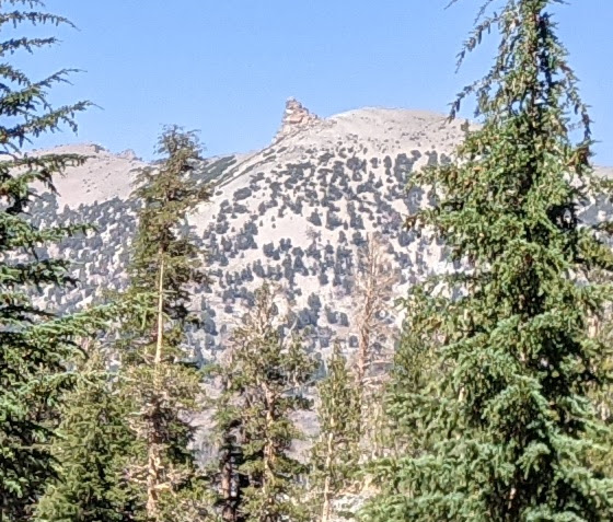
In the distance all day a mountain peak with a rocky protuberance by the summit. On the map it’s “Two Teats.”
Soft sandy trails make a difference — 16 miles!
Day 14 — August 27
“Take it slow and easy.” That’s what I wrote in my notebook the night before, remembering that this section of the trail is full of meta-volcanic fragments — dark-colored, sharp-edged rocks that spill across the trail, the remnants of volcanic flows that were subsequently metamorphized into brittle stone. I thought I could make it 13.5 miles through this terrain. Bad call.
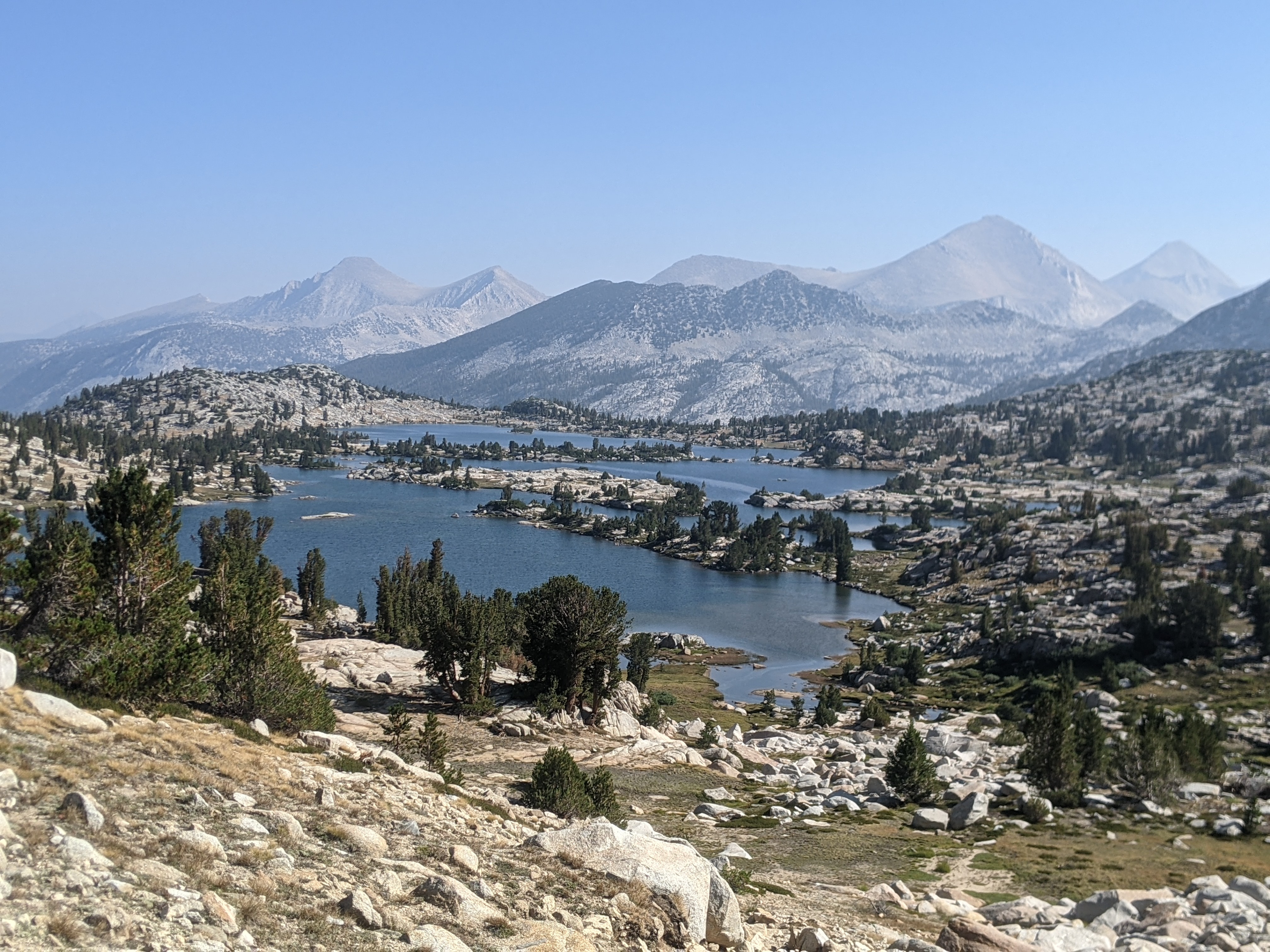
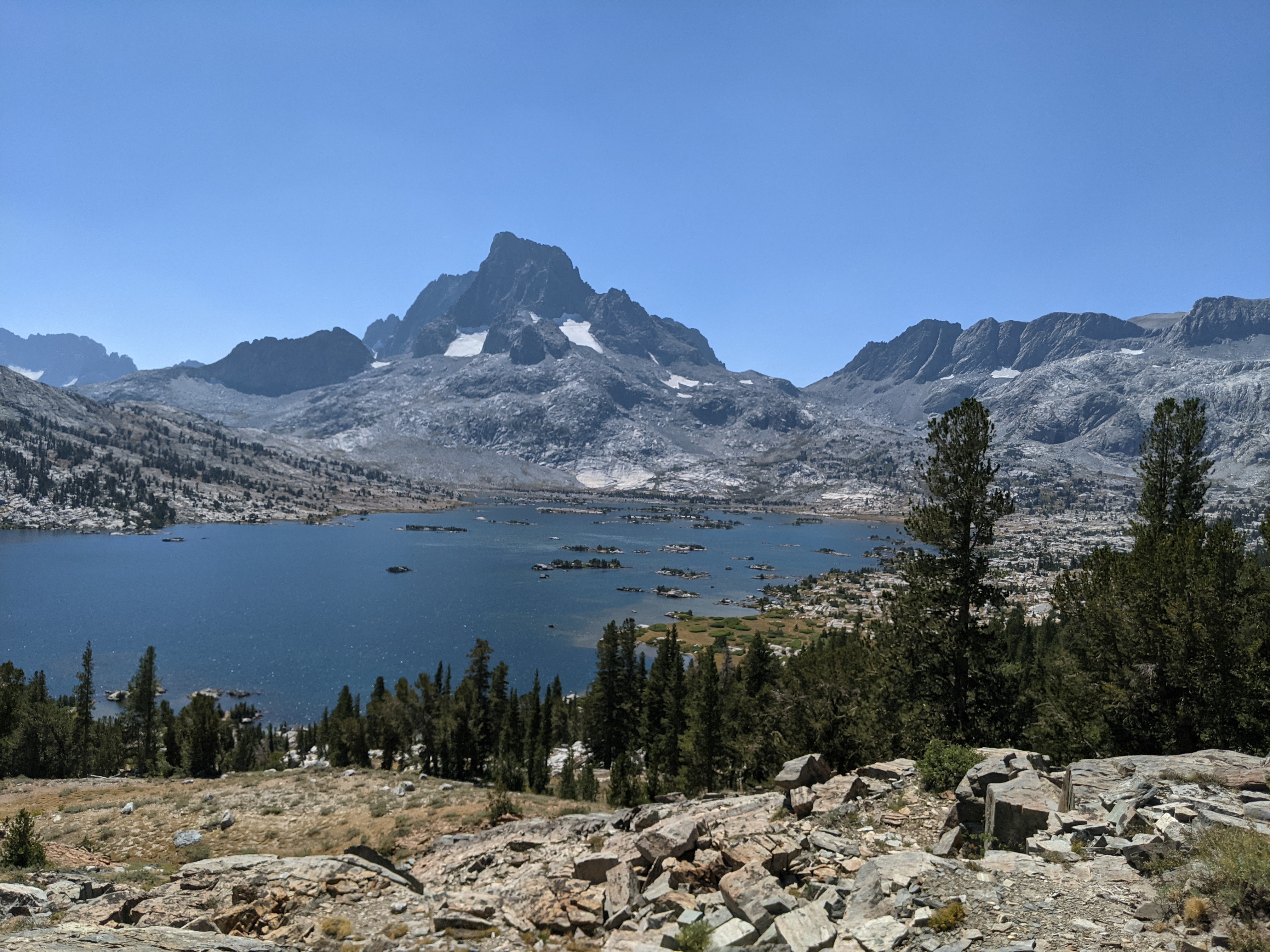
It’s a pretty area, though, with Garnet and Thousand Island Lakes lying at the base of Banner Peak and Mt. Ritter. Like giant reflecting pools beneath a monument or palace. Zen Master Dogen wrote that “All mountains ride on clouds and walk in the sky….All mountains walk with their toes in all waters and splash there.” I guess there are similar alpine scenes in Japan.
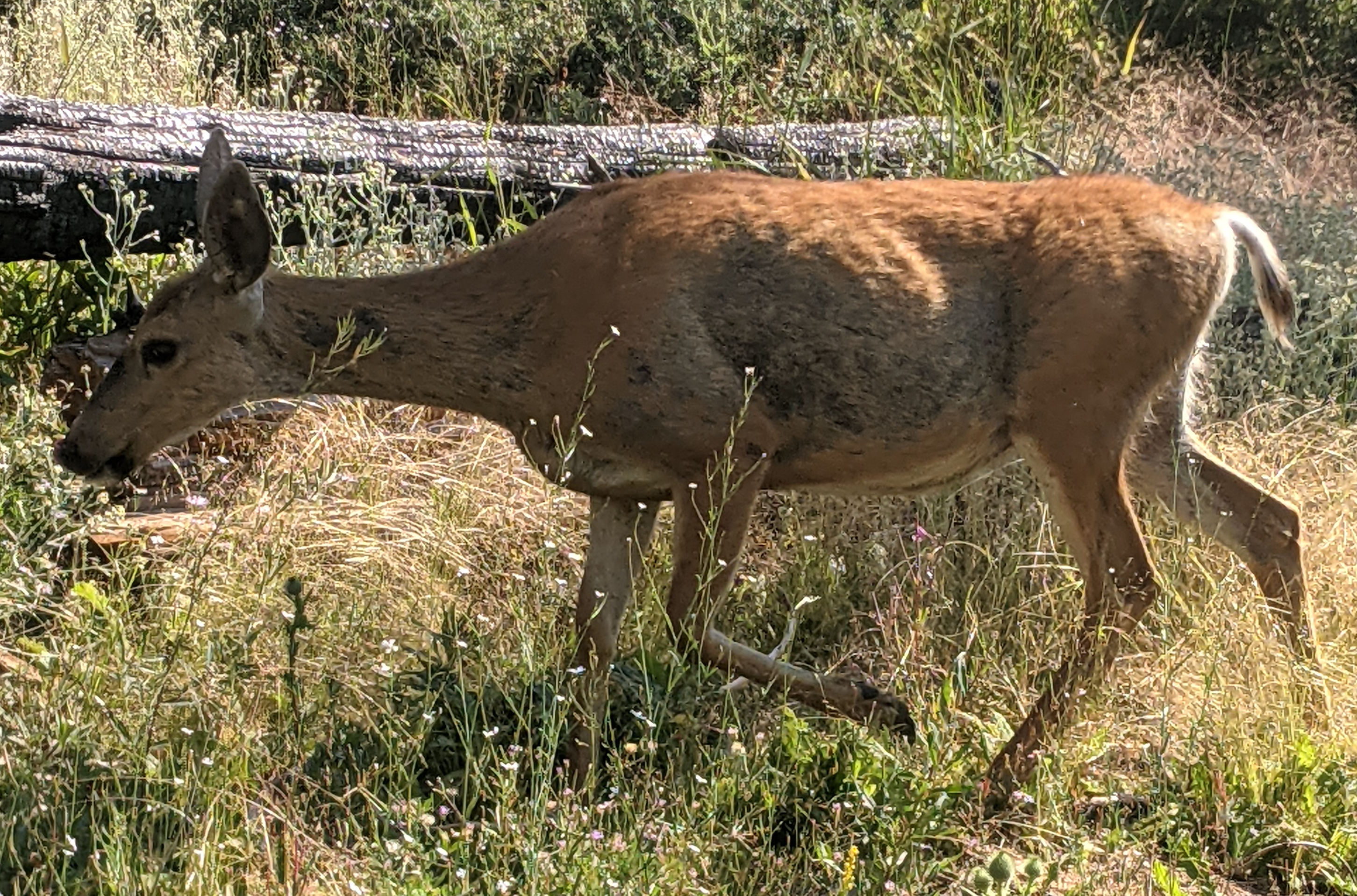
At one point during the day I see a black bear cub standing a short distance off the trail, staring lazily. Later on, a coyote comes trotting down the slope, the size and color of a German Shepherd, with ears pricked. A small black and white bird flies off, revealing a bright yellow spot on its rump. I suppose this is the yellow-rumped warbler (Setophaga coronata). A rotund bird with red chest hopping along the ground is unmistakably a robin.
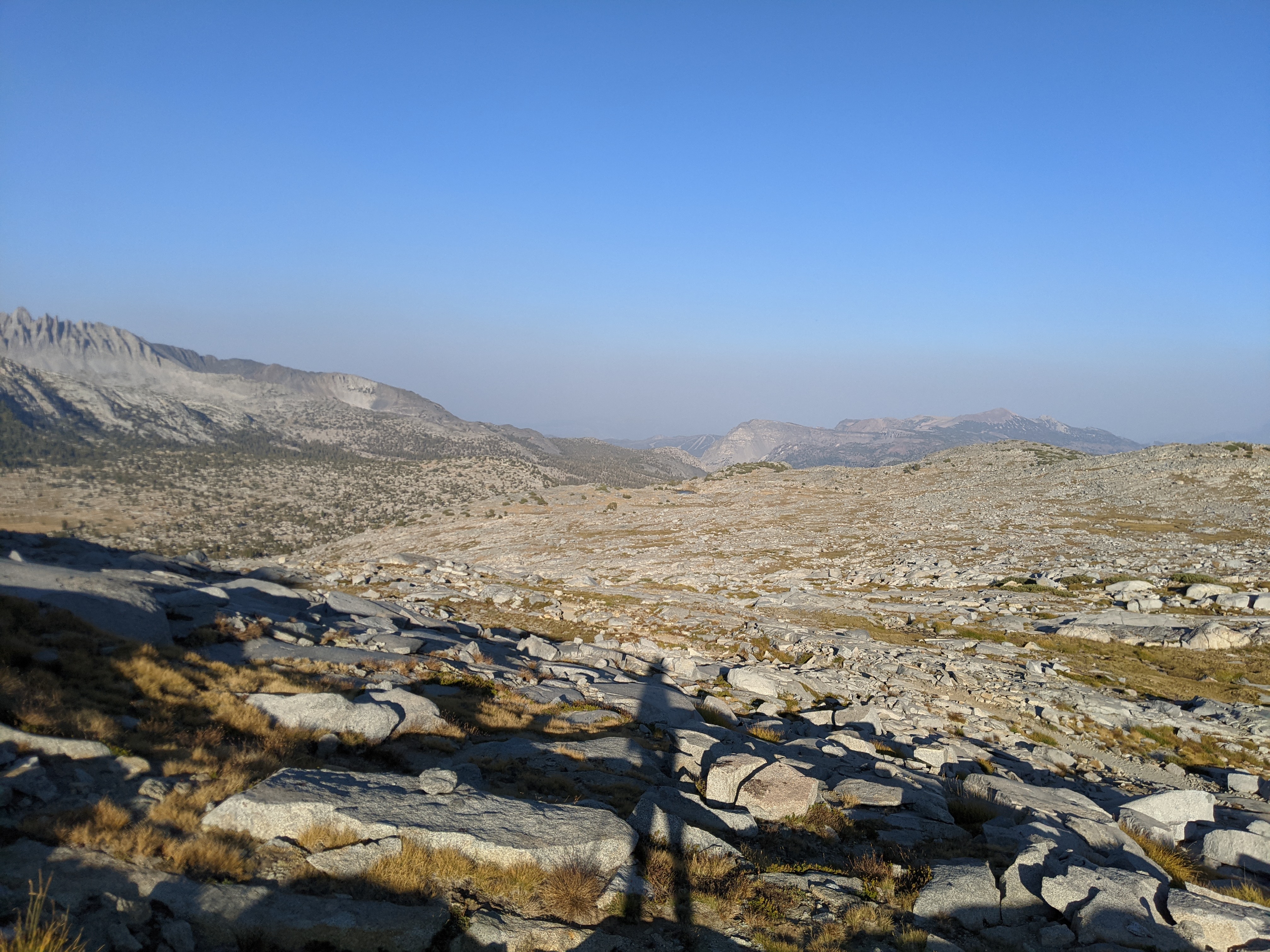
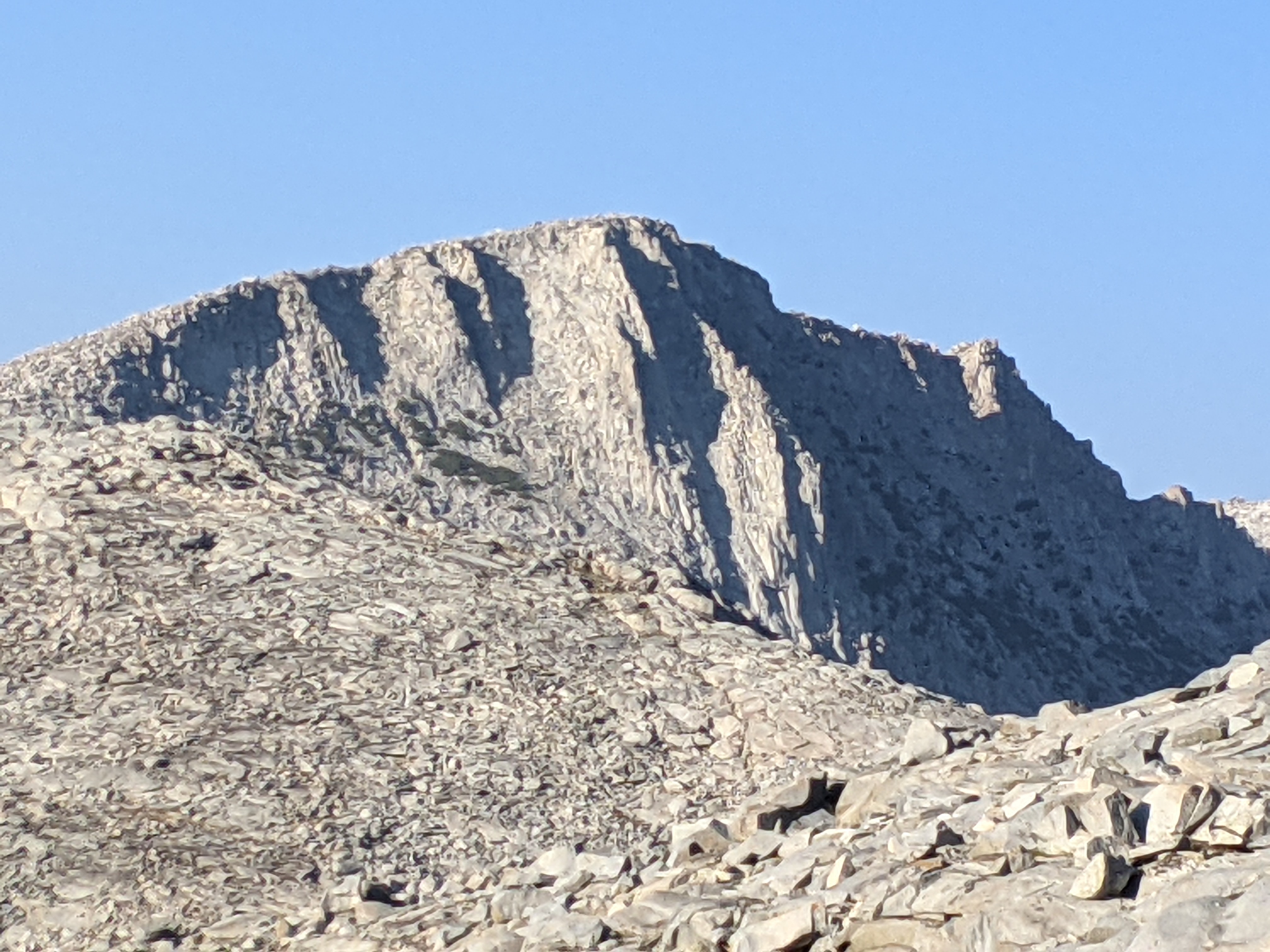
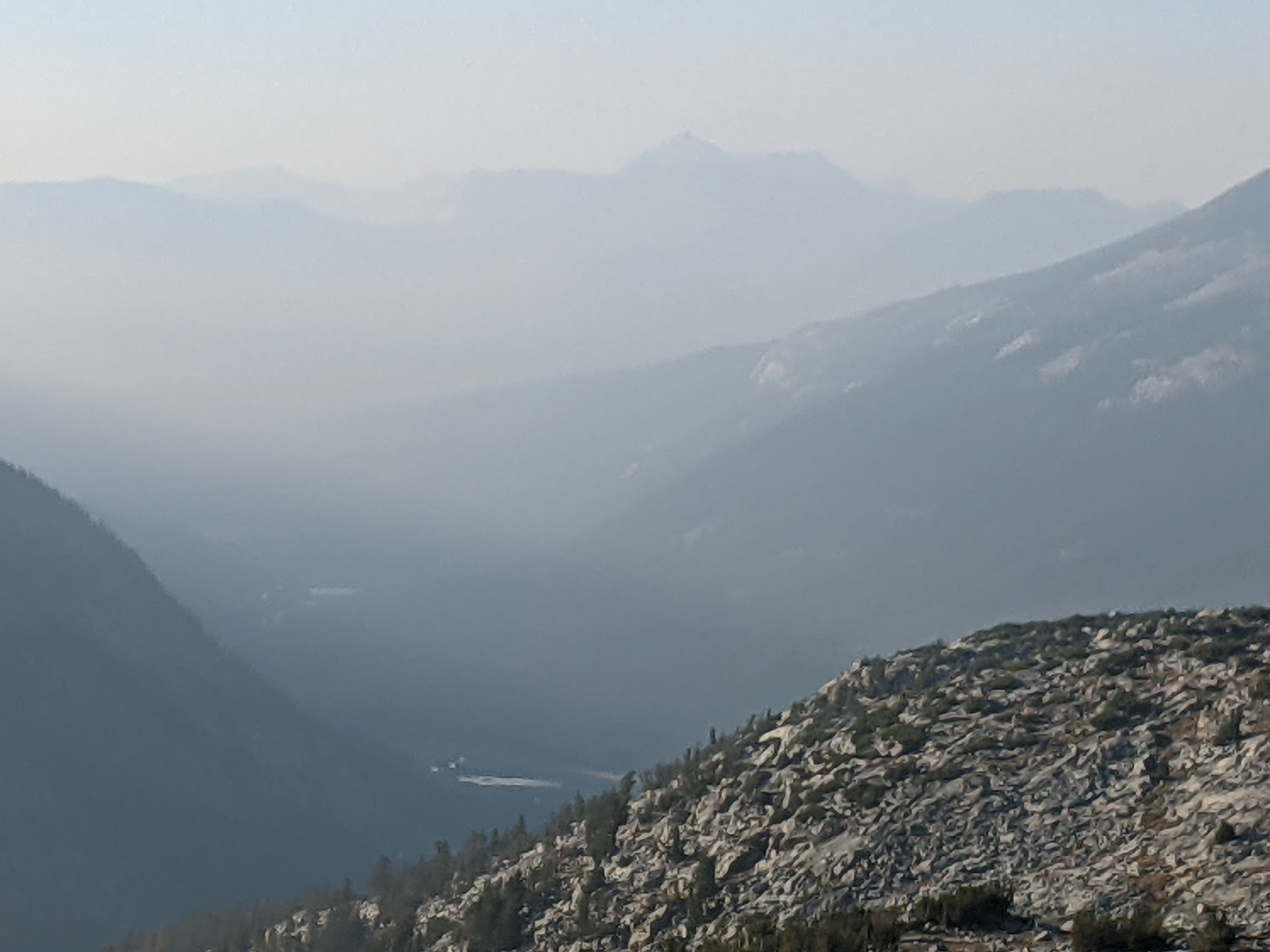
By 2:00 I’ve made it to Island Pass. 7.5 miles down. 6 to go. On this terrain, that might take all night. Reluctantly, it’s time for shoes again. Moving more swiftly, I make it up to the top of Donohue Pass. To the south, there’s a wasteland of broken rock, with Two Teats still visible in a layer of haze. To my left, Donohue Mountain is a gaping maw of granite. To the north, deep valleys filling with smoke from wildfires burning farther off. This is an elemental realm, where the rocks are battered by air, water, fire, ice and slowly crack apart. But for lichens dotting the granite blocks and tufts of alpine grass, life has left little trace here.
On the descent I spot a figure in the distance. A moment later, as I’m kneeling to filter water from a stream, he approaches — a young Ranger, colorfully decked out with radio (black), personal locator beacon (orange), badge (gold), and handgun in a standoff holster (olive). It’s his first season on patrol in the backcountry, and he’s loving it. “Not too many rule-breakers out today.” Then he checks my permit and bear canister. All is klar, herr commissar.
Day 15 — August 28
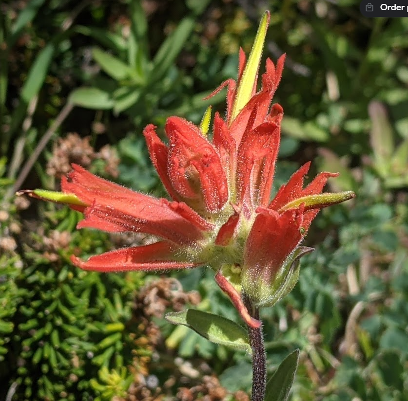
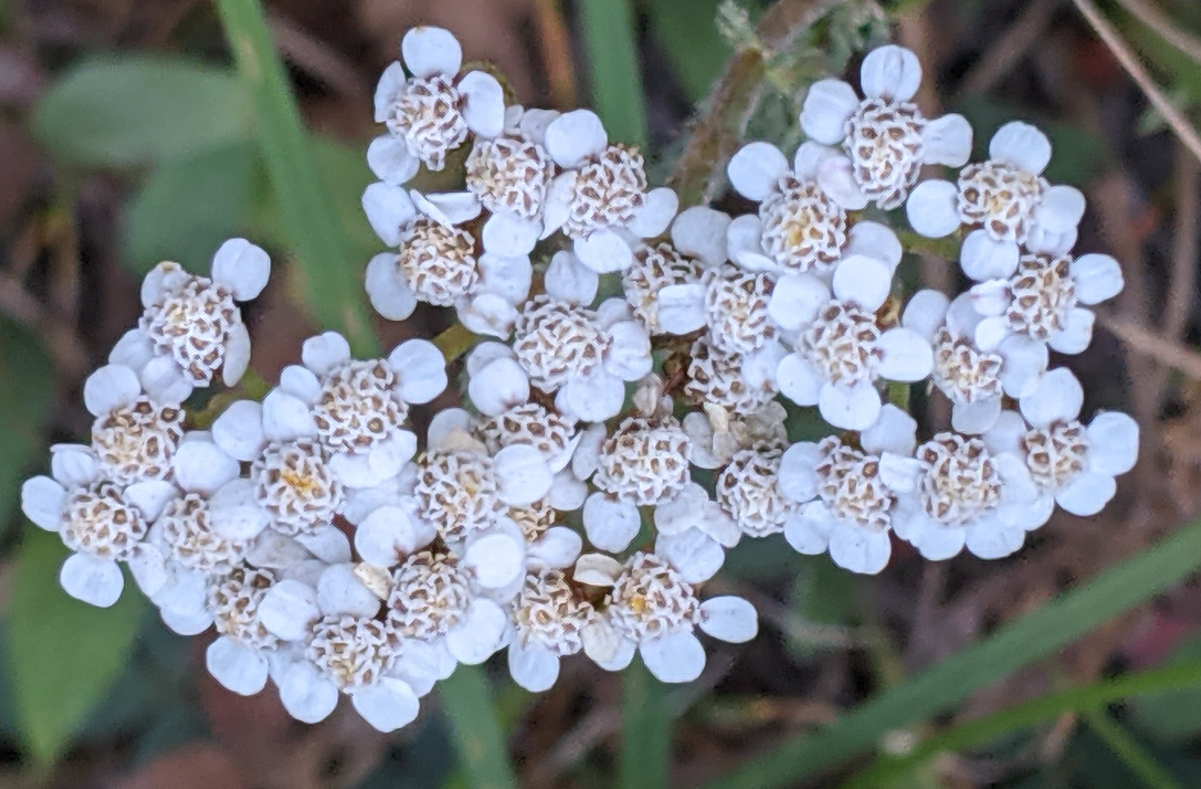
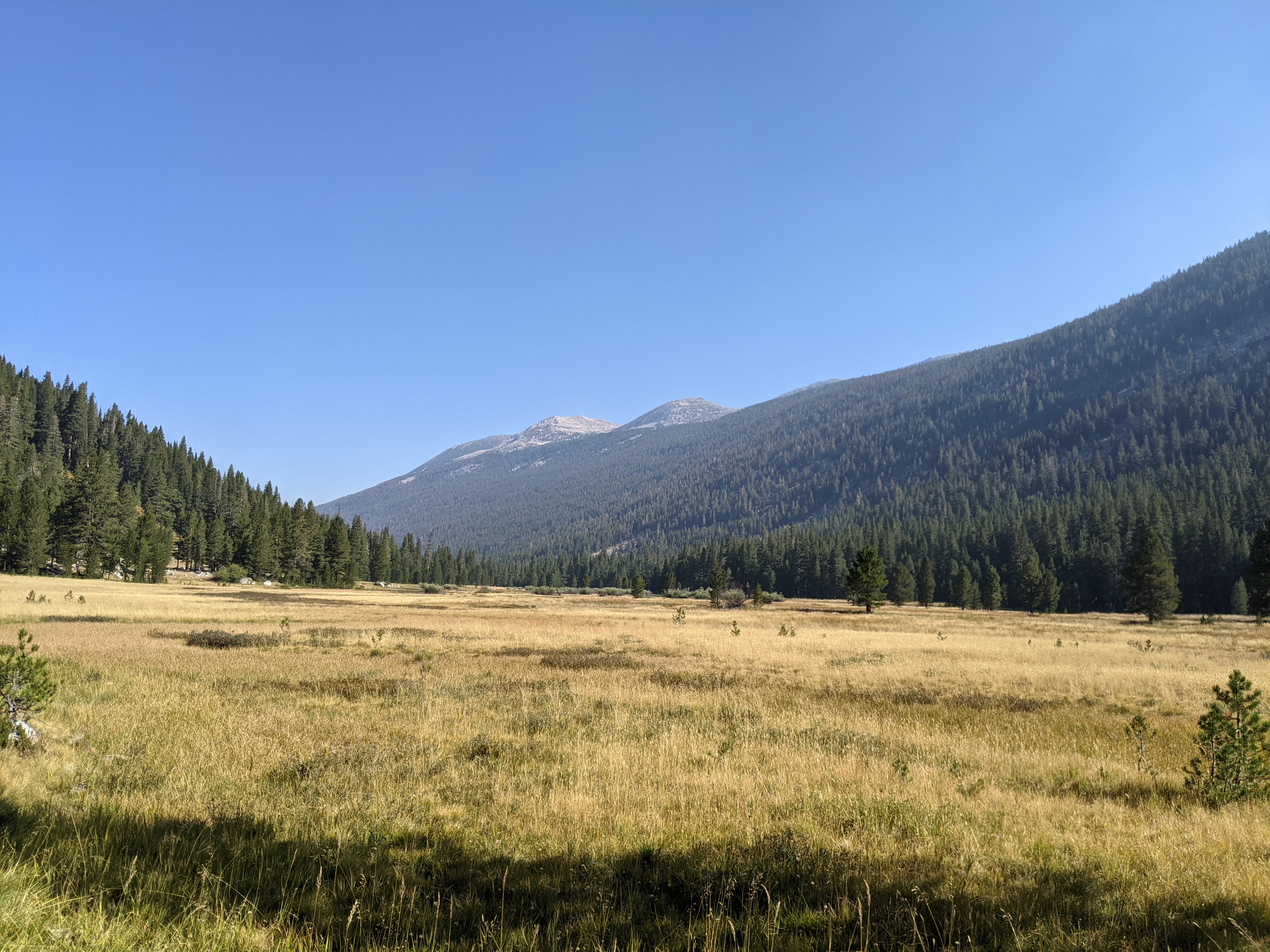
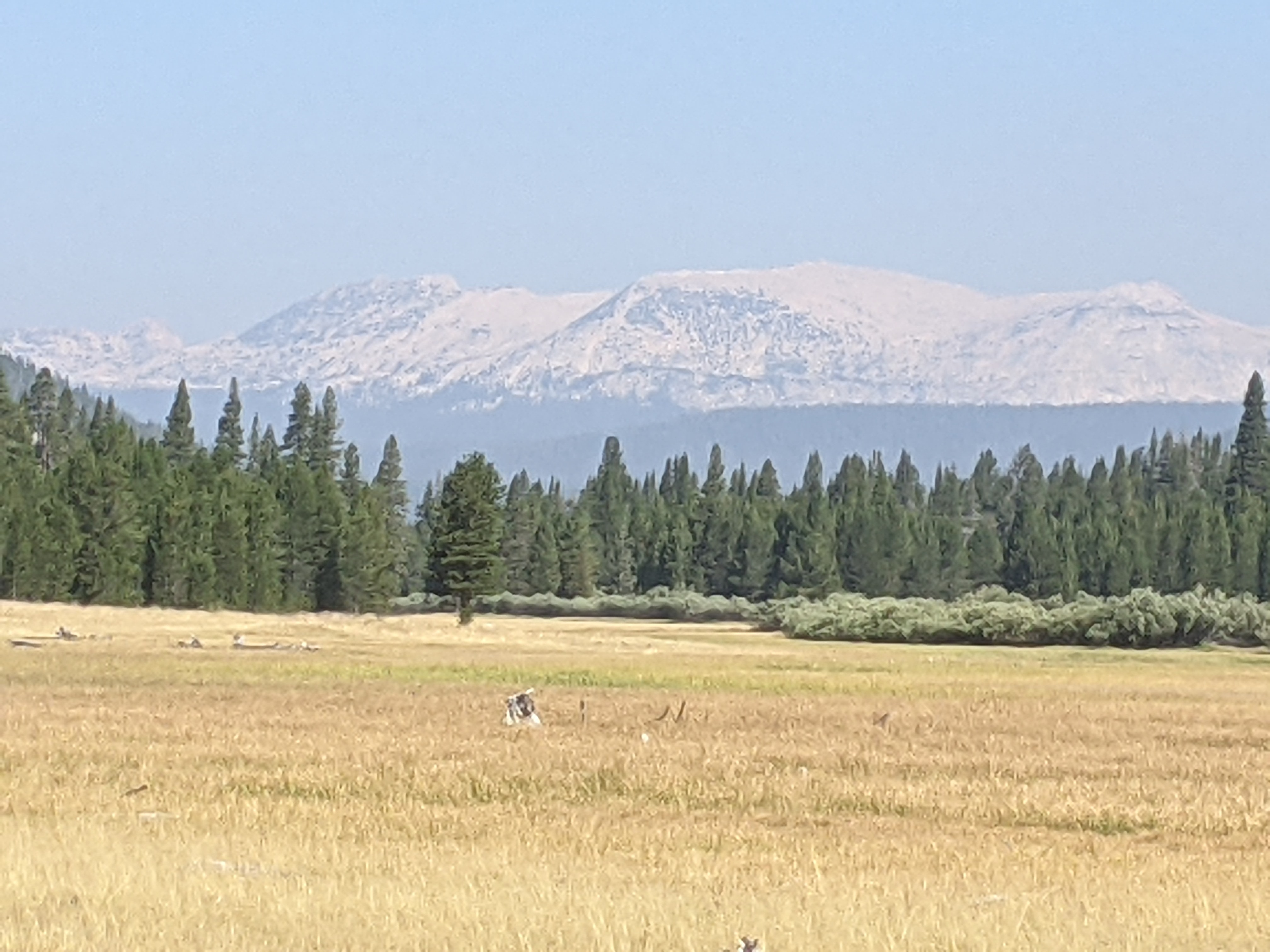
Beautiful flat sandy trails wend for miles through Lyell Canyon, alongside tawny sun-baked meadows dotted with wildflowers. White granite behemoths loom in the distance. Sometimes a scattering of grit on hard-packed dirt slows me down (pinpricks underfoot). Other times I scoot along with long strides, leaving behind clouds of gray dust (my feet and lower legs are caked with it, as is my face thanks to sticky sunscreen).
The trail curls around to the south, and now I’m making the steep climb to Cathedral Lake. I dig in with my single trekking pole (to save weight, I’m carrying only one) and power up 3 miles and 1,000+ feet, moving rapidly. At least it felt rapid, until I glanced at the map on my phone and saw there was still a ways to go.
17.2 miles. A respectable distance. I’m pleased.


Day 16 – August 29
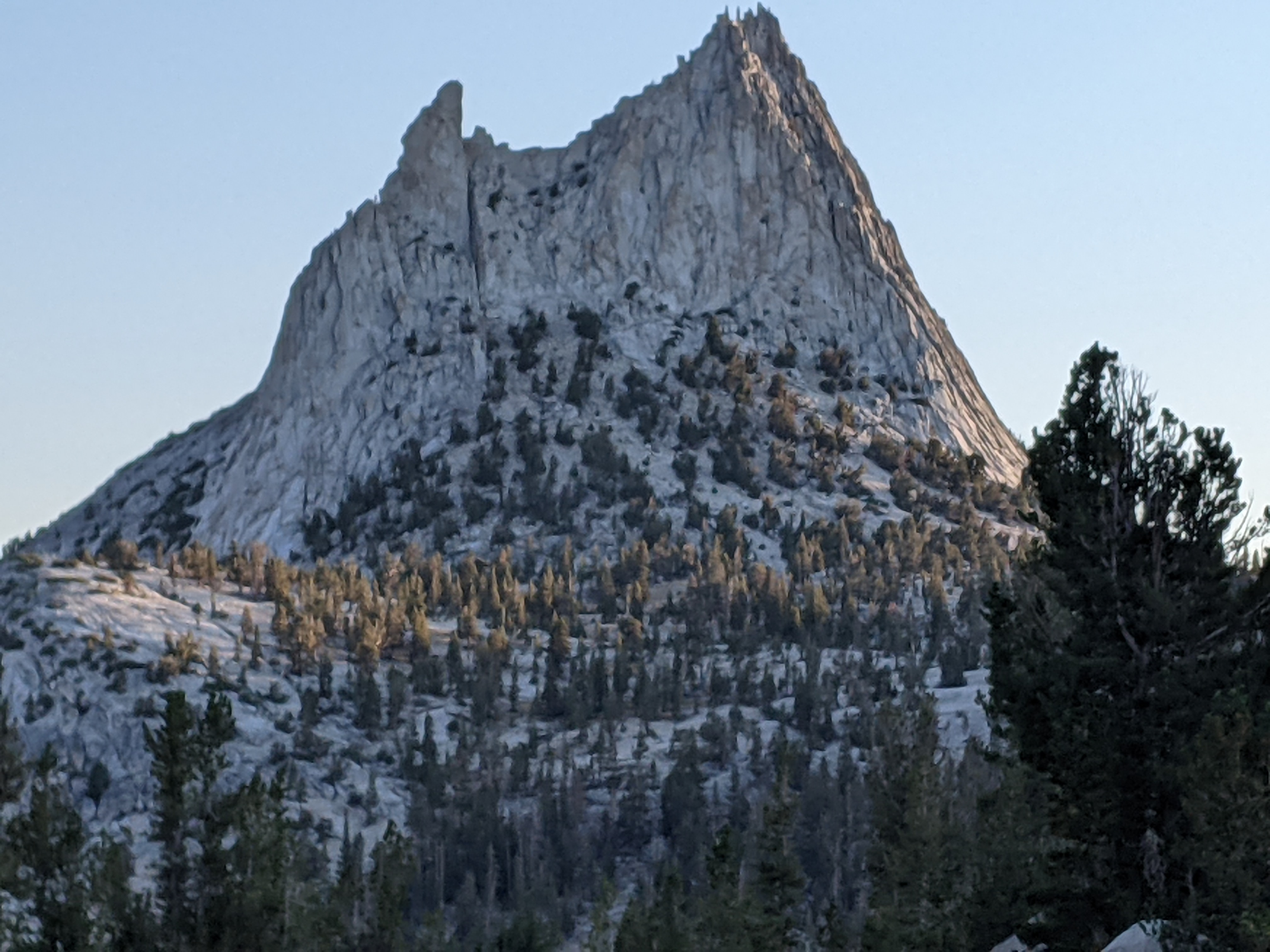
At first light Cathedral Peak towers above the pass, like Mont-Saint-Michel rising above the tidal flats, or the Monte Cassino Monastery on Italy’s southwestern coast, which Allied troops stormed during WWII.
The pass is a broad, open expanse of yellow grass. The trail angles up across the shoulder of a neighboring peak, exits the drainage of Cathedral Creek, and enters a parallel valley which contains Sunrise Creek. I navigate a 1,000-foot descent on rocky switchbacks. It requires enormous concentration. At the base, I filter water and break for lunch. As I’m standing to leave, here comes Sparkles, just starting her JMT trek and heading southbound. She’s from Boston, where she works as a nanny — the best job ever — and hikes in the mountains of Vermont and New Hampshire when she’s free. We talk about the right way to raise kids (outdoors as much as possible). And about ideal pack weights — no more than 25 pounds.
Later I meet Nick. A college student from Berkeley, he’s also a barefoot runner. Although it never occurred to him to hike barefoot. I warn him it can be slow.
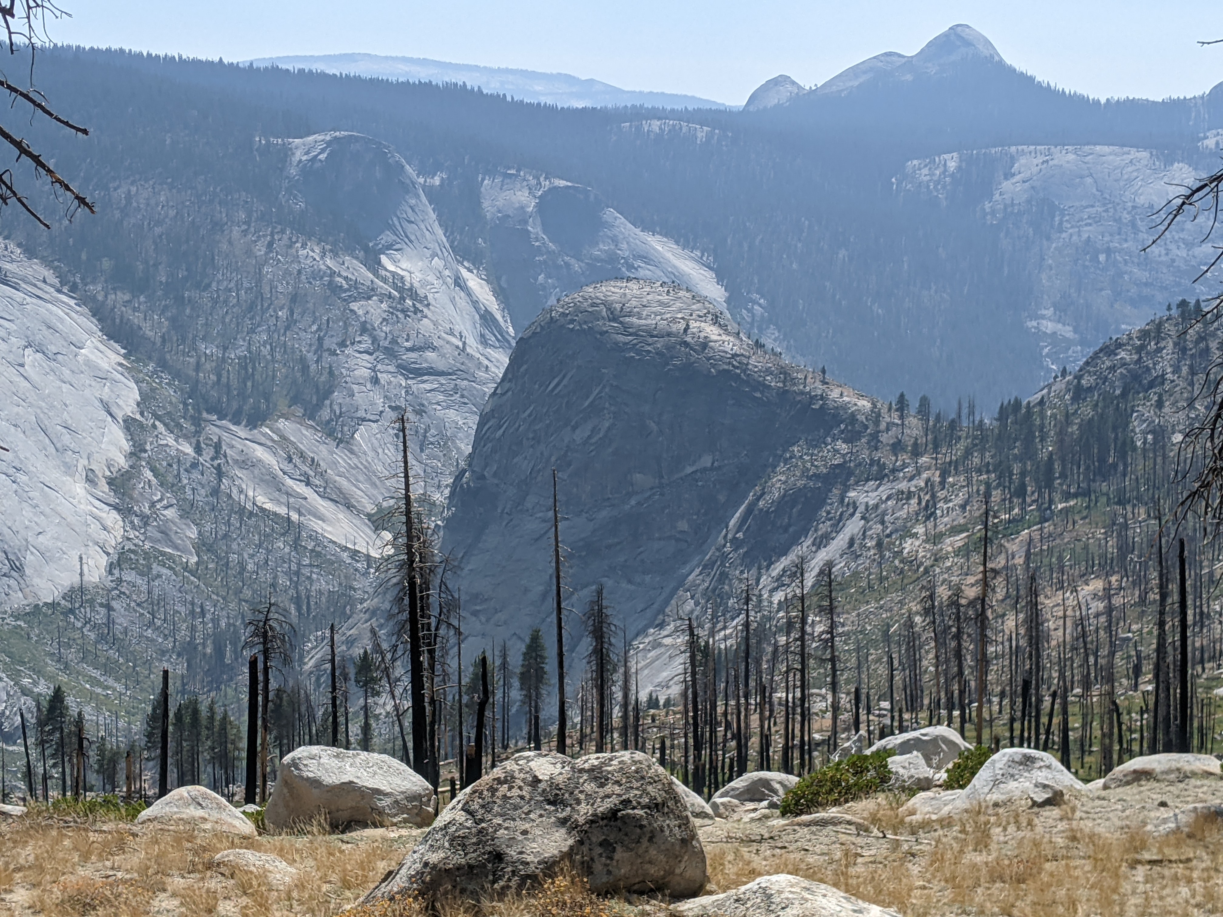
The path proceeds through a section of burned-out forest. With no shade, the sand’s turning hot underfoot, and compounding my aggravation, the mountain whitethorn bushes have grown across the trail (shouldn’t someone cut this back?), which prevents me from seeing where I’m stepping (sharp sticks and chunks of burned bark underfoot). This punishment lasts all afternoon, it seems.
I finally make it to camp. A man points me to the nearest water source. Later he tells me he’s a psychologist. He used to live in California, but was dismayed by “the culture of overwhelming laziness and entitlement.” So he moved to Nashville, Tennessee, where the attitude is different.
12 miles today. Only 7 miles are left in my trip, for tomorrow I’ll reach the northern terminus of the JMT at Happy Isles in Yosemite. Although the 3,000-foot descent will not be easy. Last year, the final 2 miles were miserable.
Day 17 — August 30
The misery starts just past Nevada Falls, where the trail clings to the side of a steep mountain wall, and the surface deteriorates into raw granite slag, partially covered with a rude concrete mix, which has broken apart in places. Then there’s two thousand feet of switchbacks, a mix of sand, gravel, stone steps hewn from granite, broken rocks, poured concrete both smooth and studded with pebbles. In one place, a crew of workers is rebuilding the surface, which has been trashed by a mudslide. The last mile is smoothly paved, like a sidewalk, but steep, and the concrete is studded with sharp pebbles. Why did they have to mix in those pebbles? This surface was not designed with barefoot hikers in mind, let’s just leave it at that.
I reach the bottom, and this year’s adventure is complete. With shoes on now, I stride 2.5 miles to the visitor center, falling in for a bit with a police officer (former Marine) from Southern California (we talk about chokeholds). At one point I pass the Merced River and think about a swim, but already my mind is shifting back to work and other things.
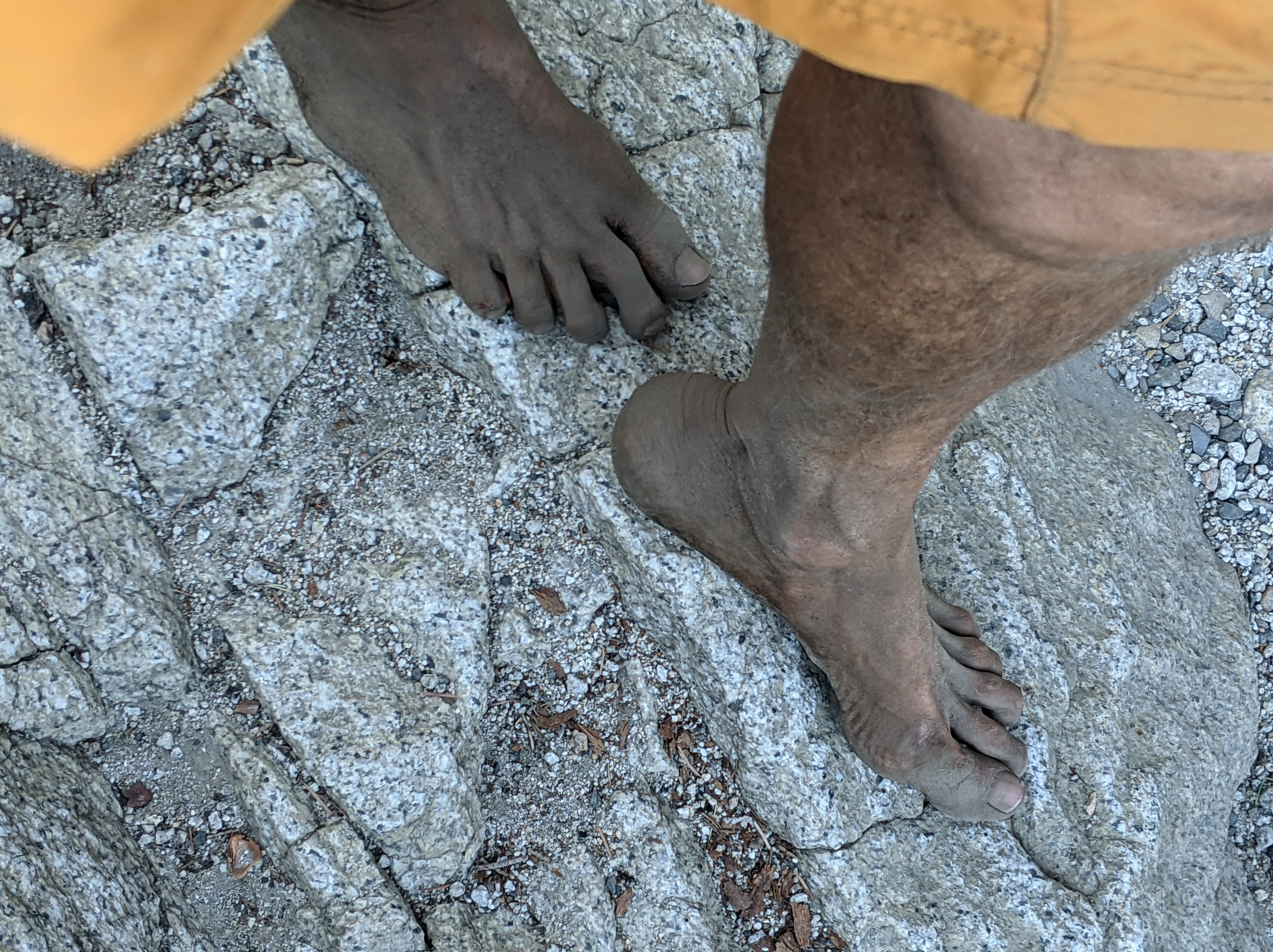
Later that evening, once I’m back in a motel, I tally my daily mileage. The total distance I traveled barefoot comes to roughly 170 miles, or 80% of the JMT. An improvement over last year (150 miles), but still short of the goal of doing the whole thing without shoes. I think I just need a little more time to make it down those passes.
Disappointment notwithstanding, it’s been a thrilling experience. Unbelievably intense. Often painful and halting, but sometimes remarkably fluid. So much concentration over so many long hours — the result is something memorable. And isn’t that how you’re supposed to feel when moving mindfully? Or did you want those miles to blur past?
Once or twice while on the move I thought of distant ancestors. They lived their lives outdoors and went barefoot all the time — they would have been impressively quick and sure-footed. But no doubt there were times when their feet hurt just as much as mine. They didn’t give up easily, though. Or we wouldn’t be here today.
I think I’d like to come back and try again.
Running the Long Path has 22 reviews on Amazon and nearly a 5-star rating. Click on the image to learn more.


Wow! I love your writing. I believe my wife and I crossed paths with you on Aug 15, on Pinchot Pass. You were descending SOBO, we were ascending NOBO. It was off the steep part but still in the rocky barren landscape up high. From afar we thought you might be an injured hiker, stepping oh so carefully. As we neared, we saw you barefoot. I believe you spoke first, something like, “there sure are a lot of rocks on this trail”. I looked at your feet and oh my. So bruised. It you were doing it. And probably in better shape (feet) than some hikers we met who wore shoes :). Congrats on your accomplishment.
LikeLiked by 1 person
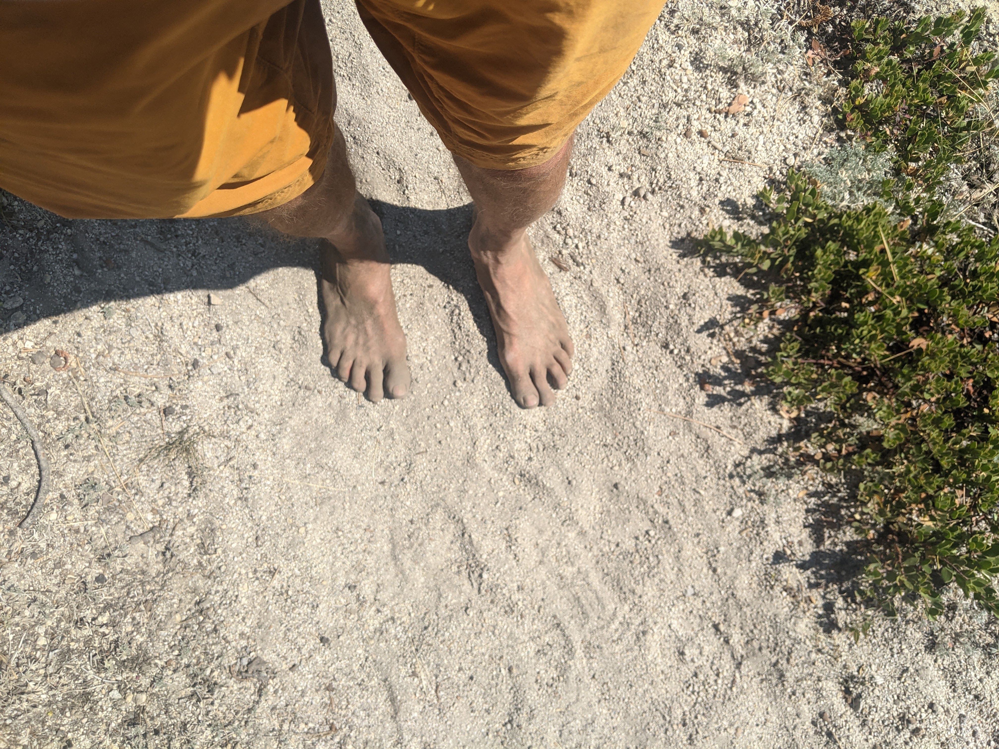
Thanks for the kind words, Explorerron. One correction: feet very dirty 🙂 but no bruises
LikeLiked by 1 person
[…] him too, and said he had the same words to say to them. As luck would have it, I ran across this post on the JMT FB page. It’s the same guy. The Long Brown Path; 170 Miles Barefoot on the John […]
LikeLike
Hello, yes, I am Bubbles! I thoroughly enjoyed walking barefoot (not surprised – I am typically barefoot whenever circumstances allow). It brought me to be much more conscious of my surroundings, and I took every step with intention. I walked barefoot for a few miles, in that time I learned how much pressure I put on my heels! The blisters were pretty deep, but are about healed now. I want to try again. I live in the Sonoran Desert, and not sure how feasible it is here (thoughts?). Passing you was a fond memory of the trip, and am grateful for the inspiration!
LikeLike
wow Bubbles, its so awesome to hear from you! I’m glad to hear you enjoyed your experiment and learned something about your gait. Good luck with your next barefoot hike. Here in NY we mercifully don’t have Jumping Chollo and the like, but we have washed out trails full of rocks, so every terrain has its unique challenge I guess. Good luck with the Desert!
LikeLike
[…] https://thelongbrownpath.com/2021/09/10/170-miles-barefoot-on-the-john-muir-trail/ […]
LikeLike
I have a photo of you hiking up one of the passes that shows just how tough the rocky path would be on barefoot. Is there a way for me to post it here for you? My sister is a ways behind you and I took the photo to show the tough terrain we were on.
LikeLike
Actually she just sent it to me on FB and I will include it in the blog. The picture does show a lot of rocks! Which explains why I was going so slow!
LikeLike
I was amazed to read your blog. As you know I trudged the John Muir Trail. You barefooted it. My hat goes off to you. I always do say “Hike your own Hike” and you did. You have much to be proud of. While this would not be the way I would chose to do the trail your feet look in a lot better shape than mine did when I had new boots that gave me oozing blisters. Almost stopped my hike. I had to hike in my boots that had many miles on them and that was a lot better. Much closer to barefoot hiking. What you have inspired me to do is to find places on the trail where I may find barefoot hiking to my liking. I love to walk on the beach barefoot. I feel part of the whole scene. You have inspired me to grow and be closer to the earth and the wilderness that I am out there to become part of. You are an inspiration for sure and I will be ordering your book. I certainly appreciate the fact that you read mine. We all carry the JMT with is in so many ways. Yours just happened to be barefoot. Happy trails-it seems you had many
LikeLiked by 1 person
[…] 170 miles on the John Muir Trail barefoot — an intense experience in California’s High Sierra and an improvement from the year […]
LikeLike
[…] to quit work). I also dream about thru-hiking long distance trails. During the summer, I walked 170 miles barefoot on the John Muir Trail (it took most of my vacation days). Hopefully, I will return one day to […]
LikeLike
[…] random goal to many people, but for Posner, it has been a years-long battle. As he explains in his blog, he made his first barefoot JMT attempt in 2020. “Barefoot is simple,” he writes. […]
LikeLike
[…] to many individuals, however for Posner, it has been a years-long battle. As he explains in his weblog, he made his first barefoot JMT try in 2020. “Barefoot is straightforward,” he writes. “Pure. […]
LikeLike