To complete the Grid requires climbing the Catskills’ thirty-five high peaks during every calendar month, and part of the purpose of this exercise is to observe new aspects of the mountains at different times of year and under different conditions. In this regard, last weekend’s trip up Peekamoose Mountain was productive: clear skies and leafless forests helped me better grasp the topography of the mountain and surrounding areas.
(Comments below refer to this screenshot taken from the NY-NJ Trail Conference Catskills map installed on my phone.)
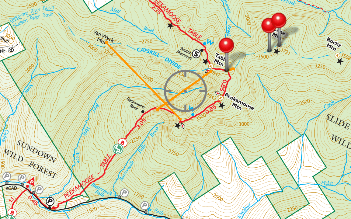
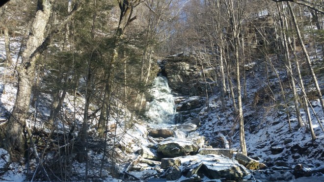
Peekamoose stands 3,843 feet tall in the southern Catskill Mountains. My friend Alan and I met in Phoenicia and then drove through West Shokan and up and over the shoulder of the mountain on route 42, passing Buttermilk Falls just a short distance before arriving at the trailhead.
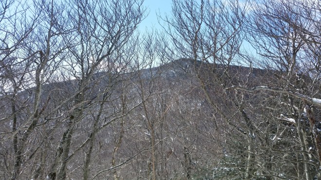
For the first 2.5 miles, the trail runs north along the spine of a narrow ridge, rising from an elevation of 1,250 feet in the valley to 2,900 feet at Reconnoiter Rock, a glacial erratic perched on a sandstone slab. The grade is a moderate 16%. As we walked along, the corner of Peekamoose’s summit loomed in the distance, some three miles away and 2,500 feet above us — a view that is masked most of the year by the forest canopy. Having struggled with treacherous ice-coated rocks during recent winter hikes, it was a relief now to walk through a couple of inches of powdery snow. Lack of ice may reflect the ridge’s southwestern exposure, which gets more sun in the winter. Also, the trail is very dry (in past hikes up Peekamoose I haven’t encountered water on the trail except for a seep just below the summit). Perhaps the trail is so dry because water drains from the ridge to the west in Bear Hole Brook and to the east in Buttermilk Falls Brook.

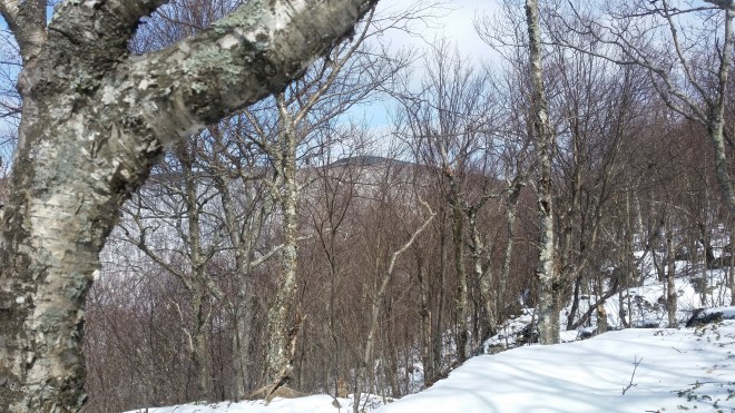
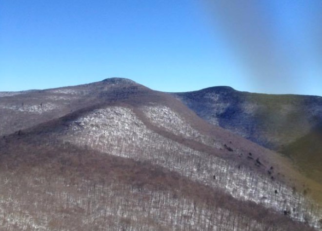
A short distance past Reconnoiter Rock, there’s a second set of sandstone ledges offering a similar vantage. With the leaves down, we were able to spot nearby Table Mountain’s summit about a mile away to the north-northeast. From this angle, the southwestern edge of the summit stands out, and the summit appears to drop away to the northeast although actually it is long and flat — hence its name. When the cherry and birch leaf out in the spring, this view will no longer be available.
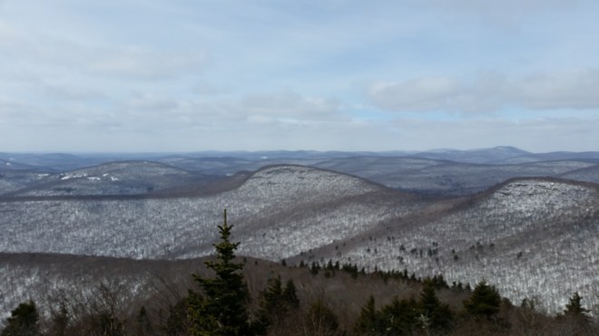
From Reconnoiter Rock, the trail begins curving to the east, and after a half-mile or so arrives at a vantage point at 3,500 feet which is marked by a star on the map. If you step out onto the small rock ledge, you’ll be treated to an expansive western vista. This time, my eye was caught by a fin-shaped peak called Van Wyck Mountain about 1.5 miles away to the west. The eastern face of Van Wyck looked extremely steep, with few trees growing on the snow-covered rocks, a contrast with the thick forest on the mountain’s shoulders. Looking at the map, it appears that the slope reaches an incline of 55 degrees (which would be a grade of 140%). Van Wyck lies on the next ridge over from the Peekamoose trail, and this ridge leads east to the summit of Table Mountain. This ridge also marks the Catskill divide, the drainage boundary between the Hudson and Delaware rivers.
While standing at this vantage point, Alan and I felt the full brunt of the westerly winds, which were blowing at perhaps 30 or 40 mph. After taking a couple of pictures and fiddling with some gear, my hands were smarting from the cold wind. We got moving again, following the trail as it turned north toward the summit along a flat windswept ridge, where the snow was piled in cornice-shaped drifts of a foot or two in some places. The gnarled beech, cherry, and yellow birch didn’t do much to block the westerly wind, but on a positive note they let plenty of sunlight wash across the snow. The final 300 foot climb to the summit took us into a dense forest of fir and spruce. Ten or twenty feet above us the treetops danced and shook in the wind, but at ground-level the air was relatively calm. Soon we arrived at Peekamoose’s summit. There’s a vantage point a few yards to the east, but we didn’t stop for the views, instead continuing on to Table Mountain which lies less than a mile away.
The summit of Table Mountain is long and flat, about 1/4 mile long, oriented east-west, and cloaked in a dense fir thicket, and it seemed to take a long time to reach the small cairn that marks the official high point. We quickly turned about and entered the forest where the ridge drops down from the eastern corner of Table’s summit and follows the Catskill Divide on the way north to Lone Mountain. As we descended the ridge, we could see Lone lying to our front about a mile away, and beyond it Friday and Cornell Mountains, and off to the right Balsam Cap. Far off in the distance lay another mountain range, just barely visible, and perhaps this is the line of peaks traversed by the Devil’s Path almost twenty miles away. To confirm this, we’ll have to go back on another clear day with a pair of binoculars.

At 3,650 feet, just a little bit short of the peak of Lone Mountain, we encountered a wall of rocks (this point is marked by a red drop pin on the map). A chute between slabs of sandstone offered us access onto the summit, although a few steps were a little icy. To the right, the walls are impassable, while to the left, there’s a shorter wall and one spot where you can grab a tree and pull yourself up. I’ve been up both ways many times before.

On the return from Lone, we took in a final view of Table and Peekamoose through trees that in a few weeks will be leafing out.
On the drive home, I stopped at an overlook in the northern Shawangunks. From this angle, Peekamoose has a very distinctive shape, peeking out above the long ridge that runs from the vantage point where we saw Van Wyck all the way to the shoulder of Lone. It’s a “Kilroy was here” sort of shape. Without a telephoto lens, this is the best my phone can do.

Running the Long Path is available on Amazon. Click on the image for more info


[…] the long winding ridge, the view points, and scrambles, all remembered from prior hikes, including one with Alan during the winter, but in many cases looking different, as it’s often on the way up that one pauses to observe […]
LikeLike
[…] I came here with my friend Alan Davidson. On this trip, we stopped at Reconnoiter Rock and admired the views. I measured azimuths with my compass to determine (once plotted on the map) what precisely I was […]
LikeLike