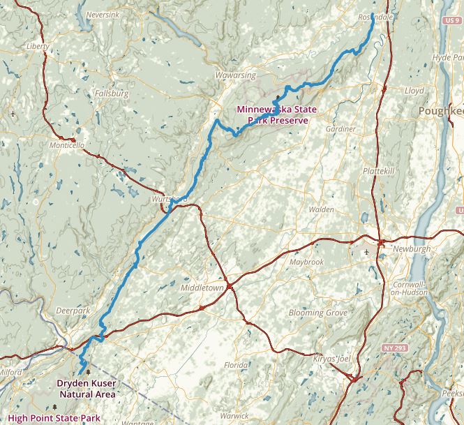
Last weekend, I thru-ran the 74-mile Shawangunk Ridge Trail (SRT), establishing a new fastest known time (FKT) of 24 hours and 8 minutes. The previous FKT was 29 hours, which I ran in May 2014. Both of these FKTs are “unsupported,” meaning no aid from other persons or caching of supplies.
Thru-running the SRT is a special experience. The trail crosses a magical wilderness, and covering the distance all at once combines many impressions and feelings into a powerful appreciation for the land. By way of background, the distinctive white quartzite conglomerate which forms the Shawangunks eroded from the Taconic Mountains some 500 million years ago. 250 million years later, during the birth of the Appalachian Mountains, great plates of this conglomerate were tilted and uplifted, until the Shawangunks reared high above the Hudson Valley, dominating the landscape with rows of gleaming white cliffs, from which the vistas exceed 100 miles in some places.
That these mountains have been largely preserved from commercial development is no accident, but reflects the leadership of many people and organizations, including the Open Space Institute, which has acquired thousands of acres in the Gunks for parks and preserves, and the New York-New Jersey Trail Conference and its volunteers, who conceived of the SRT and maintain it and miles of other trails.
On Friday, July 3, 2015, my wife Sue kindly dropped me off at High Point State Park in New Jersey. It was a sparkling clear day. The plains of the Hudson Valley spread out to the east, while in the west the town of Port Jervis nestled in the confluence of the Neversink and Delaware Rivers. To the north, the Shawangunk Mountains reared like a series of breaking waves. My objective lay just beyond the last crest, some 74 miles distant.


Our dog Odie barked with excitement as I said goodbye and Sue wished me good luck. The southern terminus of the SRT was a quarter-mile walk away, at a junction with the granddaddy of american hiking trails, the Appalachian Trail. Just a few days earlier, ultra-running legend Scott Jurek had passed by here on a quest to set a new FKT for the 2,000-mile Appalachian Trail. My journey would be much shorter, my challenge, considerably less daunting.
My kit consisted of 1 liter of water, with a filter to resupply from streams, 3/4 pound of home-made pemmican, 3 dark chocolate bars, phone, lights, batteries, and an extra shirt. The pack weighed about 8 lbs. I carried trekking poles for the hills and wore lightweight minimalist trail running shoes (INOV-8 TrailRoc-235s). And perched proudly on my head was an embroidered Trail Conference baseball cap.
The time was 12:02. I noted this with pen and paper, at the same time pressing start buttons on GPS watch, satellite personal locator beacon, and smart phone map app.
For the first few miles, the rolling hills and southern hardwood forests of High Point State Park passed in a blur. It was a beautiful early summer day, pleasantly warm in the sun and cool in the woods. The trail meandered from narrow footpaths onto old logging roads and then darted back into the forest depths. I startled a bear, who bolted through the underbrush, disappearing in a flash of black fur.
After descending a steep slope, the SRT passed onto paved roads for a mile or two, at one point crossing beneath I-84. Above me, the holiday traffic had ground to a halt — the contrast between my freedom and the motionless vehicles seemed surreal.
Then it was up a hill, and I suddenly recognized Hathorn Rd. as a turn, but saw no blazes. Upon closer inspection, there were blazes painted on a telephone pole, but someone had nailed a sign on top of them. There was another blaze on a stop sign, but it was covered by ivy. Trail Conference volunteers do a magnificent job maintaining 2,100 miles of trails including the SRT, but they can’t be everywhere.
The SRT reentered the woods through a patch of mud, and shoes and socks were quickly soaked. The path turned to soft dirt then crossed a talus field of conglomerate boulders, forcing me to hop tentatively from rock to rock.
At mile 10, the trail paralleled an active railroad line, and then it jumped back into the woods, where I startled a second bear. A few miles later, I stopped by a rushing stream to filter fresh water. I drank as much as I could, hoping to minimize the number of stops.

And then it was back along the railroad line for another mile before the trail diverged onto an abandoned railbed. When I first ran down this trail in 2013, the chunky gravel had poked through the thin soles of my minimalist shoes, forcing me to detour into the woods to escape the painful pounding. But now, with more miles under foot, including some barefoot running, my feet didn’t seem to mind, at least not as much.
Experience and training pay off, and I was feeling good! Steady, strong, positive, now I was trotting purposefully under tall power lines, taking in the sun, the wind, the cries of of raptors wheeling in the air above, and even better, glancing at my watch, I saw mile 16 had clicked by in 4 hours, certainly a modest pace, but projecting out to the finish, this implied a sub-20 hour time — and a massive improvement over last year’s 29-hour run. Of course, the terrain would become significantly more difficult ahead, I knew this well. Nonetheless, a sub-20 hour time was the kind of wild goal that could help me push the pace while the course was still runnable, and I shifted into a more aggressive mindset.
Just past route 211, the SRT swings up to the top of a small hill called Gobblers Knob. In the past I had cursed the Trail Conference for this gratuitous climb, but this time I flew through the forest.
Bashakill is southern New York’s largest wetlands, a vast expanse of reeds filling a narrow valley; the trail hugs the shore, just inches above the waterline. I flushed mysterious-looking ducks who splashed away honking loudly, stepped over a turtle burrowing in the dirt, surprised a fawn which leaped away snorting. There was water on the trail, and my feet got wet, then dried out, then got wet again. Then I splashed into a section that was knee-deep. Looking up, I could see fully the next mile was under water, and I fumed about the delay as I slogged slowly forward. The trail emerged back onto dry land, and I finally escaped from the wetlands only to venture through an underpass beneath route 17 which was flooded a foot deep.

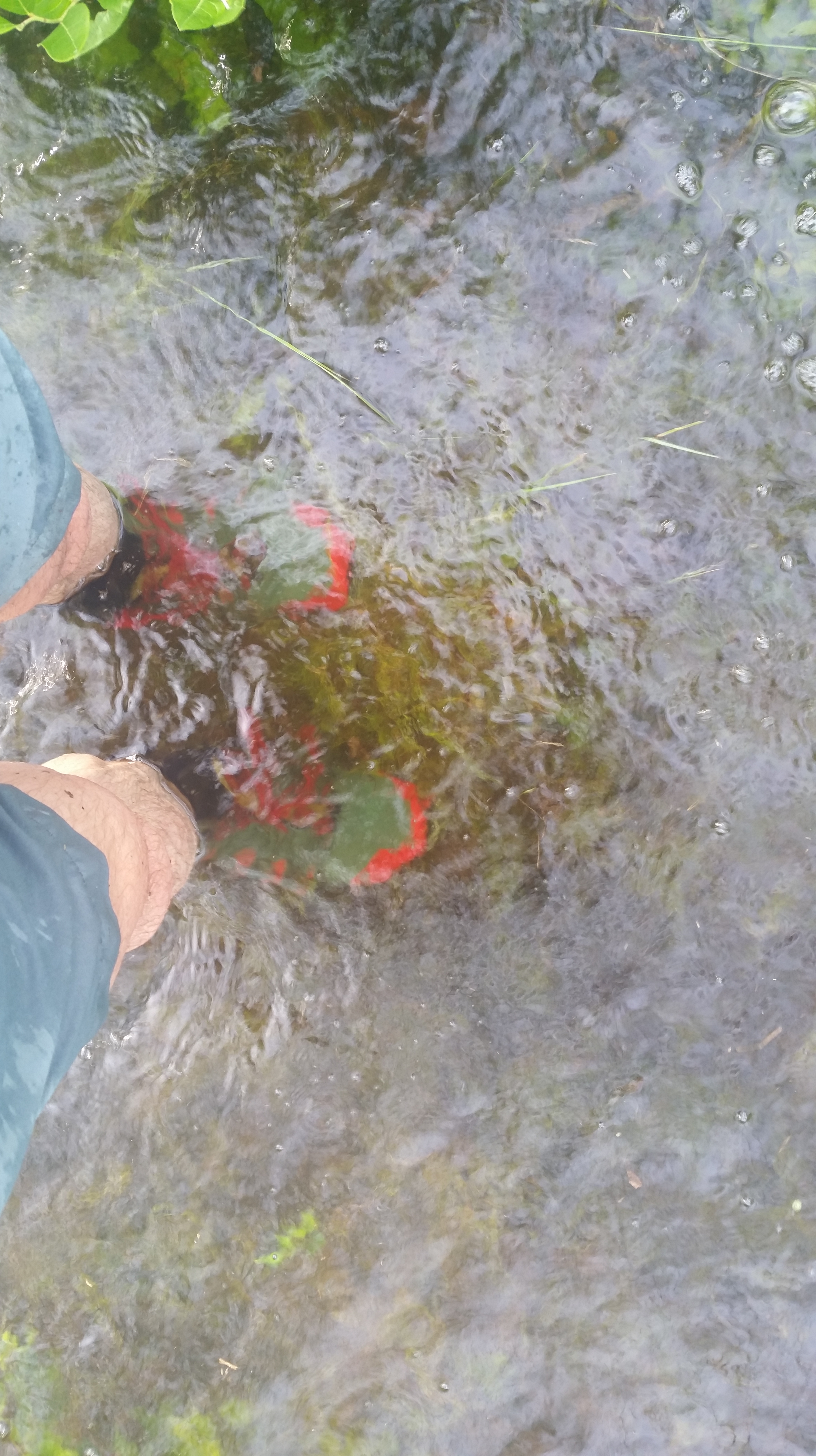
My water bottles were dry again. The town of Wurtsboro lay just ahead, and the idea of stopping in a bar occurred to me, but after careful deliberation, this strategy seemed questionable, although tempting. Reluctantly, I paused to filter some of the water that was once again streaming ankle-deep across the path.
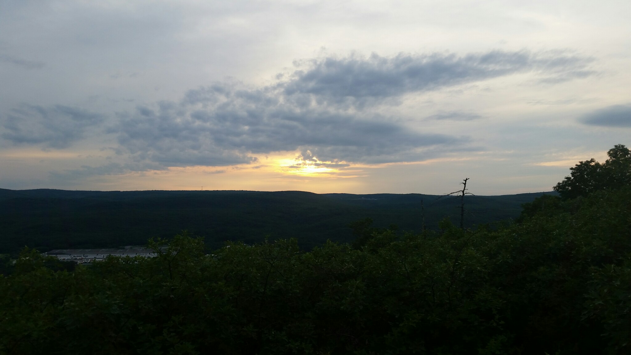
The road through Wurtsboro allowed me to make up some time; police station, art studio, car repair, post office, motorcycle dealer flashed by, and soon I was climbing Wurtsboro Ridge and now for the first time encountering the difficult conglomerate jumble characteristic of the Gunks. I climbed up a rocky trail, then stepped carefully across slabs of conglomerate slanted at angles that could send your feet flying out from under you, and finally stopped for the first food of the day at mile 30, where I rested on a rock, watching the sun slip below the horizon.
The trail dipped into a deep valley, dark in the gathering dusk, then rose back up to the ridge, then it fell once again into the forest, and then it leaped across Ferguson Road and mounted the ridge once again. I was moving through the area of a recent fire, where the scrub oak had been burned away, allowing an aggressive colony of fern to claim temporary dominance. But other young plants were jostling for room and light; they appeared to be new shoots of blueberry, and I recalled that itinerant berry pickers used to set fires to improve the crop. Some of the pitch pine trees had been burnt from top to bottom and appeared lifeless crisps, but they had not given up the ghost: green shoots were emerging from charred branches and trunks.
My first break for food had consisted of a few handfuls of pemmican and a bar of dark chocolate, probably 1,000 calories of fat and not much else, and as much as I favor a high-fat diet, that was a lot take in at once. I felt a little queasy for the next few miles, and my pace slowed. A hint of smoke hung in the air. On the top of the ridge, a campfire was burning, the first sign of other people on the trail since the start, while way out to the west, fireworks dotted the horizon. I passed a trail marker and couldn’t find the next turn in the path. I circled around on the slope, fighting through burnt brush, and reemerged onto the trail covered in ash.
And then once again, the SRT dropped steeply off the ridgeline, taking me onto an abandoned road that the locals call “Old Plank.” Dance music drifted up, but deep in the forest, I couldn’t tell from where — I ran slowly along, enjoying the beat, remembered my goals, and sped up the pace, dodging the rocks and gravel that littered the washed-out surface and hopping over streams that had channeled through the road and were pouring into the depths below.

Old Plank reached route 52, and the SRT crossed this busy road and plunged into the woods on the far side, following South Gully up almost 2,000 feet to Sam’s Point Preserve. It’s the biggest climb along the SRT, but South Gully didn’t faze me now. Plenty of hill training over the last year had paid off, including running repeats on South Gully itself, as I had done with friends last fall.
From Sam’s Point, the lights of small towns and hamlets sparkled from the dark plains below. A rocky trail led to Verkeerderkill Falls, and once again I was teetering across sharply pointed blocks of conglomerate. Back in April, the snowmelt had flooded this trail, it had been a veritable stream, and now it was wet from recent rains, and soon enough, shoes were soaked. Up ahead the waterfall roared in the darkness, and I paused to filter more water before hopping across the channel, mindful of the 140-foot drop just a few feet somewhere to the right.
I moved past two sky lakes in quick succession. A layer of clouds had blocked the moon, and Mud Pond was not visible. Wooden boards took me across a marsh, sagging with each step. Then I scrambled up a small cliff, saw once again the lights spread out in the valley below, and passed by Lake Awosting in the darkness. The SRT descended through a field of boulders, worked its way through a squeeze behind an enormous block that had fractured and fallen onto its side, scrambled back up the cliff to Castle Point. Then it slipped down into a fold between parallel ridgelines, passing underneath Rainbow Falls. Water spattered down. Dawn broke. It was grey and drizzling. I was starting to struggle. The slanted rock faces threatened to send me flying, tangles of roots tired my feet, there were more boulders to clamber across. My breath was labored, energy was dropping, knees were aching. Even the slightest uphill slowed me to a walk, and scrambling up through clefts in the cliffs sent heart rate soaring.
I looked up from a vantage point: the rocky face of High Peters Kill beckoned in the distance, yet it seemed so far away. I felt drowsy. In 2014, I had stopped right here and laid down on a rock and closed my eyes for just a few minutes. Now my watch revealed a slowing pace. 20 hours was forgotten, 24 hours seemed unlikely.
Digging in with both poles at once, I levered myself forward, dragged my body to the top, made it to High Peters Kill, and surveyed the small bowl in the rocks with grim satisfaction, then tottered downhill past a luxurious growth of blueberries into the Mohonk Preserve, conscious that the remaining mileage was diminishing one step at a time.
Undivided Lot Trail clings to the side of the mountain high above the Coxing Kill, huge slopes looming across the valley, the Catskill Mountains floating somewhere off in the clouds. The path picked its way along the side of the mountain. I placed each foot carefully. But then the trail opened up, and I was running. The local covey of ravens took note, and its members called back and forth in loud, theatrical voices that reverberated among the trees. The path ended on another series of wooden planks through a marshy patch. Rain was falling steadily.
My breathing felt shallow and labored. I took deeper breaths, and this helped. My energy was low. I ate another square of chocolate, and this helped. My legs were no longer steady, but if I picked up my feet, I could still run, slowly, at least on the flats and downhills, and on the uphills I dug in with the poles and hauled.
From Crag Trail in the Mohonk Preserve, the SRT officially turns right onto Northeast Trail, but I turned left instead, taking a variant route designed to avoid paved roads (this will eventually become the official route). I passed the famous scramble up Bonticou Crag, and took instead a shorter climb to the top of this narrow ridge, glancing around at misty views of the surrounding hills and then quickly back at my feet. From the crag, a soft dirt road plummeted into a swamp with hemlocks and a rushing stream. The mud soaked through my shoes one last time, and then the trail followed a long spur down through lands recently acquired by the Mohonk Preserve, until it dropped me onto the rail trail. I ran across an enormous railroad trestle, 140 feet above the Rondout Creek, making sure not to look down.

I pushed the stop button on my watch and looked at my phone, estimating it would be at least 2:00 PM. But to my surprise, the time read 12:10 PM.
The SRT is an important trail, and it deserves an Olympic-caliber FKT. For now, 24:08 will have to do, but one day, a truly talented athlete, someone like Scott Jurek perhaps, will run the SRT in well under 20 hours. That might happen as soon as September, when we’ll hold a race along the SRT.
For me, it had been an amazing twenty-four hours, with several goals accomplished. An improved time. A reconnaissance of conditions to report to the Trail Conference. A training run to prepare for future endeavors. A new appreciation for a magical wilderness.
I wandered back across the trestle and found a little tavern in the town of Rosendale. An hour later, Sue and Odie arrived and very kindly brought me home.


What a beautiful narrative. I’m imagining the thousands upon thousands of sensations you experienced in just those 24 hours, and I’m admittedly a bit jealous.
Well done, my friend….
LikeLiked by 1 person
[…] than 10 grams of sugar per bar) and felt quite good throughout and afterwards. Two weeks later, I thru-ran the 75-mile Shawangunk Ridge Trail in 24 hours and 8 minutes, consuming 1/2 lb. of pemmican and […]
LikeLike
[…] finisher was Jason Berry, who completed the the 74-mile distance in a time of 22:02. He beat my time of 24:09 which I had set in July 2015 and as such became the new unsupported FKT (fastest known time) […]
LikeLike
[…] ending in the town of Rosendale. I had fallen in love with the Shawangunk Ridge Trail after thru-running it in 2014 and subsequently organized a foot race along the trail in 2014 and […]
LikeLike
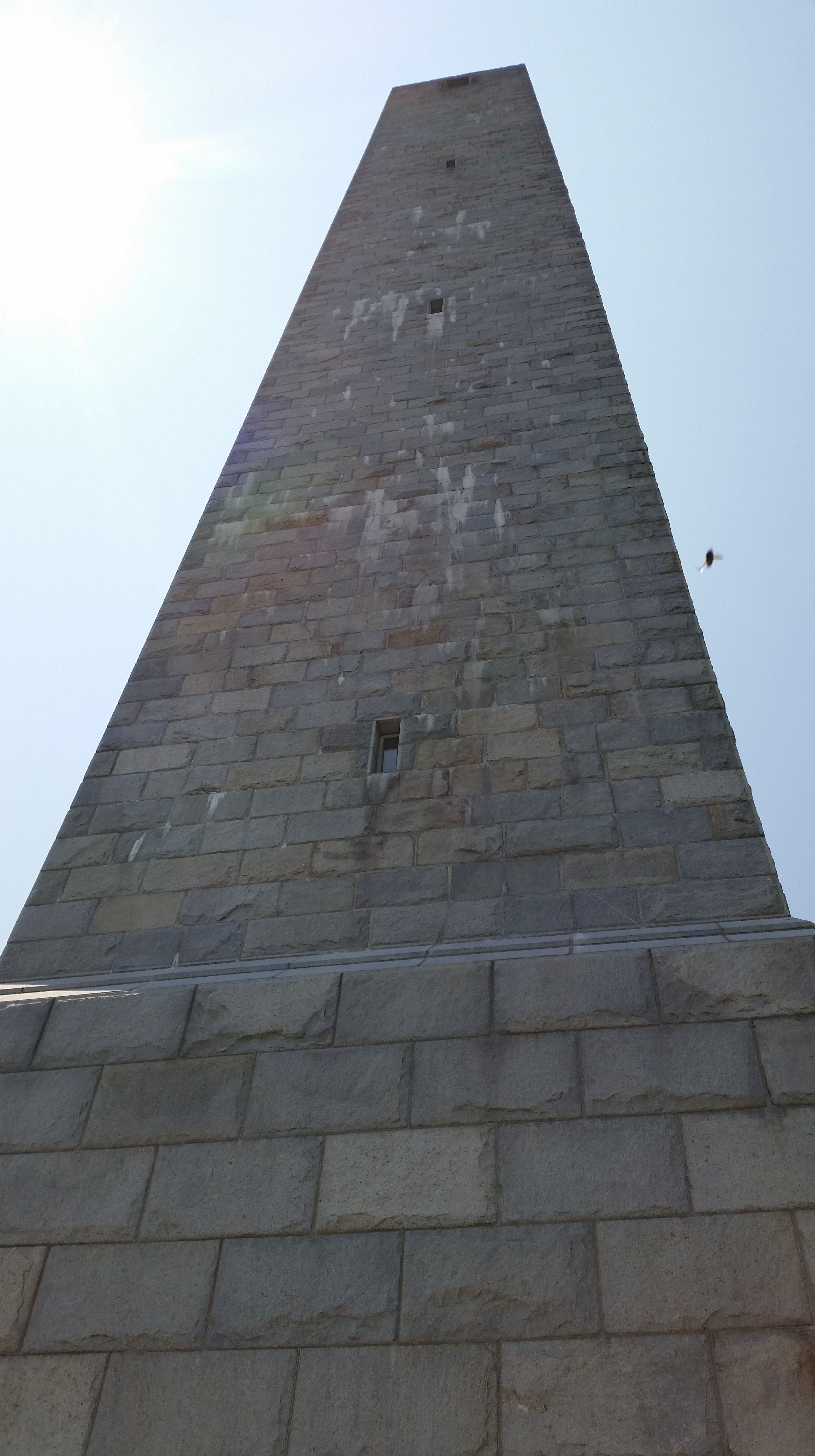
[…] The 70-mile race is long and daunting. The trail starts in the High Point State Park outside Port Jervis, New Jersey, at a junction with the Appalachian Trail and immediately passes under the shadow of a monument tower that can be seen from the Catskills sixty miles away. It proceeds through rolling forests and alongside the Bashakill wetlands and rises onto glacially-scoured rocks on the crest of the ridge before dropping into quiet forests in the northern section of the Mohonk Preserve. The trail ends in the town of Rosendale, New York just past a restored railway trestle that crosses 140 feet above the Rondout Creek . The word “dramatic” does not do justice to the Shawangunk Ridge Trail. I discovered the SRT in 2014 and fell in love with it, most recently thru-running it in 2015. […]
LikeLike
[…] the entire 70-mile Shawangunk Ridge Trail (SRT), most recently in 2015, when it took me around 24 hours. This year, however, still recovering from a sore ankle tendon, it would have to be a slower […]
LikeLike
[…] of previous years carried me along.” Your race director, who’s run the 70-mile course three times, would like to recognize Mark Moroge and Ben Leese, who’ve completed the course twice, Jason […]
LikeLike