Some highlights from a 37-mile circuit over the holiday weekend along the so-called “Super Pemi Loop” in New Hampshire’s Pemigewasset Wilderness. The purpose of this trip was i) to make progress on the peak-bagging list for New Hampshire’s 48 mountains over 4,000 feet and ii) to test gear and train for my upcoming trip to the John Muir Trail in California’s High Sierra.
Day 1
- After driving four hours Wednesday night, stopping over at a motel in New Hampshire (where at check-in I had to certify I was free of Covid-19 symptoms) and then an early rise and another one-hour drive, I finally reached Lincoln Trailhead. The most important part of many hikes (especially those close to holiday weekends) is the Parking Plan. Arriving at 7 am, I was delighted to find plenty of spaces.
- The trail starts by heading across a bridge spanning the East Branch of the Pemigewasset River.

- From here, several miles along an old railroad bed: flat, level, straight — a tunnel through green forest, with sounds of the river on the right. In terms of barefoot hiking, it’s hard-packed dirt with a sprinkling of gravel, which forces you to pay attention.
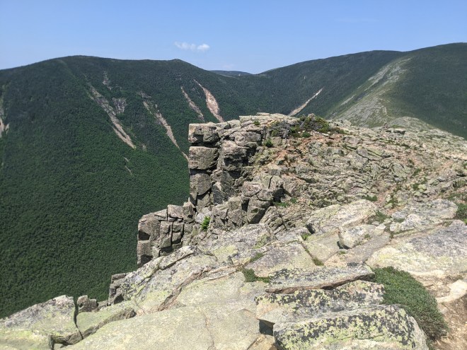
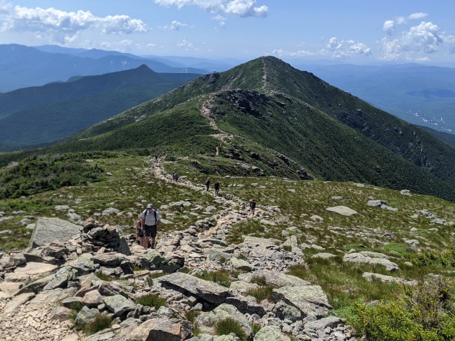
- Then a long gradual uphill trek along a pleasant dirt path. Eventually I reached the exposed ridge crest. Here the trail was full of colorful New Hampshire granite — gray, pink, and orange — in broken rocks and scattered chips, which is not the easiest surface without shoes. This is the alpine zone (above treeline) where the rock is directly exposed to the elements. But small hardy plants make this difficult environment their home: greenland stitchwort, ligonberry, labrador tea, and fir and spruce trees growing knee-high.
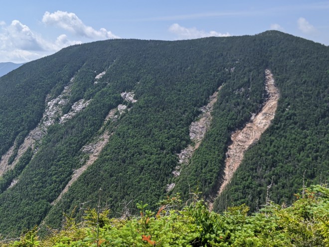
- I bagged the first three peaks in relatively rapid succession: Bondcliff, Bond, and West Bond. Clear skies, endless views, especially from Bondcliff, which offered a 360-degree panorama. Mt. Washington loomed to the east, a gray mound that dominated the other peaks. Across the valley, the face of a prominent ridge was marked by long rock slides, as if it had gotten raked by giant talons.
- Onwards to the Guyout Campsite — but first a stranger makes a helpful observation: there’s a 1-mile out & back to bag West Bond, which somehow I’d missed while planning my route. I dropped my pack and scampered slowly (still without shoes) off to the peak. A group of youngsters passed me by. Once there, hanging out on the summit, I chatted with these young climbers. One told me he had completed the NH 48 two times already and intended to complete the NH Grid (the 48 high peaks in each month of the year, or 48 x 12, almost 600 separate ascents), which he described as a “lifetime goal.” If you plan far enough ahead, anything might be possible. I’m always pleased to see young people who are fit, ambitious, and determined. Maybe it is true, as people like Walt Whitman, John Burroughs, and Norman Clyde once believed, that exposure to the outdoors world makes people strong and healthy and optimistic. As we were talking, tendrils of rain appeared and began to drift our way. I hastened on to the campsite, where I secured a spot to pitch my tent.

Day 2
- It rained briefly during the night. The day dawned underneath low clouds, and very little was visible. I ate breakfast, packed up, and was on the trail by 6:00 am. My feet were a little sore from yesterday’s rocky trail, and with the weather not looking promising, I decided a quicker pace would be appropriate, so I put on my shoes for the walk to Zealand. The trail turned to soft dirt, black mud, and large smooth rocks, which made me regret that decision. A compromise: at the saddle below Zealand, I went barefoot again, and this became my formula for much of the rest of the day: barefoot up to the peaks, so I could claim them toward a barefoot NH 48, and then shoes on for the descents in order to make up time.
- On the way to Zealand, a loud flutter in front of me, and a spruce grouse flushed from the trail and flapped off — but only about 8 feet above, where it perched on a branch. If I’d been carrying a shotgun (or reached down for a rock to throw), it might have ended in the dinner pot. But I was well-provisioned with freeze-dried food, so I only paused to take a picture.
- From Galehead Mountain along the northern side of the Pemi Loop was a long wet slog, all done in shoes, in order to get to the Garfield Campsite before it filled up. Mud, slippery rocks, streams, a dripping green forest — and then a climb up a steep rocky trail that was also a streambed and streaming with water (in fact, as it was now raining, the trail became itself a waterfall). At Garfield Campsite I set up my tent and then, as per campsite procedures, cooked and ate my dinner in the open eating area in the pouring rain.
 Spruce Grouse


Day 3
- It rained for much of the night, but somehow I woke up still dry, amazed that my flimsy lightweight tent had protected me (although to be fair, it has never yet failed me). After breakfast, a short but wet and steep climb to the summit of Garfield, which offered views of mist-filled valleys and clear skies.

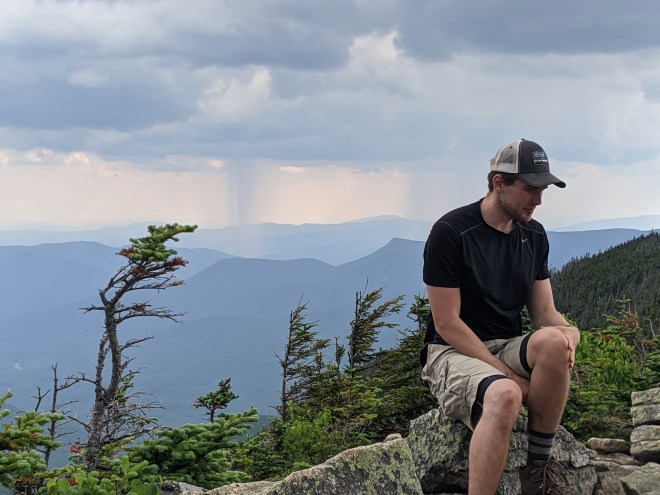
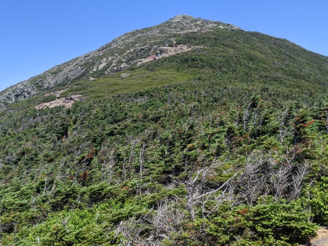
- After Garfield, the trail follows the crest of a long ridge, surmounting Lafayette, at 5,249 feet, the highest peak on the circuit, and then Lincoln, Little Haystack, Liberty, and Flume. The day was hot. I rationed my water. This being a holiday weekend, the trail was packed with day hikers who’d come up to the ridge from side trails. Even so, there’s a great sense of freedom up in these mountains, albeit freedom that you have to work for. It occurred to me, as I sat on the summit of Liberty Mountain on the 4th of July, that you must work for all freedoms.
- The pattern remained barefoot up the peaks, and shoes on for the descent into the next col. When people on the trail asked why barefoot, I had a couple of stock answers: “to keep my shoes from getting dirty” or “I read Born to Run.” Someone looked at me and commented, “That’s next level” — which I took as a compliment, although truthfully, barefoot is prior-level, since it’s what people used to do.
- After Flume, the last peak on the ridge, the trail descended steeply, dropping down on wooden ladders and staircases fashioned from large stones, and after that, it became a beautiful dirt path, similar to what I’d experienced the first day of the loop. An interesting contrast: on the southern slopes, the paths were dry dirt, whereas on the northern loop, it had been a wet rocky jungle. Shoes on, I cruised at a relatively fast pace, until I found a campsite by a stream.


Day 4
- Skipping breakfast, I broke camp, and hiked the 2.3 miles back to the car.
Summary
- The Super Pemi Loop bagged me 12 of the New Hampshire high peaks, bringing me to a total of 19 out of 48, or roughly 40%.
- I completed the 37 miles roughly 70% barefoot/30% in shoes.
- The loop was a good shake-out for my gear and supplies. I have a couple of items to repair or replace and some ideas to cut a few more ounces from my load.
In early August I’ll head out to hike along the John Muir Trail in California’s High Sierra. My training and preparation have been effective. To say that I’m excited about this trip would be a large understatement.
Running the Long Path is my account of a 350-mile run in pursuit of a fastest known time record and what I discovered along the way. (Click on the image for more info)

Thanks for sharing. I enjoy reading about these adventures. Take care.
RH
LikeLike
To say I’m looking forward to your trip report about the Mt. Whitney adventure would also be an understatement! Hope it went well!
LikeLiked by 1 person
[…] the way, a long ridge with a row of mountains: Lafayette, Liberty, Flume, and others, which I climbed in 2020, incidentally. Below us, Lonesome Lake, which I’d passed on the way up. To the left, the […]
LikeLike