A long weekend, five peaks, and a few scratches. . . and the July Grid is done.
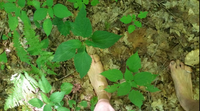
Going shirtless, in shorts, and barefoot is not the recommended uniform for summer bushwhacking in the Catskills, but it keeps you cool when the temperatures head into the 90s, and not only that, it teaches you to be “mindful,” which is yoga-speak for paying attention. Better pay attention to where you step!
Saturday, July 7, met Kal at the Phoenicia Diner. Phase one of the plan: bushwhack Sherrill and North Dome, following the same route I completed in late June, but this time going counter-clockwise instead of clockwise.
We cross a bridge over the West Kill and park on the side of the road. The planned route heads straight into the treeline, but above us beckons an open field. Wouldn’t it be more pleasant to saunter through knee-high grass then poke about in the dark and crowded forest? Accordingly, we head uphill, delighted to be moving quickly, at the same time scanning the periphery of the field for buildings (in case this is private property) .
What a shame though, I’m thinking to myself, we’ll miss that narrow creek, the one I’d passed last time here dropping over a ledge and pooling in a pretty red shale basin underneath some pine trees. That we’re heading up on the east side of this creek, instead of crossing over to the west, doesn’t seem consequential.
Eventually the fields end, and there’s no choice but to plunge into the woods, but luck stays with us because here’s an old forest road heading uphill. Easy walking and more delightful quick progress! Of course, we keep an eye on the sun to make sure we’re not drifting off course. “As long as the morning sun’s on our left, we’re heading North,” I declare (meaning to say “South”).
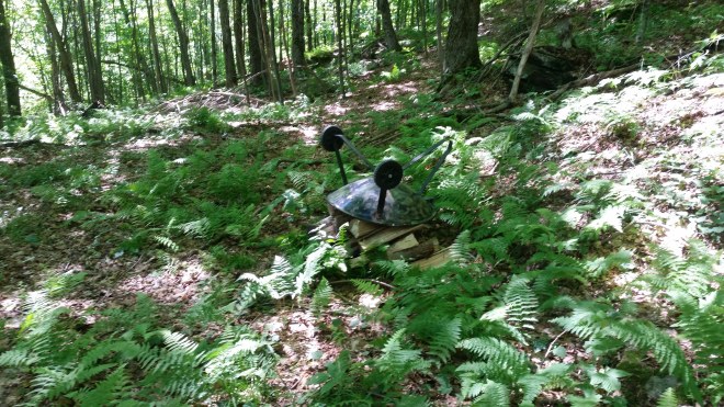
The road curves east, so we reluctantly leave it behind and step into the bushes, only to stumble upon another forest road. Moving right along, after awhile it’s onto some unmarked footpaths, which are also good walking. . . at one point we pass a barbecue grill and chopped wood . . . and later on I find an empty orange bucket labeled “Big Game Butter — The Best Big Game Attractant” (based on a peanut butter formulation).
This is supposed to be a “natural navigation” ascent, that is, we’re supposed to find our way to Mount Sherrill’s summit without referring to map, compass, or GPS. . . but it’s taking a really long time to get there, and something doesn’t feel quite right. . . so I steal a peak at the GPS, only to discover that we’re not on Sherrill, but its eastern neighbor, North Dome.
Oh, that sneaky little creek!
The map shows it drains from the saddle between the two peaks: by taking the fields, we pointed ourselves just ever so slightly off-course. This is a “natural navigation fail,” but also a valuable lesson about paying attention to terrain features.
No real harm done, we’ll just complete the loop clockwise after all. We sign in on the North Dome register, noticing that someone named Jake’s already been by this morning, and then move out along the unmarked social trail that leads west to Sherrill.
As we near the saddle between the two peaks, the trail peters out. I’m determined not to lose it — because stepping along even the faintest path is easier than blundering through thickets — so Kal and I scan the ground for clues, and then split up, one going left and the other right, until we find the path again.
What a nice path: as long as we pay attention, it takes us straight to the saddle and then up Mount Sherrill, where we encounter Jake, eating a snack at the summit. Jake’s headed down the same way, and eager to get a ride from us back to his car, which is parked further away. I’m happy to accommodate, but warn him we’ll be slow. After all, Kal and I are barefoot and dressed in shorts, which means we’ll be moving deliberately and choosing each step with care.
So far this morning we’ve enjoyed fast progress — through the fields, along the various forest roads, and on the social trail between the two peaks — but now our pace slows to a crawl as we head out into the boreal thickets, fight through 8-foot tall hobblebush, dodge beech branches, swish through waist-high ferns, all growing among tumbled rocks, and after contouring for a little while, we plunge downhill. . . . and waiting for us are the dreaded stinging nettles, at first growing dispersed among other plants, but in some places forming dense bands across the slope. We look about for routes across rocks or under trees or through bushes, otherwise exposed skin on legs and feet will pay a price. It’s like moving through a minefield. Poor Jake, he should’ve walked to his car, it would’ve been much faster!
The hike becomes a little desperate, but that’s not to say there aren’t some interesting discoveries, like this fern whose fronds radiate out from a dark wiry ring-shaped stipe (stem). Northern maidenhair fern.

We make it back to the car, drop Jake off, and then Kal and I grab an early dinner in Phoenicia. Now it’s time for phase two: we convoy out to West Shokan and park along Moon Haw Road.
We immediately confront a steep scramble to get up on the ridge — it’s just awful — a full stomach and a single beer are apparently sufficient to destroy my sense of balance — to keep from slipping, I have to bend so far over I’m practically crawling. . . . but once on the crest it’s easy walking, and after a little bit we reach a grove of hemlocks, our campsite for the night.
The next morning we’re awakened by a hermit thrush. Kal is charmed by the song, regarded as one of the most beautiful northern birdsongs. I appreciate the song, too, but 5:00 AM is not my favorite time of day, and this thrush is quite loud.
Without breakfast to slow us down or even a cup of tea (I brought the stove but forgot the pot), we’re soon on the move, following the crest of the ridge along yet another social trail. This ridge is dry and open, with tall trees and plenty of leaf-litter on the forest floor — such a contrast to the damp tangled thickets on Sherrill.
The trail diverges from the ridge crest and contours around to the south, taking us toward the saddle between Balsam Cap and Friday. We pass an intersection marked by an enormous yellow birch, which we guess is the route to Friday.
We stroll through the fir-spruce thickets towards Balsam Cap, enjoying the strong morning sun, the cool air, the faint sweet-resiny fragrance, following a trail which is almost invisible but magically free of branches.
From Balsam Cap, the the trail to Rocky peters out, leaving us groping among thin trees growing inches apart. I keep veering south, looking for the route I’d taken when here in February, but no luck. On the way back from Rocky, however, the mountain spirits must have smiled, because the southern route reveals itself — not that any path is visible per se, but nonetheless I’m being shepherded around the worst obstacles — while Kal, who’s searching further north, gets caught in a mess.
Back at the big birch intersection, Kal wants to climb Friday. I’d rather save my energy for phase three, but I can’t let him go alone because this is a difficult route. So we head up together, find the “ramp” that leads up along the cliffs, and finally claw our way to the summit. On the way back, it’s my turn to take the less desirable route (at one point making it down with the help of a climbing rope someone left draped over a cliff), while Kal marches straight to the ramp. After shouting back and forth through the woods, we link up, follow the ramp back down to the trail, and eventually, reach the cars.

Kal and I say goodbye as he’s heading back home, while I head out for phase three of the operation: an ascent of Halcott Mountain, which if I survive will finish the Grid for July. I have just barely enough energy left.
Parking on Shaft Road, I cross the streambed next to the highway and head uphill. The streambed is bone dry. And the forest here, similar to the ridge heading up Friday, is dry and open.
Steep work, although an old forest road gets me off to a decent start for as long as it lasts, but then my feet are slipping on dry leaves putting me back into bent-over mode. Passing through a hemlock grove — tonight’s campsite– but now onwards to the summit while the light lasts.
A long walk, and not only all the standard obstacles, but Halcott has distinguished itself among Catskill peaks by attracting an especially dense concentration of blackberry canes. The young shoots aren’t too bad, still green and flexible, they might give you a tiny nip as you pass by — it’s the old monsters that cause problems, with thick, tough, purple canes bristling with shark teeth-like thorns or when bleached and dried out and matting up the forest floor, those thorns hurt to step on! Shirtless, in shorts, and barefoot is not an adequate uniform, I decide, when I get stuck in a particularly virulent patch. I reach out, gingerly pull canes aside, trying to grasp the stems between the thorns.
By the time I gain the summit, my resolve has wilted. Shoes go back on for the descent. And what a difference they make! With some shielding plus gravity now helping, I practically run back down the trail — only to find 1/4 mile later it’s the wrong way — so I contour back across the ridge, striding vigorously, then turn downhill and stomp upon the berry canes from above, crushing them into the ground. Ridge crest outlined against twilight sky, alpenglow on clouds and mountains across the way — these glimpses guide me back the right way.
The fast pace lasts until the first dense band of nettles. Mindful of exposed legs, I grab a fallen branch and whack away at the plants, like a sword-wielding knight, until the stick breaks, and now I’m trying to fight knee-high nettles with a dagger. I toss away the stick in disgust.
Two or three bands of nettles leave me frustrated and fatigued, although I sustain nothing worse than a little tickle on the calves. Reaching the hemlock grove in the darkness, I roll out my bag.
The next morning at 5:00 AM the cacophony returns, featuring yet another loud hermit thrush accompanied by a robin and an eastern peewee (loudly rasping “PEEEE-A-WEEE”). I have my cup of tea (having remembered the pot this time) and stumble back down to the car.
Going shirtless, in shorts, and barefoot teaches you to step carefully! The berry canes left me with a few scratches to remember them by, but nothing serious. And now, with the July Grid complete, on to other projects!


Running the Long Path is available on Amazon (Click on the image to check it out)

Love living vicariously through all your adventures. Your passion and perseverance are truly inspiring. Thank you for allowing us all to be a part of your life’s journey!
LikeLiked by 1 person