I put in a huge effort and managed to complete the Grid for October — and with so much momentum, it felt like I was getting close to finishing the entire project, but that was a mirage: the spreadsheet shows me just crossing the half-way mark: 250 ascents complete, 180 to go…. And now here it is November, and due to a number of conflicts I won’t be able to finish the thirty-five climbs for the month, and thus the earliest completion date for the Grid rolls to November 2018. Oh well, people tell me not to rush — but why wouldn’t you rush to finish something important?
Southwest Hunter and Hunter
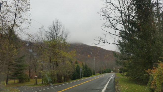
The plan had been to bushwhack up to Southwest Hunter along a narrow ridge a couple miles south of the Devil’s Tombstone Campground, but on the drive up, I saw that heavy clouds had obscured the ridge tops, and then rain began to spatter against the windshield. My heart sank. November is a transition time, and after the dreamy warmth and colors of fall, the bleak cold wet winter landscape seems daunting. Today I scratched the bushwhack plan and opted to take the trail instead, thinking it would be a nice day to see some people.
And on the climb out of Devil’s Tombstone, I encountered two hikers on their descent. Gesturing to my bare feet, one asked, “Is it meditative?”
To which I replied, “It can be, but often it’s just plain aggravating,” thinking to myself that probably you can’t enjoy the one without suffering the other. Indeed, on this chilly wet morning the rocks felt even more aggravating than normal, but I persevered and in due course reached the Devil’s Acre lean-to, where I took a break from the wind and drizzle.
As I was sitting in the shelter, I noticed a bird feasting on the berries hanging from a nearby mountain ash tree. Then I spied two companions perched in trees on either side, as if standing watch. After a few seconds, the birds rotated in a clockwise direction, and one of the sentinels got his turn at the berries. After a few rotations, one of the birds (presumably the chief) fluttered back to the berries, and now the rotation changed direction and continued counter-clockwise. The birds were the size of robins, with dark backs and russet chests, and maybe they were robins, although the mists were so thick it was hard to get a clear look. I think of robins as spring birds jumping about in the grass after worms, but I read that they overwinter in groups and feed in the trees, so perhaps that’s what I saw.
In due course, I made my way out to Southwest Hunter, enjoying the soft dirt path which leads there. On the way back I met a gentleman who introduced himself as Jim Bouton, canister chair for the Catskill 3500 Club, and he turned out to be a wealth of information and advice (he’s also a relative of the ADK member and hiking enthusiast for whom the Bouton Memorial Lean-to on Table Mountain is named).
Noticing my bare feet, Jim mentioned that he knew of a fellow named “Barfoot Phil” who’d climbed the thirty-five high peaks without shoes back in the 1970s (he spelled it that way after a southern friend once exclaimed “Jezzis, Phil, you’re barfoot!”) Barefoot hikers being few and far between, it was certainly interesting to learn there is a history.
Then he explained the origin of the unofficial trail we were standing on. It was originally the route for a horse-drawn railroad operated by Fenwick Lumber Company that took lumber from the mountaintop to the lean-to area, where coal-fired engines operated, and the wood was then shipped down through Myrtle Brook, which lies in the ravine below the narrow ridge I’d planned to bushwhack. Much of this wood was used to construct the Ashokan Reservoir, Jim explained, and he thought I was right to save that bushwhack for a day when the views could be appreciated. He asked if I’d noticed the coal slag that litters the trail near the lean-to, and as a barefoot hiker, yes, you couldn’t miss it, it was uncomfortable underfoot. What was really strange, we both agreed, was to imagine the mountaintop denuded of trees and the coal fires belching black smoke. Today a lush boreal forest has reclaimed the mountain, and the slopes are cloaked in a mix of balsam fir, red spruce, paper and yellow birch, and mountain ash, among other species.
I mentioned I was planning to take a short cut from the lean-to up to the firetower on Hunter Mountain, and Jim advised me to follow the old railroad bed in that direction. After wandering through the woods for a few moments, I did find an old road-bed, but it was too choked with deadfall to follow for more than a little ways. I made my way uphill, discovering another old path which might have been one of the “haul lines” used to drag timber, and then worked my way up around some ledges and through more fir, feeling a little cold and wet by this point, despite multiple layers and goretex, but eventually popped out on the trail to Hunter.
Blackhead, Black Dome, and Thomas Cole
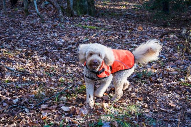
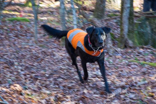
The next weekend, I met Steve Aaron and his friend Rick at the Saugerties Diner, and we drove off to the Big Hollow Trailhead for an 8-mile loop through the Blackheads. Accompanying us were Odie, Steve’s young vizsla Lilly, and Rick’s dog Linc (short for Lincoln).
Lilly and Linc being young pups, raced back and forth and tore all around, while Odie, who is now ten years old, kept up a dignified trot, appearing somewhat bewildered by the younger dogs’ exuberance and inclined to tune them out and focus on operating efficiently.
The ledges were just starting to ice over, and we worried how the dogs would manage, but they seemed to understand perfectly well how to maintain traction on ice, and if one paw slipped, the other three made up the difference. When we reached some of the steeper ledges, for example, the scramble up Blackhead, Lily and Linc bounded straight up, while Odie being more conservative waited for me to catch up and where necessary lift him up to the next level.
That said, I recall earlier in the fall, when Steve and I had gone on a short hike in Harriman State Park. Lilly was dashing around, while Odie trotted along oblivious to her antics — until a deer appeared in the distance. And then Odie was off in a flash, tearing through the heath, bounding over fallen trees, barking with glee, while Lilly stood and watched.

Twin, Indian Head, and Panther
It was a cool day, with heavy featureless layer of dark clouds blotting out the light. Upon reaching the first summit of Twin Mountain, I found abundant mountain ash berries (the same kind I’d seen the robins eating on Southwest Hunter). These are very tart, but I’ve developed a taste for them, and I happily munched a couple of handfuls. They won’t be around much longer, either because robins and bears grab them, or because of the frost.


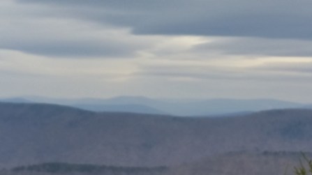
From the second summit, the western Catskills spread out across the horizon under a dark and gloomy sky. The lower layer of clouds was heavy with moisture, and indeed the forecast was calling for rain that afternoon. To the north, there were some patches of bright blue sky visible through gaps in the clouds, but these were only intermittent, and at a higher altitude another layer of featureless gray was moving in and closing off the light.
Peering into the distance, I made out the usual suspects: Sugarloaf, Plateau, and Hunter to the west, with the firetower on Hunter sticking out like a needle, while Peekamoose, Table, and Slide were visible to the southwest, with Giant’s Ledge and Panther standing out as well. A glimpse of white — that must be the ski run on Belleyare Mountain — and then tracing the ridgeline to the south, for the first time ever I picked out Balsam Mountain, with the vantage point on the northern corner of its summit from which I’d looked out this way just a few weeks back.

The plan was to spend the night in the Biscuit Brook lean-to, but it wasn’t even 3 PM when I returned to the car, so I drove out to Panther Mountain. This 6.6-mile roundtrip was uneventful, and mainly took place in the dark. Towards the top, a light dusting of snow made the trail slick in a few places, especially on north-facing dips, and wearing Vibram Five Fingers at this point, I didn’t have much traction, so some care was warranted.
Fir Mountain
It was nearly 8:00 PM when I arrived, and the temperature had warmed somewhat, so I hiked the two miles in to the lean-to barefoot, possibly my last shoeless steps of the season. The day ended with 14 miles, and on an encouraging notes, the ankle felt fine. I’ve been undergoing a treatment called “EPAT” which consists of shockwaves directed at the sore tendon, and which is supposed to help stimulate regrowth of healthy tissue to replace the scar tissue.
It was raining steadily when I arrived at the lean-to, and what a relief to reach shelter. I heated some water over a can of sterno and drank a cup of tea while the Biscuit Brook roared nearby and the rain pattered on the shelter roof, and then slept reasonably well, although waking up a few times feeling chilled.
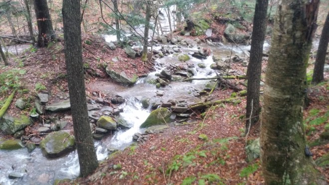
The streams were moving quickly in the morning, swollen with the evening’s rain. I paused for a moment to admire the Biscuit brook pouring over a cascade, collecting in a pool, then tumbling through a series of rocks. I headed up into the forest above a ravine with another beautiful rushing stream.
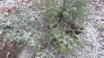
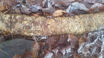
I kept the Vibrams on. It was too cold to go barefoot. Above me, the winds thundered across the summit, and snow flurries dusted the forest floor. I stepped over the serpentine root of a yellow birch and marveled at the deep yellow color flecked with orange. A cluster of young balsam fir was growing on top of a rock, happy with an inch or two of dirt.
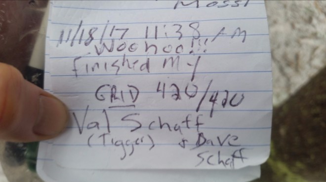
And then, there was a surprise waiting for me in the canister on Fir’s summit. The person who had signed in before me had just completed the Grid! I don’t know Val Schaff (Tigger), but I offer her a hearty congratulations. And take her success as a good omen for my continuing efforts. Woohoo!!!
Running the Long Path is available on Amazon


