I’ve been reading a very good biography of Ralph Waldo Emerson, and that’s been encouraging me to think about and try to articulate why I seek to spend so much time on the trails:
- As modern society is becoming more and more digital, I want to stay physically active, as it seems to me mind and body completely are intertwined, so one can’t be healthy and happy without the other
- As the world is becoming more and more artificial, I want to spend time in nature, which seems like the real source of joy and exhilaration, of which media and other content are but faint imitations
- As people are becoming more and more interconnected, I want to cultivate an attitude of self-reliance, not meaning that I shun relationships, but rather how can you interact meaningfully with others if you can’t stand on your own two feet
Which brings me back to the Grid, which is the goal of climbing all 35 of the Catskills’ high peaks in every calendar month. Heading into August, I was in pretty good shape, with 27 done and only 8 left to go, thanks in large part to my August 2016 attempt to thru-hike the entire 35.
Here are some notes from a recent hike where I completed 6 of the remaining 8 together with my friend Alan D.
Rusk Mountain
- Friday evening during the drive up to the Catskills, the weather was unsettled, with clouds churning in the mountain valleys and a spattering of rain against the windshield
- Alan and I met up in Phoenicia and arrived at the Spruceton trailhead just a little after 6 PM. The parking lot was empty: the weather must have scared people away
- Our first objective was to bushwhack to the summit of Rusk, with a special goal: we’d try to do so without using navigational aids, i.e., no compass, maps, or GPS. This goal was inspired by commentary on the Facebook page, Catskill Trail Conditions, in which someone had talked of doing this, and this comment in turn had inspired me to read the old classic, “Finding Your Way Without Map and Compass” by Harold Gatty. There’s also a more recent book, “The Natural Navigator” by Tristan Gooley, but while the author’s experience is impressive, the text seems largely derivative of the Gatty classic.
- In preparation for Rusk, I’d carefully studied the map, which shows a broad ridge reaching up to Rusk’s summit flanked by streams on either side. Therefore, to reach the summit, all we’d need to do was march uphill and avoid drifting into streambeds. Once we reached the top, the summit would be a little to the left.
- Off we started, and after walking less than a mile on the horse trail, turned in to the woods at a distinctive curve in the trail. At first there was a very obvious social trail where countless hikers had gone before us, this curve being the logical starting point for the bushwhack to the summit. But the trail soon disappeared. We marched uphill through relatively open forest, keeping to the broad ridge according to plan, and steered a little to the left, since the summit was off in that direction.
- After a little while, we began to notice faint signs of people who’d passed this way before us: a rock that had been knocked out of place, scuff marks in the soil, a few bent fern fronds, leaves on the ground looking a little more compressed than those to the side, a fallen log with the bark scraped away where people might have stepped on it. None of these were definite, but the more clues we saw, the higher the probability that we were following some kind of trail.
- We saw what looked like a flow of water down the slope, not a stream per se, as no channel had been carved in the soil, but the leaves had clumped together in certain places as if a water had washed down this slope during a recent rainstorm. Alan and I reasoned that where the water had cleared away some of the leaf litter, hikers might see an easier place to step, and that conversely over time as hikers stepped in certain places, this might form a natural channel for water to wash down the hill.
- Whether or not we were following a social trail, the walking was relatively easy, even without shoes (in my case), as the surface was just a little firmer than it sometimes is on tumbled slopes, and the vegetation wasn’t quite as thick.
- We had 1,000 feet or so to climb and we moved up steadily if not quickly, and as we rose, the possible trail gradually turned into a definite social trail. We ended up following it to the top. This was quite a different experience from my earlier bushwhacks of Rusk, where I struggled with really steep slopes, thick vegetation, and steep rock slabs. By studying the map and pointing myself in the most logical direction to the top, I’d done what others before me had done, and that turned out in this case to be the best route up. Indeed, in reviewing our GPS track afterwards, the social trail seems to follow a direct compass azimuth from the curve in the trail to the summit, which makes sense.
East Rusk
- From Rusk, the next objective was to bushwhack over to East Rusk. This route would entail heading East down into the shallow saddle between the two peaks, and then following the narrow ridgeline as it curved southeast. Once again, the goal was to navigate without using map, compass, or GPS.
- The major trick here would be to point ourselves to the east without using a compass, because if we headed in a different direction, we’d drop down off the ridge and into one of the valleys on either side. Fortunately, there was just enough light from the setting sun that we could see tinging clouds to the east, and this gave us broadly the right direction to move.
- Almost immediately we stepped onto a very well-defined social trail and followed it cautiously as it descended toward the saddle. It’s dangerous to assume that a social trail is going the same direction you want to go, and when heading downhill, small errors in direction can lead you far astray.
- As the sun sank, the forest sank into shadow, but we could see just enough light through the vegetation to tell that we were still on top of a narrow ridge with steep descents to either side.
- The social trail was a firm walking surface and took us through glades of ferns, hobblebush thickets, fir trees, and other thick vegetation and rocky outcroppings that would have been slow to penetrate. In some cases the trail branched, but this was generally where a fallen tree had blocked the original route, or in some cases, where the trail snaked through fir trees, and some people probably didn’t want to brush through the branches, there was an alternate route around to one side.
- By the time we got to the saddle, it was fully dark, and we clicked on lights. From here we had the relatively more simple task of marching uphill to the summit of East Rusk, and the social trail took us exactly to that spot.
- From the summit, the plan was to descend through the woods and rejoin the horse trail up Hunter at an intersection in the saddle between East Rusk and Hunter. The social trail headed off exactly in this direction, which is not surprising as that intersection is the logical spot to aim for, for anyone who wants to continue on to Hunter. About half-way down the mountain, we lost the trail in the darkness as we descended over some rock ledges. We had to fight through a few fir and beech thickets and ended up about 100 yards south of the intersection when we finally arrived.
Hunter
- The walk up to Hunter was uneventful, and upon arrival, we flashed our lights at the firetower, which was shrouded in fog. From here, we walked the 1.7 or so miles down to the Devil’s Acre lean-to. Because of heavy rain earlier in the day, the trail was flooded in many parts, which was more of a challenge for Alan in trail running shoes, as he sought to keep his feet dry than it was for me in bare feet, for whom puddles are a little easier: as soon as you step out, the water rolls off, and your feet are dry again, you just have to be careful about rocks lurking underneath the mud.
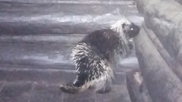
- Upon arriving at Devil’s Acre lean-to, we were delighted to find it unoccupied — indeed the unsettled weather had kept the crowds at bay — unoccupied, that is, except for a porcupine, who when he saw us tried to hide in one of the corners. I believe I saw this same porcupine last time I was here. In both cases, I moved to the left, giving him plenty of room to exit to the right.
- During the night, the rain fell so hard it sounded like thunder
- The next morning the path took us back down to the Spruceton parking area. The weather was foggy, with nothing visible from Geiger Point, and the lack of light made me feel a little bit slow and tentative. Then I got the idea of going for breakfast, and with this motivation in place, I put on sandals in order to move a little more quickly on the rocky path.
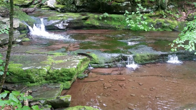
- We passed the headwaters of the West Kill and Diamond Falls and followed the creek on the way to the parking area. The water was remarkably clear.
Blackhead, Black Dome, and Thomas Cole
- After breakfast in Tannersville, we pulled in to the Big Hollow trailhead outside of Maplecrest and began hiking along the trails toward Blackhead.
- The morning was foggy, but as we began the climb, the sun started to break through the clouds, and before long the weather had cleared. There were still lines of cumulus clouds in the distance, but the morning’s cloud cover had dissipated into random shapes and was now drifting off to the east. As the frontal system passed, the humidity dropped, the wind rustled playfully in the trees, the sun warmed the ground, and it became a beautiful summer day which could not be any more perfect.
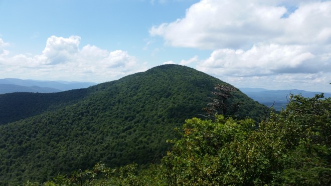
- We stopped for a few minutes on the summit of Blackhead, which has no views, but the overhead sun beamed down on us and it was wonderful to feel its warmth.
- I made my way slowly down the wet and rocky path from Blackhead, while Alan ranged ahead.
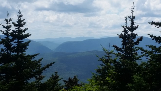
- From Black Dome, we admired the view to the south of the Devil’s Path, picked out the firetower on Hunter, and stared into the sharp cleft in the mountains between Hunter and Plateau that marks the Devil’s Tombstone campground.
- I looked at my watch, but it was such a beautiful day, there was no choice but to head on to Thomas Cole. While many of the trails in the Catskills are quite rocky, op on top of this ridge the trails are beautiful soft dirt and easy walking, no matter what footwear you’re wearing or not. There was no place I’d rather be.
- In hiking the six summits, we’d covered 20 miles in 24 hours, which is as much as I’ve done since injuring the tendon in my ankle at Rock the Ridge in May, and most of this was barefoot. It’s taken many miles to toughen up my feet, but now hiking on the Catskill’s generally rocky trails is much easier, although some sections can be very trying and slow, especially downhill.
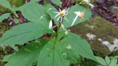
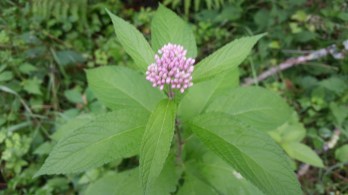
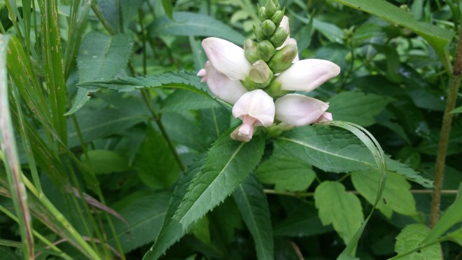
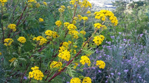
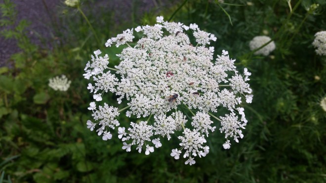
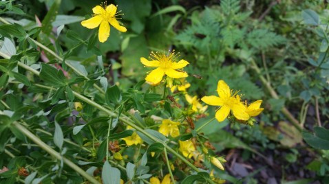
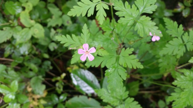
- One of my goals of this weekend’s hike was to identify some of the late summer wildflowers in the Catskills, which are indicated below. The overwhelming impression of the summer mountains, of course, is of green, and the Catskills flowers are often small and indistinct, but once you’re aware of them, you start to notice the dots of white, yellow, pink, purple, and blue. They are more prevalent along trails and in clearings than in the deep woods. By the roadsides down in the valleys, the colors, variety, and proliferation of vegetation is nothing short of astonishing.

Running the Long Path is now available at the Bookstore Plus in Lake Placid, NY, but if you’re not nearby, you can order it on Amazon

