A few weeks ago, my wife and a couple friends participated in The Great Saunter, a 30+ mile circumnavigation of Manhattan along the city’s Waterfront Greenway, and reported that they had had a great time. This seemed like a promising exercise for me, too, and not just for the training miles, but also for the experience of circling the island, which I had never done before. Accordingly, last Saturday morning after a cappuccino and a handful of mixed nuts, I headed out to Riverside Park on Manhattan’s west side. It was a beautiful, clear spring morning, with the forecast calling for sunny skies and moderate temperatures, although as I would learn later the temperature would peak at 91 F.
Once I reached the park and turned north, the Hudson River was shimmering on my left, the George Washington Bridge loomed in the distance, and the path lay in the cool shade of the trees.
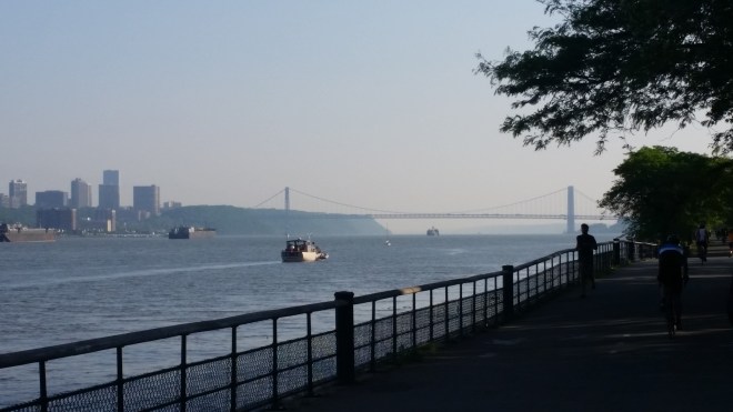
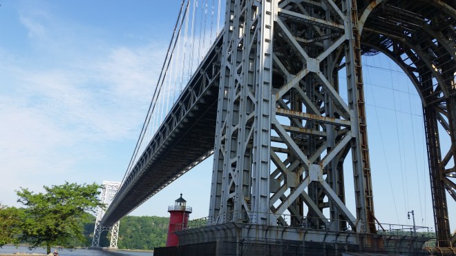
It was just 8:00 AM, and but for a handful of runners and cyclists, the park was quiet. After a mile or two along the water, the path ducked underneath an elevated roadway, passed by the Riverbank State Park, and then emerged at the base of the George Washington Bridge. Built in 1931, the GWB (as we locals call it) is today the busiest vehicular bridge in the world. One of the bridge’s massive steel towers rose above the eastern bank of the Hudson, dwarfing a little red lighthouse dating from 1880, and across the river another tower rose from the New Jersey shore. I peered up into the heights and spotted runners trotting along the pedestrian level far above.
Now the path headed uphill and skirted the northbound lanes of the Henry Hudson Highway. I paused at Inspiration Point, a Grecian temple with Doric columns built in 1925. Now lying to the south of me, the GWB basked in the sun. I wouldn’t see the GWB again until I rounded the southern tip of Manhattan, well over twenty miles down the road. Now it was time to press on into unfamiliar territory.

Somewhere along the northern edge of Manhattan I entered Inwood Park and was happy to find a water fountain for my first drink since starting out. It was becoming warm, and after seven miles I was already thirsty. Thirst momentarily slaked, I move out again, but the path soon reached a dead end along the water. Out came my cellphone, which I had prepopulated with the Great Saunter interactive course map. But in the glare of the sun (and without reading glasses) it was hard to make out which way to go. A staircase leading to an overpass looked like a good bet, and so I crossed over some train tracks, wound along a steep forested slope, and found myself at the toll station for the Henry Hudson Bridge, which carries the highway across the Spuyten Duyvil Creek and into the Southern Bronx. This didn’t seem quite right, but the map indicated that the path would drop down below the bridge, and soon I was underneath and peering upwards at a maze of steel girders.

The path curled through the woods. Through breaks in the trees I saw expansive mud flats lying down below along an inlet of the creek. I continued at a steady pace, occasionally glancing at my watch, aiming for nothing faster than a 9:30 pace. Soon I was feeling thirsty again.
The path exited Inwood Park and then followed the streets for a mile or so before crossing the Harlem River Drive and regaining the waterfront on the west bank of the Harlem River. The traffic on the Harlem River Drive is ferocious, but the narrow park along the river seemed to block it out, and when I looked up, suddenly the river was sweeping southward in a grand curve, with three new bridges beckoning in the distance.
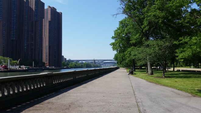

The view was beautiful, but the path was totally exposed, and there wasn’t a cloud in the sky. I stopped to put on sunscreen. A large boat chugged slowly past, waves rolling lazily across the water. I passed parks here and there with flower gardens full of blooming roses and peonies. The path crossed back over the highway and took me uphill and through neighborhoods that were bustling with Saturday morning traffic. I stopped to check the map every few blocks.


Away from the river, there was no breeze. The sun beat down from above, while heat radiated up from pavement. I was very thirsty, and trotting past school playgrounds kept looking for water fountains but didn’t see any. Finally I stopped in a grocery store and bought a bottle, but it was too big to carry with me; after a few gulps I reluctantly dropped it in a trash can.
And now the route took me back onto the bank of the Harlem River, but the path suddenly dead-ended in a chain-linked fence. A young lady out for a walk asked me for directions, and I squinted at the cellphone screen in the bright light. Right next to us a pedestrian overpass led back across the highway, but the path was blocked by piles of debris, including a broken swivel chair lying on its side. I told her there was another overpass about a quarter mile back, and this one turned out to be passable.
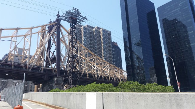
Another two miles through the streets of Harlem, and then it was back onto the waterfront just below the Robert F. Kennedy Bridge. Across the water lay Randalls Island, where the week before I had watched my son Philip win a one-mile race and set a new personal record. Below Randalls Island, the Harlem River merges into the East River, and a mile or two in the distance I could make out the Ed Koch Queensboro Bridge flanked by glass-skinned office towers, but it took a long time to reach.

By the time I passed the Williamsburg and Mahattan Bridges and reached the Brooklyn Bridge, it was almost mile 27 into this journey, and I was ready for a break. Normally I wouldn’t bother with food, even when racing this distance, but the heat was draining my energy. Without replenishment, the remaining miles might devolve into a long walking break. Happily there was a small restaurant with outdoor seating just across the street. I pulled up a chair, ordered a platter of Eggs Benedict and a beer, and enjoyed not moving for a bit.
And then it was time to move on. There were only five or seven miles left, I thought (actually, there were nine), and I headed back onto the waterfront path at a brisk walk, giving my full stomach a one-mile break before trying to run again. Sitting out on a pier was a WWII-era P-47 fighter plane, and I realized that this must be the aircraft that had crashed into the Hudson the day before.

Battery park was thronged with tourists enjoying the beautiful day. The waterfront path took me past gardens, sculptures, office plazas, dog parks. People were lying out in the sun, splashing about in kayaks, walking, running, or bicycling, while automobiles crowded the southern reaches of the Henry Hudson Highway. I was running slowly, but full stomach and the afternoon heat left me feeling a little queasy, so I slowed to a walk for a few minutes before running again. Reaching Chelsea Piers I moved onto the sidewalk, careful to exploit the shade cast by the large building for as long as it lasted, then it was back into the open sun. Next to the Intrepid Aircraft Carrier Museum, a second aircraft carrier was docked as part of Fleet Week festivities, and tourists stood in line to explore the large vessel, while security personnel in camouflage fatigues and body armor kept watch and military helicopters circled overhead.


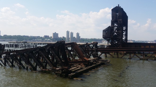
This part of the Manhattan waterfront path has been extensively developed, but there are occasional signs of the past:
Eventually there were only two miles left. In the distance, the GWB was once again shimmering in the sunny haze, as if inviting me for a second visit to its massive steel tower and the little red schoolhouse and perhaps even the Grecian temple further on, but I declined the offer. I ran a little faster, felt queasy again and slowed down, then picked up the pace for the last half mile, until finally it was time to turn off the waterfront and back into Riverside Park, right where I had started that morning. My reward was a final flower garden with sprays of multi-colored blooms.

East coast naturalist John Burroughs once wrote, “to learn something new, take the path you took yesterday.” I will certainly run this one again.


This is an especially fun run. I did it with Catherine once and she got whistled at by a couple of guys while we were running through central Harlem. We giggled. 😉
Looks like you ran pretty much the same route that I do, and I see that you found the re-connection point to the East side greenway is at 120th St.
LikeLiked by 1 person
The east side was a little tricky, and I was constantly checking my phone (and squinting to read it in the sunlight!), but I did find that connection. Would be fun to get a little group together and run it again one day — could we talk Catherine into joining us?
LikeLike
[…] toward the FDR Drive and here’s an overpass which I recall from the time two years ago when I ran thirty-six miles around the periphery of Manhattan, but since then it’s been freshly painted an intriguing plum color. This is my first time […]
LikeLike
[…] run along the river before, including circling the entire island, and obviously it’s a different experience than running in the mountains, which just means […]
LikeLike
I’ve been considering running the island of Manhattan for a few year now. I wasn’t even aware that others did this as well! Planning a run / explore in early 2025. Originally borna and raised in NYC – can’t wait to explore, especially with the greenway that has been developed!
LikeLike
Have a great time!
LikeLike