This post describes a hiking adventure on Dominica from December 2014. Dominica was recently hit by tropical storm Erika, resulting in significant damage and loss of life. If you’d like to contribute to recovery efforts, please click here:
“Where’s your guide!”
I looked about sheepishly. The tourist book has strongly encouraged hiring a guide, but we did not have one.
“If you get lost in the woods,” the man continued, his face accusatory, “you’ll be in deep trouble.”
A couple was tagging along behind him, evidently clients. “We got off the trail near the top,” one said.
“Luckily, I recognized the way we’d come,” the other added.
The man sighed and stubbed out a cigarette. “Why not pay a little money for a guide?” The lecture over, he patted me on the shoulder, and the group continued on their way downhill.
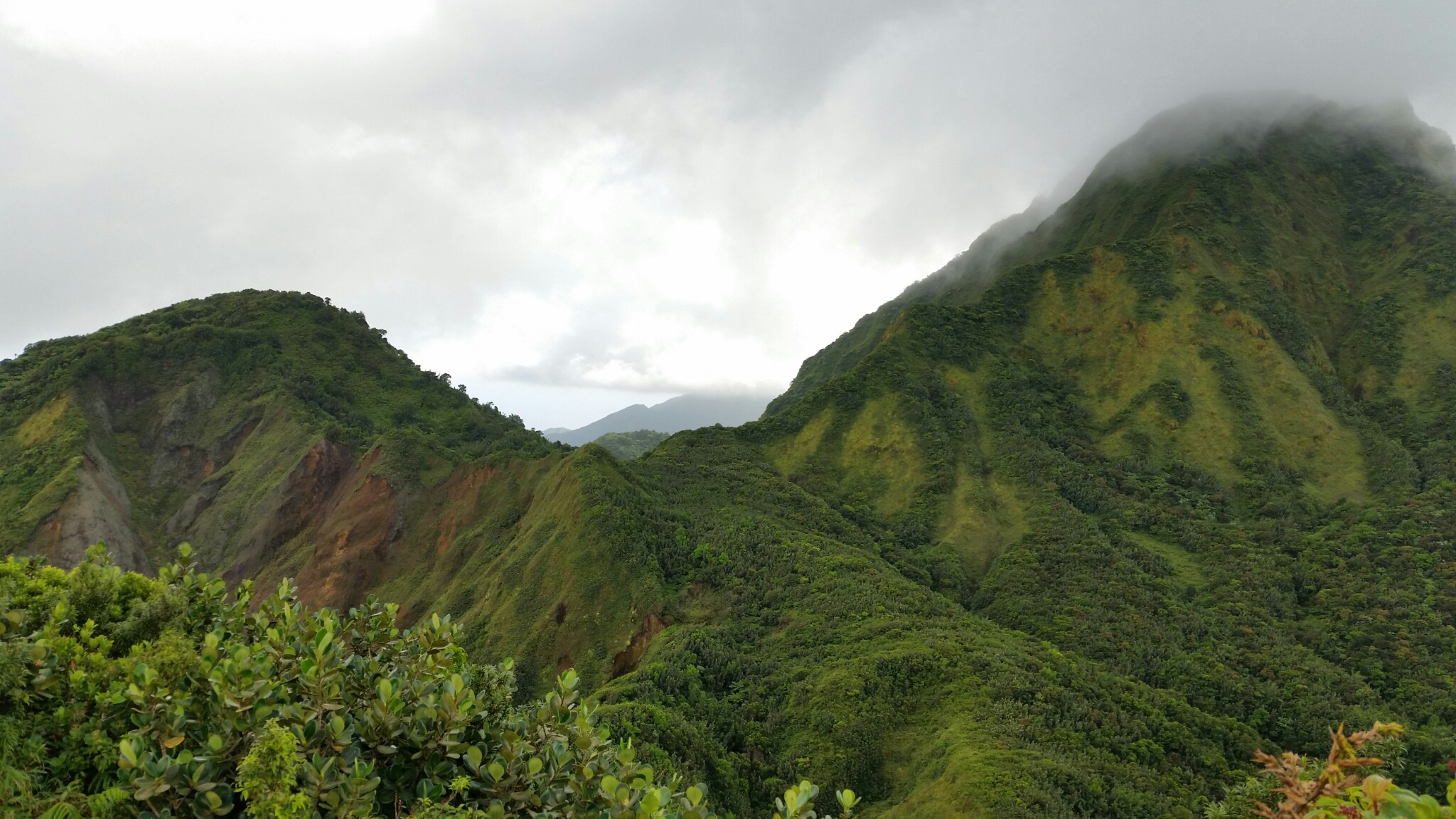
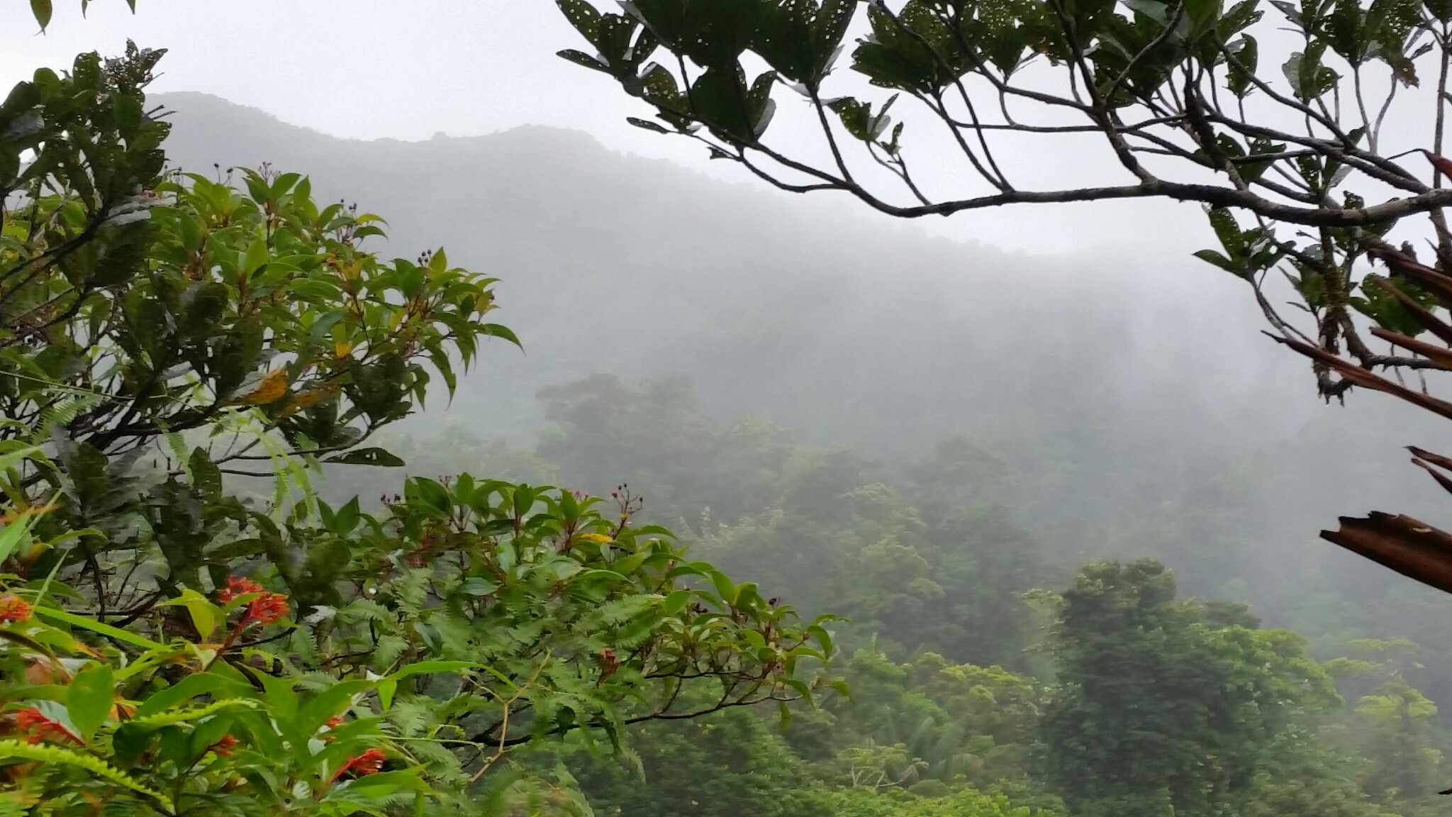
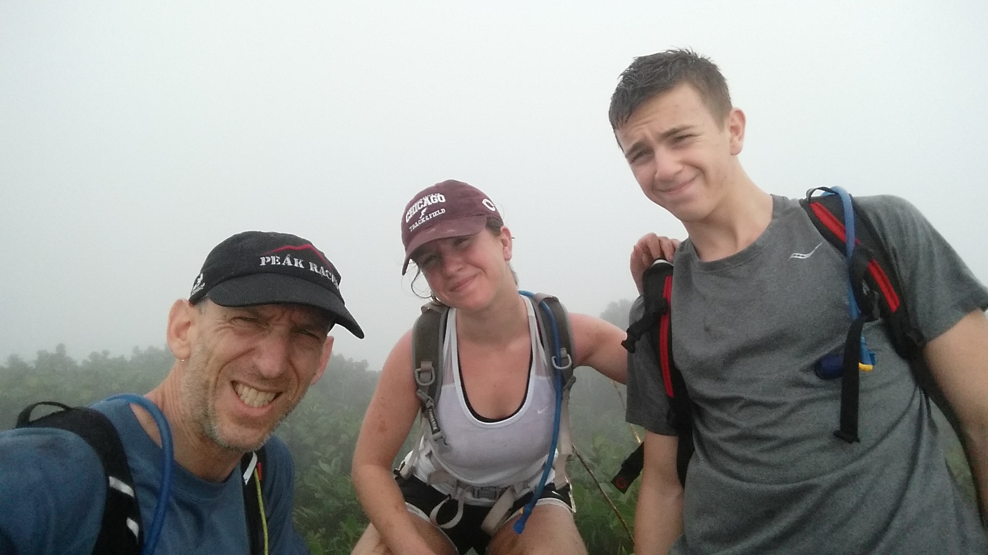
My son, daughter, and I were half-way up Morne Diablotins, at 1,380 meters (4,527 feet) the tallest peak in Dominica, a Caribbean island nation located north of Saint Lucia and the Grenadines. My wife had chosen Dominica for our holiday break because of the temperate climate, unspoiled wilderness, and rugged landscape. And indeed Dominica is the wildest and most rugged of the Caribbean isles, with precipitous mountains thrown up by recent volcanic activity, their ridges deeply incised by hundreds of streams. Slopes are covered in jungle and cloaked in clouds.
Upon arrival, we had piled into a rental car and set forth for our guest house, braving twisty mountain roads and trying to remember to drive on the left (Dominica was previously a British colony) — without catching a wheel in the ubiquitous drainage ditches that line the shoulderless pavement. Without access to cell coverage and thus deprived of Google Maps, we were following printed directions. These called for a left turn, but when we made it, the road rose into the hills and the pavement broke apart into dirt. We were surrounded by jungle, dark and silent. “We need to read the directions more carefully,” I suggested. A heated argument ensued. Eventually it was discovered that the correct left was one mile further down the road.
Two days later, we set out for the Morne Trois Pitons National Park, a designated UNESCO World Heritage Site, determined to reach Boiling Lake, apparently the second-largest hot spring in the world.
It took us a little while to get there. Once again following written directions, we kept making a left at what we thought was a statue, but turned out upon closer inspection to be some kind of shrine. “We’re confusing facts with interpretation,” I noted. Tempers flared. Eventually we overcame the navigational challenges and arrived at the trail head.
The tourist book said a guide was “required” for this hike. But now that we were here, there was none to be found. A gentleman told us not to worry. For $20, he gave us a briefing in broken English and then disappeared. With this guidance, we set out.
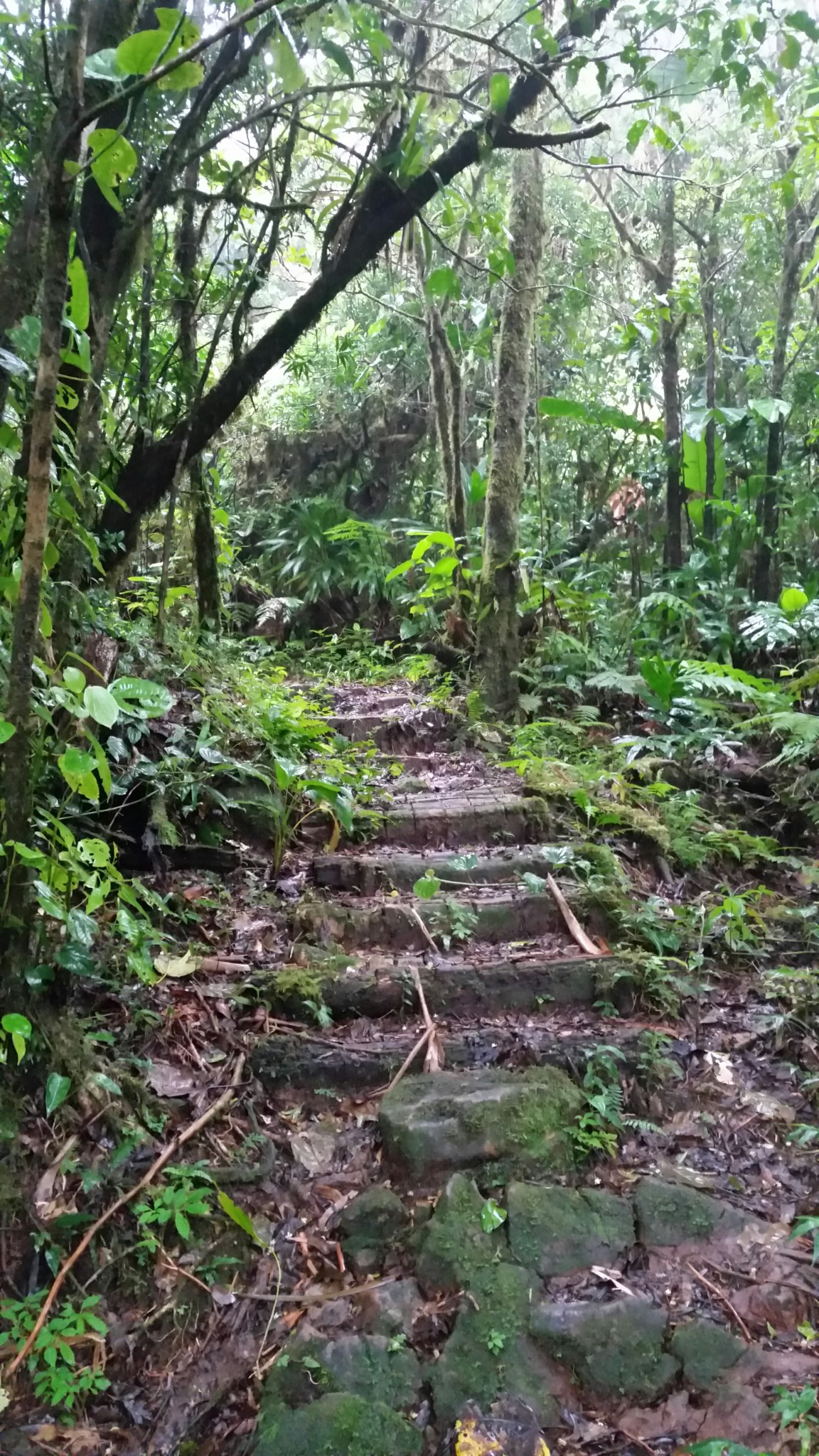
The trail tunneled under double-canopy rain forest and rose along a series of steps carved into the mountain. We passed large fern trees with fiddleheads unfurling, palm trees adorned with red spiky fruits, and tangles of aerial roots. It drizzled, then rained hard. As we gained in elevation, the winds picked up and whipped the clouds through the trees. We emerged onto a windswept ledge and peered down into a deep ravine. Far below we could see tourists — with guides — slowly navigating a narrow trail.
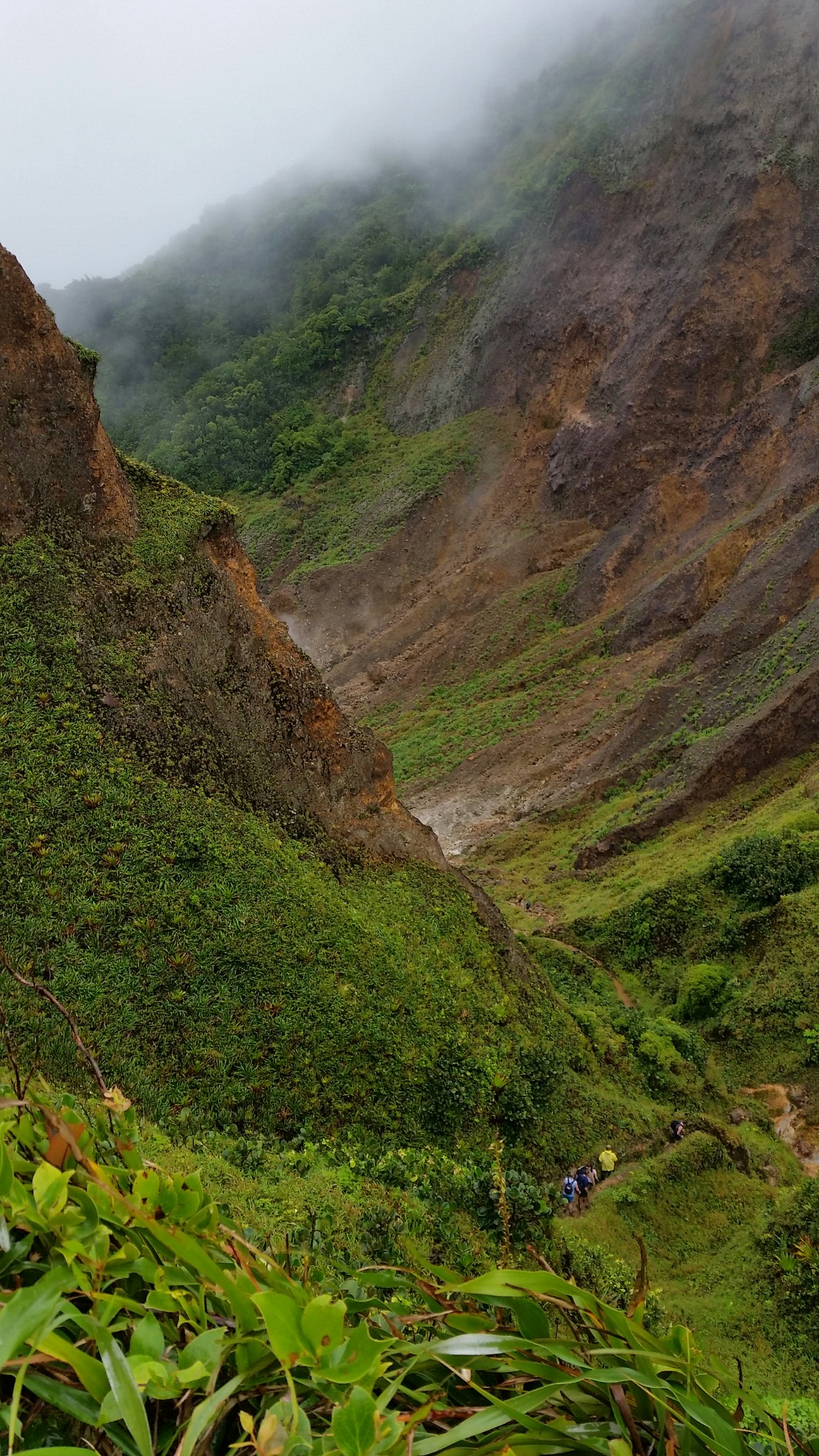
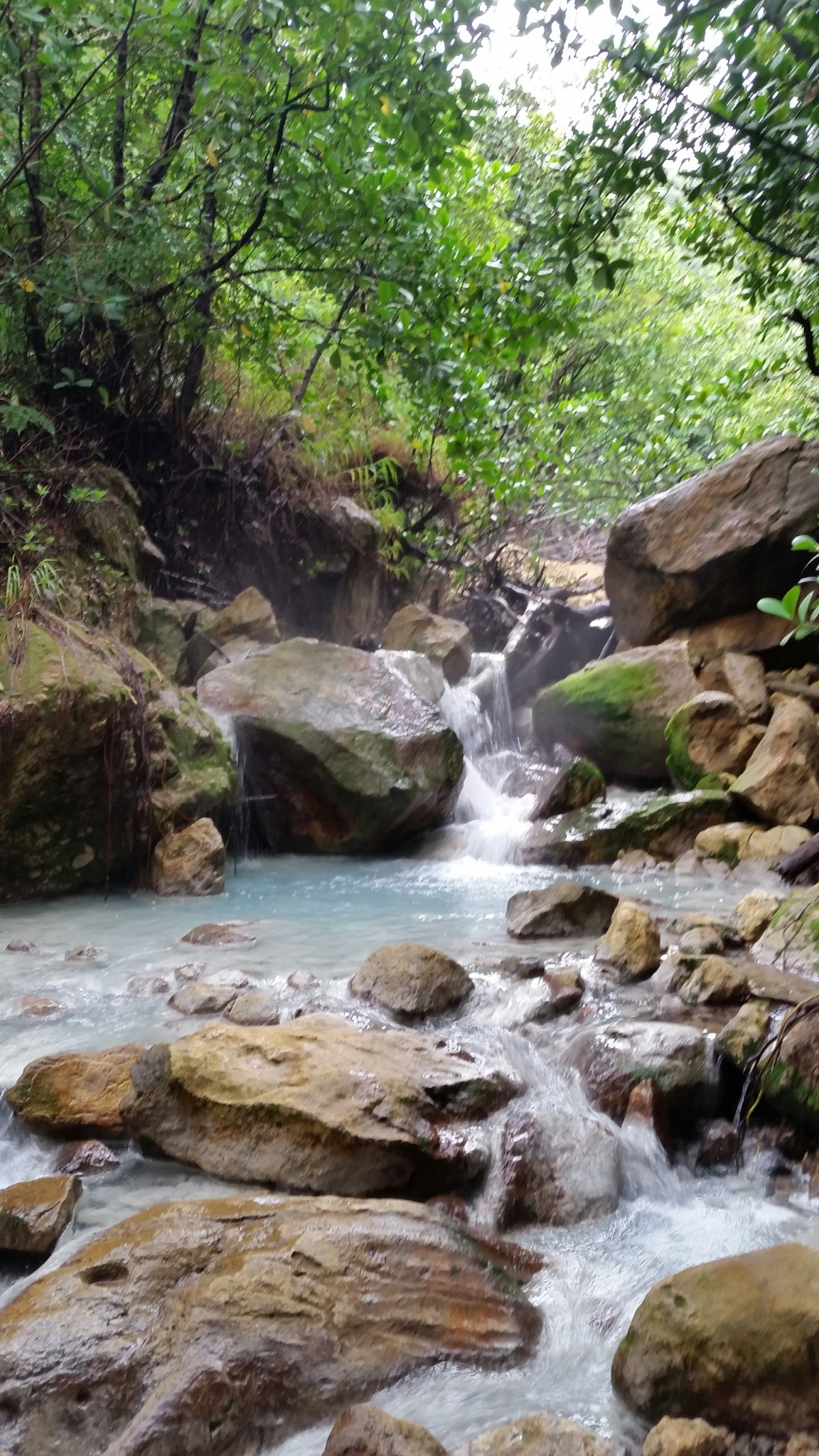
We made our way down a steep muddy footpath, crawled over large wet rocks, and soon found ourselves stepping among sulfur pits that were bubbling, spitting, and smoking away. We had reached the Valley of Desolation. Through the middle of the valley ran a stream of bluish-grey water. I dipped a finger in and discovered it was pleasantly warm. Further on, a group of tourists was bathing in a small pool.
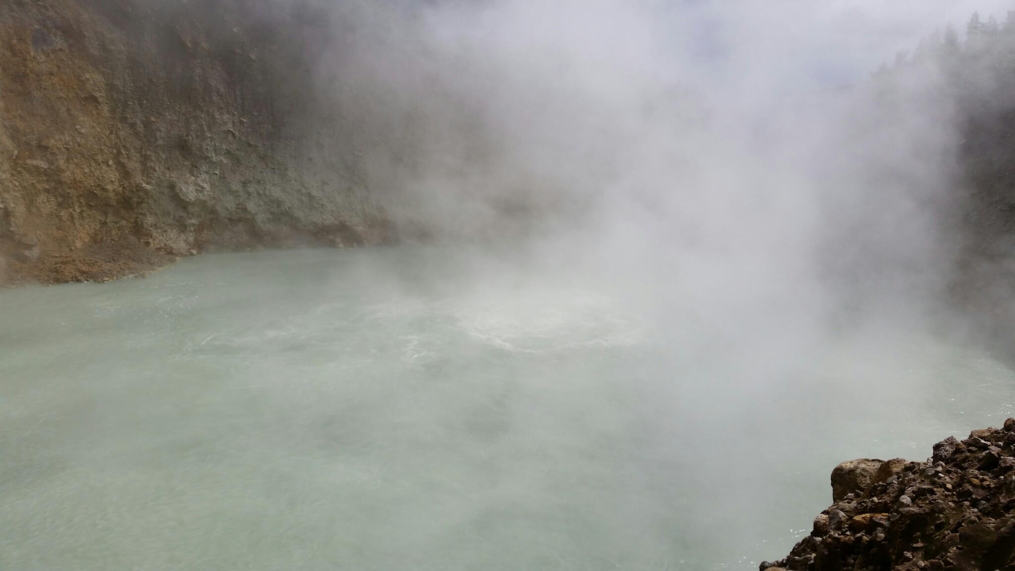
In due course, we arrived at bluish-grey lake, about two hundred feet across, swathed in mist. As the wind stirred the vapors, we could see large bubbles frothing in the center. Evidently, water seeps down through a “fumarole” or a crack in the Earth’s crust to a pool of molten magma, and then the super-heated steam boils back up.
That evening, back in our guesthouse, we reflected on the day’s adventure. While the 8-mile round-trip hike was steep, slippery, and not fully marked, we had managed fine — and that without the “required” guide. Emboldened by this success, we contemplated the hike to Morne Diablotins, for which a guide was merely “encouraged.” My daughter Emeline found a blog post that described the hike and read out loud. Morne Diablotins is loosely translated as Devil’s Mountain, she told us. According to the blog, the “trail is well marked in most places” — then the Internet went out.
Soon our vacation was almost over, and there wasn’t time for further research. On the morning of our last full day, we headed out full of enthusiasm, if not fully informed on the destination. As luck would have it, we found signs on the main highway pointing to the trailhead, which was helpful because we weren’t entirely sure where it was.
On the road to Morne Diablotins
We hopped out of the car, grabbed packs, and scanned the misty heights, wondering what we’d encounter. However, we weren’t flying totally blind. I was carrying lots of technology:
- Map app on my smartphone with a downloaded PDF map of Dominica
- Suunto GPS watch with navigation features
- SPOT Satellite GPS Messenger personal locator beacon
In the old days, I reflected, before this kind of technology was readily available, it took a lot more time to research and prepare. I thought back to lessons in planning and navigation from my Army days, years before the Internet and GPS. Prior to moving into unfamiliar territory, we’d study the maps and plan our routes in detail, breaking them up into segments, with distance, compass heading, and checkpoint duly noted. For important missions, we’d build sand tables to illustrate the terrain, so that everyone on the team could understand the lay of the land. But that was a long time ago.
The trail to Morne Diablotins started similarly to our previous hike with a long series of log steps carved into the mountain. The distance to the top was less than 2 miles, but the elevation gain would be almost three thousand feet. It would be slow-going.
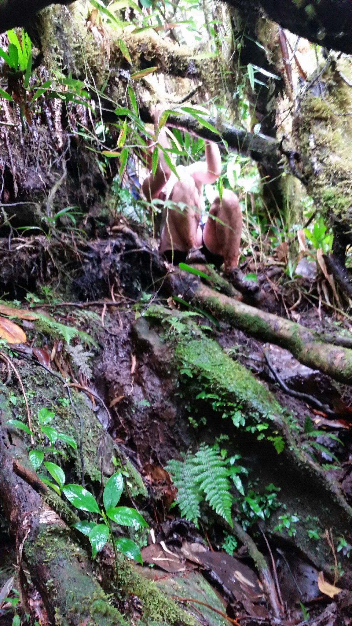
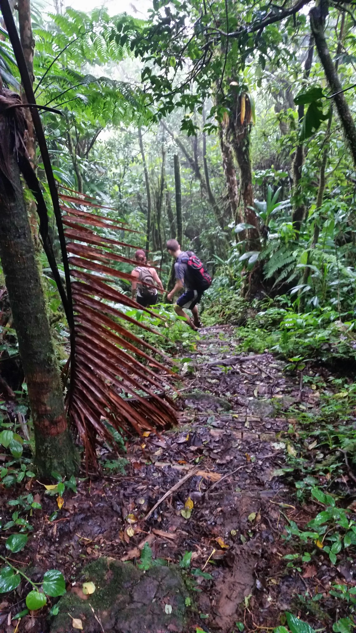
After a long climb, we left the stairs behind. And now we entered the Elfin Woodlands. Because of the steep slopes and thin soil, the trees here were stunted and twisted. The winds whistled through the branches, blowing mist through the forest, which was dark and wet.
The trail lurched through deep mud puddles, took us up and over rock faces, and then we were climbing into and through the trees, stepping from one branch to another, twisting our bodies underneath and around other branches.
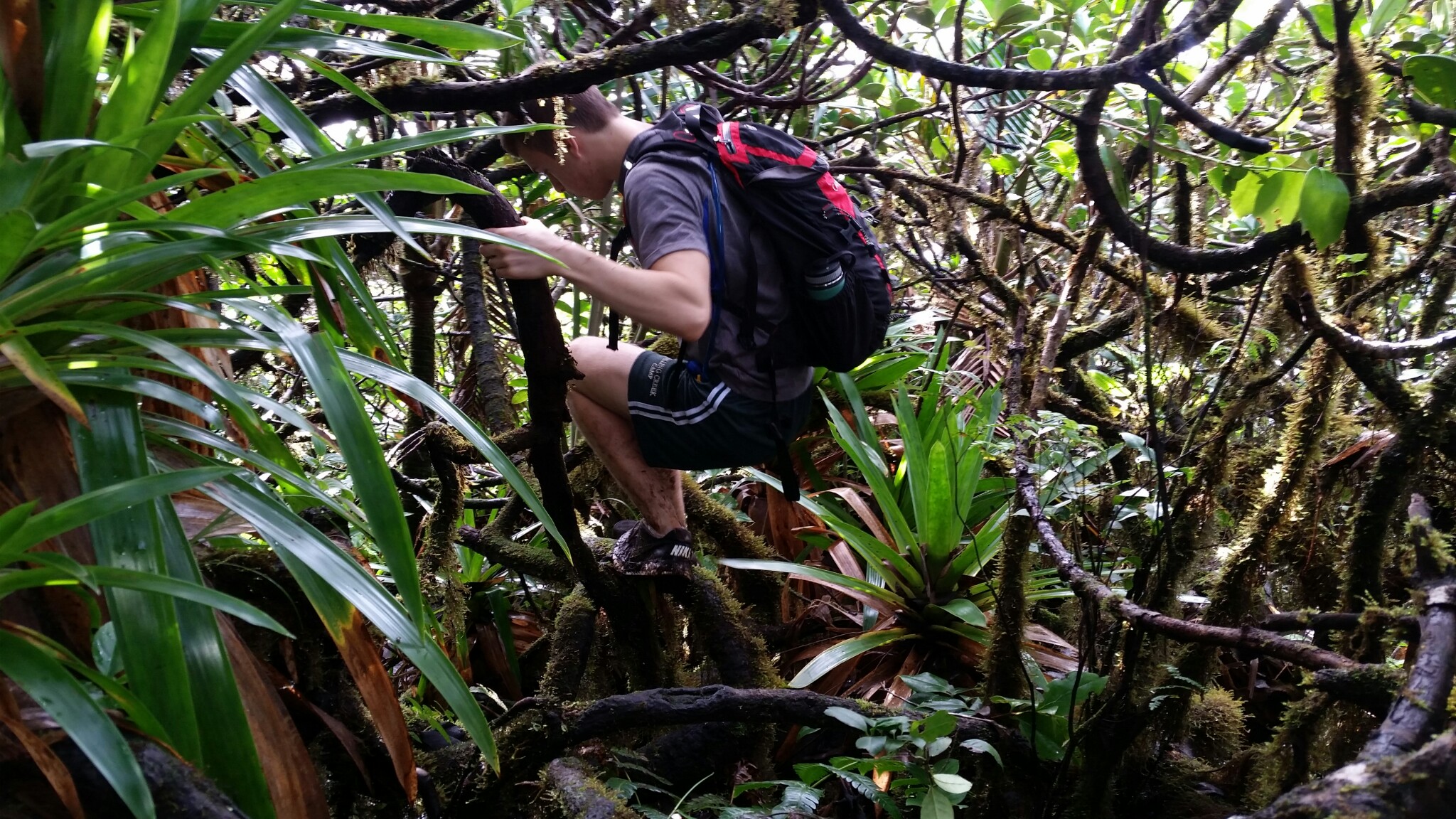
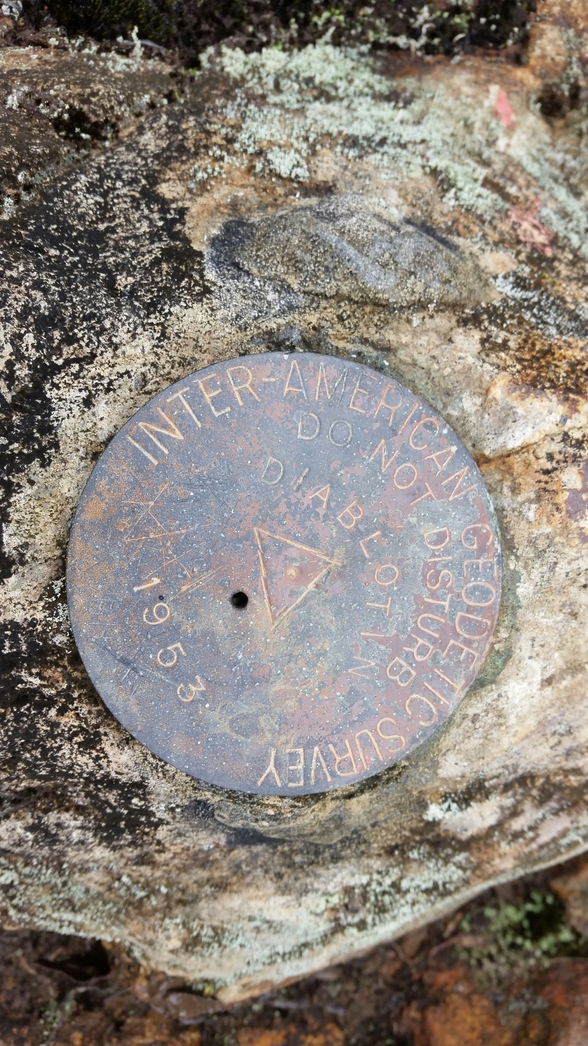
There were no blazes on the trail, but you could see smooth sections on the branches where people had stepped before, and occasionally there was a footprint in the mud.
We encountered the guide and his two clients. We pressed forward.
The obstacles were fun at first, but they demanded full concentration. Our pace was maddeningly slow: not even one mile per hour. For runners used to covering ground with a certain rhythm, this was frustrating; progress was becoming an ordeal. Eventually, we reached the fog-shrouded summit. I breathed a sigh of relief.
And then it was time to head back. We followed the trail in reverse, paying attention to the smooth branches and the occasional footprints. The trail took us down a muddy chute, and we slid down on our butts, and then followed footsteps to the right. Then the footsteps petered out.
“We’ve lost the trail,” I announced, trying to sound calm.
Returning through the maze of Elfinwood was going to be daunting enough, without the nightmare of wasted time and energy groping about to find the trail again. And if we couldn’t find the trail, we’d be in deep trouble, just as the guide had warned. The terrain was so difficult, we’d never make it back off trail, no matter how many GPS devices we had.
My daughter Emeline recalled that one of the guide’s clients said they had gotten off trail near the top. “This must be where they went,” she hypothesized.
We turned around and retraced our steps. But trying to clamber up the mud chute didn’t look promising. We detoured to the right. I reached up and grasped a handful of vegetation, trying to hoist myself up the slope, but the roots and branches broke off in my hand. I tried again and dragged myself up on my stomach. But now the mud chute was no longer visible. I looked around but couldn’t find it.
“We’ve lost our tracks,” I announced. “No need to panic, but let’s stick to facts and not make guesses.”
I glanced at the Suunto GPS watch and hit the navigation button. While I could see the track of our route, the display was too small, and the resolution insufficient to determine where we were or which way to go.
Then I turned to the map app on the phone. On a whim, I had hit the tracking function, thinking it would be interesting to have a record of the hike. The tracks stood out as an orange line on the map. This was fortunate, because it was evident that the trail indicated on the map did not correspond to the trail we had followed. Even the summit was in a different location. The map was not accurate.
Judging from the orange line on the display, it seemed we’d just need to take a few more steps uphill to regain the trail. But from experience, I know that the display on the phone doesn’t orient itself reliably, which means by looking at it you might get the wrong impression which way to go. So to be double sure, I pulled out an old-fashioned compass and used it to orient the smartphone towards magnetic north.
A few steps later we were back on the trail and in due course made it safely back to the car.
If we had really gotten in trouble, I could have pushed the “SOS” button on the SPOT GPS Messenger. The device broadcasts GPS coordinates using satellite phone technology, which is a great feature where cellphone coverage is unavailable. My wife, who had stayed back at the guesthouse, had planned to follow our progress on the SPOT website. Hitting the SOS button would communicate our coordinates to local first responders. But upon our return, my wife reported that not a single coordinate had been sent. Evidently, the forest canopy was too thick for the signal to penetrate.

The moral of the story is that nothing takes the place of paying attention and reacting quickly, whether you’re following paper directions or armed to the teeth with the latest technology.
I think this moral may apply to life in general. If you have ambitious goals and are in a hurry to achieve them, if you seek out adventure and are hungry for new experiences, or if you (figuratively) want to move fast and cover a lot of ground, then sooner or later you’ll face unexpected challenges. How you respond could make all the difference.
One who pressed forward incessantly and never rested from his labors, who grew fast and made infinite demands on life, would always find himself in a new country or wilderness, and surrounded by the raw material of life. He would be climbing over the prostrate stems of primitive forest trees.
― Henry David Thoreau, Walking

[…] example, when my legs started cramping during a mountainous trail race, or when I momentarily got lost in a cloud forest, or went hiking barefoot in the […]
LikeLike
[…] the pathless summit of Rusk Mountain: Try “flowing” here Elfin Woodlands of Dominica: Good luck “flowing” through […]
LikeLike
Nicee blog you have
LikeLike
Thank you
LikeLike