After completing twenty peaks in June, July is going to be a little bit easier, with only twelve needed for the Grid, and then August, which is already complete, will be a vacation from the Catskills. My attitude is: dive in and get ’em done, and then go on to other projects.
So far, so good, with the peroneal brevis tendon feeling a little bit better, although I just banged some toes…
- The forecast calls for a high of 96 F, and the morning is already steamy: on the drive up to the mountains, the eastern sky is vaguely peach-colored
- I meet my friend Steve Aaron, who’s working on completing the Catskills thirty-five, and then we head off to Kaaterskill High Peak.
- After parking, we scramble up and into the abandoned Cortina Mountain Ski Area, today little more than an open field covered in grass and wildflowers, with views to the west of the criss-crossed shoulder of Hunter Mountain, a ski area which is still very much open and in business. Then it’s underneath an old cable with rusted chairlifts, through a gate, into forest.
- We’re greeted by abundant dark green bulrush with clusters of spiky ball flowers, still green in the woods (the flowers have already turned brown in the open field)

- Next up, a little patch of partridge berry crawling along the ground, sporting small white cross-shaped flowers growing in pairs…in due course, small red berries will appear with tiny twin navels where the flowers once were

- As we walk along past a puddle in the path, there’s a dash and then a splash, and then it happens again: leopard frogs, green with black spots, and a little slow to react, we’re on top of them before they dive for the water…I bend down to scoop one up, but the frog squirms off in the muddy water and eludes my grasp

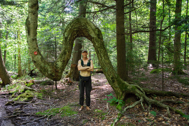
- We reach the presumed Native American marker tree below the summit scramble.

- It’s a warm day, just as was forecast. We’re in the shade and probably five to ten degrees cooler on account of the elevation. From a time to time a breeze rolls through the forest, and then it’s pleasant, but mostly it’s still and a little sticky.
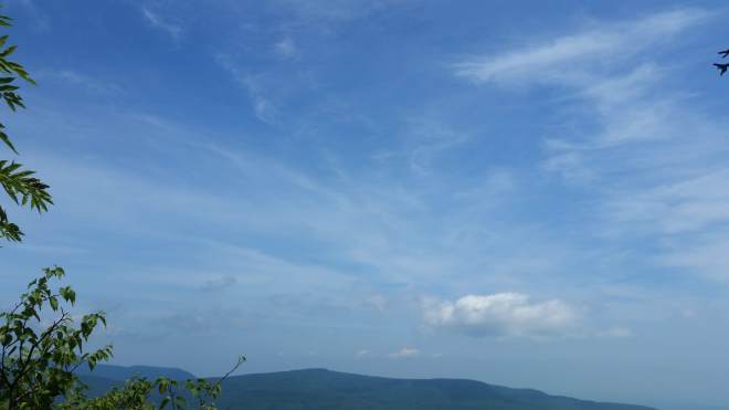
- We scramble up to the summit and cross over to Hurricane Ledge on the southern edge, where the sun beats down mercilessly. Filaments of cloud criss-cross the sky without apparent pattern, as if the high-altitude winds suddenly calmed leaving the atmospheric vapors to twist about randomly.
Steve’s successfully completed the thirteenth high peak in his quest to summit the thirty-five. We say goodbye, and after a break for food and drink, I head off to the Biscuit Brook trailhead.
- The familiar trail takes me two miles in to the lean-to and then crosses a creek, where I pause to filter water, knowing there will be little or none on the ridges above. Then begins the familiar climb through the forest. For a little while, the creek splashes down in a ravine to my right. I nod to a massive triple-trunked black cherry which I’ve passed on this route multiple times before.

- Many others have passed this way as well, as this is easiest route to the summit of Fir Mountain, one of the thirty-five that’s on every peak-bagger’s list. The accumulated footsteps have created what’s known as a “social trail” or “herd path,” unofficial, unmarked, unmaintained, and sometimes indistinct, but definitely easier walking than it would be plowing straight through the forest. There’s a little art to following social trails, however, because they fade in and out, and sometimes the marks of passage are subtle: a few bent fronds, abrasions on a log, scuffmarks in the dirt, or simply the absence of branches and other obstacles. Sometimes these clues are so subtle I fear I’ve lost the trail: then I look off to the sides, because the loose rocks and tangled vegetation on the periphery usually contrast with the path, no matter how obscure.
- That said, I lose the trail on the final climb and stumble through the undergrowth for a while….but eventually regain it near the summit. I haven’t used compass or GPS, so this counts as a “Natural Navigation” ascent.
- Now it’s time to continue a little further north before turning west and dropping downhill in search of the saddle between Fir and Big Indian, where I plan to camp tonight. The setting sun is stipling the forest with spots of golden light. Fern glades lend easy passage in some places, while fir stands threaten entanglement, but soon enough I’m at the saddle and unrolling my sleeping bag (no need tonight for a tent).
- Surface winds push over mountains through the saddles between peaks, which are the lowest points on the ridgeline, and tonight the wind is blowing steadily here, reminiscent of tradewinds at the beach but smelling of damp earth not salt. After a warm day, this feels cool, even chilly. Above me, a dome of green and gold, a mosaic of beech leaves gradually darkening, the spaces in between filling with dim blue light, and then everything is dark.
- Next morning a hermit thrush singing loudly and without pause. After a cup of tea, it’s off to Big Indian, another social trail on the crest of a ridge that gradually curls northwest — slow and steady progress takes me to the summit.
- Now it’s time to cross a long ridge to Doubletop Mountain, and here the terrain is pretty tangled: heavy deciduous thickets full of beech saplings and hobble-bush, stands of fir and deadfall blocking the way, a damp spot with peat moss.
- Eventually a tiny glimpse of Doubletop appears through a gap in the canopy just a few leaves wide, just a corner of the jagged fir-clad summit, and this glimpse contrasts with some places where sky peaks through, allowing you to estimate the broad outline of the mountain and orient accordingly.

- The final climb to Doubletop’s summit is a little steep, but then there’s a path through the boreal spruce-fir zone to the canister, where I sit down for a moment, drink some water, and let the flies crawl all over me and tickle my ankles (but they don’t bite).
- Back across the ridge, and now five miles of trail with a pretty mountain creek on the left, but too far down to go get water, so I ration what I have a few swallows at a time.
- Passing through fields of Indian hellebores turning yellow, brown, and black, wilting, and many falling over now, but some of them have produced tall spiky flower stalks, and no doubt they will be back in force next spring


- Chipmunks chirping away, a gray squirrel climbing a tree, I pause for a moment next to large dead birch log and discover two kinds of slime mold: scrambled eggs slime mold and chocolate tube slime mold. What strange creatures….thought to be of ancient origin (nearly a billion years old), they consist of individual amoeba-like cells scattered about in the forest floor which under certain conditions migrate together and form a moving, pulsating blob which grows stalks that release spores. And from these spores, the next generation of slime mold is produced. An interesting parallel to humanity, since we operate independently from each other to some extent, and then come together for many purposes, too, including reproduction. Scientists are amazed at how slime molds interpret and adapt to their environment: they display considerable intelligence for creatures without nerves or brains — it makes one wonder whether people are as clever in the grand scheme of things as we like to believe — hopefully over time we will do our jobs as well as the slime molds have.


- That evening, I’m feeling the effects of two days out in the hot humid summer forests. Skin reddened, I drink and drink, feel tired at dinner, and it’s off to bed early.
A few days later, it’s time to hit Bearpen and Vly, for the 11th and 10th times, respectively, and then off to Rusk, for the 10th time.
- Glorious summer, hot and humid, another day in the 90s, another steamy morning, the mountains indistinct in the haze and merging along the horizon into featureless white.
- Hickory trees blooming along the road, and so are the male specimens of the staghorn sumac with spiky yellow flowers growing from their uppermost branches, while the females are producing small maroon-colored feathery fruits. The road to Bearpen passes some wild celery with yellow flower clusters mixed in with some purple-stemmed angelica, and orange tiger lilies.
- Today’s goal: mix in some running, so I charge up the hill, reflecting on how once upon a time this gravelly road was so painful I almost gave up, but now I’m trotting along barefoot without a care (it may be, too, that the shoulder’s been widened to accommodate lumber equipment, leaving a strip of gravel-free dirt on the side).
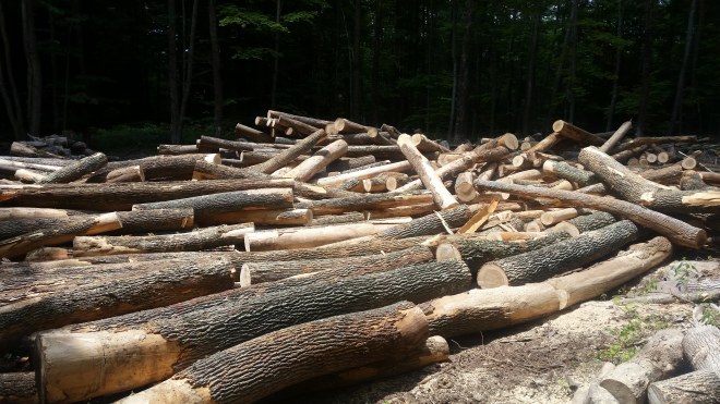
- Machinery is moving about in the woods, and there’s a huge pile of ash logs off to one side — waiting to be carted off, or perhaps the wood’s been ruined by the ash borer and the logs have been abandoned.
- A snowmobile trail leads to the summit, and the little bit of extra light getting in through the canopy encourages a wide variety of “plant people” (as Muir might call them): orange hawkeye, blue eyed grass, berry canes and stinging nettle growing tall, meadow rue now blooming with spiky white petal-less flowers, and all sorts of mysterious grasses.


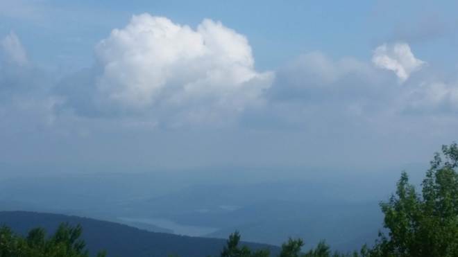
- From the top of Bearpen, a hazy view of the Schoharie Reservoir
- I run all the way back down to the saddle between Bearpen and Vly, in a crouch with knees bent, which is the proper shock-absorbing form according to barefoot guru Ken Bob Saxton. And now I charge up Vly, mixing a brisk walk with a few running intervals.
- On the descent from Vly, here are three hikers coming up, Steve, Rick, and Tom. Tom is close to completing his first Grid, Steve Emanuel (Grid #22) is close to completing his second Grid, and if I heard properly, then Rick Taylor (Grid #21) just completed his second. Impressive! We all agree that Connie Scuitto (Grid #3), who is close to completing her third Grid, has taken things too far (but we don’t really mean it).
- Inspired by this chance encounter, I run all the way down to the car, exulting to be breezing through the warm damp sweaty grimy air.
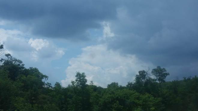
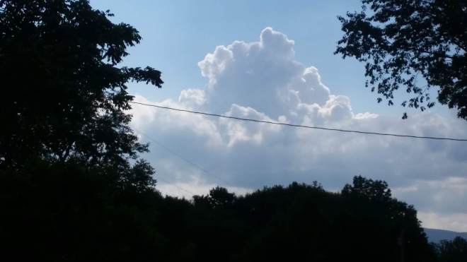
- On the drive out, huge cumulus clouds are moving over the valley, and where their vapors boil up high enough, the convolutions catch the sun’s light, become illuminated, appear massive and discrete, convey a sense of force — such a contrast to the morning haze
- On to the parking area at the end of Spruceton Road through a spatter of rain. Exiting the car, the air is once again heavy and humid. I break off a spruce branch and swish it around at the insects like a cow waving its tail
- The gravel road is painful, but only half a mile or so until it’s time to step into the woods and onto the social path towards the summit. Past a huge broken ash tree whose trunk has split into two sections which fell in separate directions.

- I start out aggressively, but then I stub a toe, and then a little while later, this happens again, and now I’m howling with pain. It’s always the left foot where things go wrong, it seems, and then I stub a toe on my right foot even worse. There’s nothing to do but go into “stealth mode” — stop cursing, move slowly, keep eyes open — and then I stub the right foot again — so now it’s into “safety mode” with no other purpose but to make it to the summit and back without any further damage.
- I hang out at the summit for a bit. A faint breeze stirs the upper branches of the cherry and birch, then subsides. Another cumulus cloud, large and portentous, moving across the sky as if being towed on a line.
- I creep back down the mountain, watching each step, and sometimes wincing. The breeze picks up, the air has cooled some, it’s less humid.
- The berries are coming out on the red elderberry bushes.

- Oh my, the gravel road is painful on the way back to the trailhead.
- Driving out, a cumulus cloud sits above the valley, massive, forceful, dominant, towering above the ridges, glowering in the sunlight, capable of unleashing violence that will over long periods destroy the mountains, answering only to the atmospheric conditions that produced it, with no duty to consider small creatures creeping about in the forest and presumably no interest in us, either
- My poor toes. The left big toe required a band-aid and some tape, while the right pinky toe ended up with a purple-red bruise. Although I was able to run four miles at the track the next day…. There’s a lesson here: running up and down rough Catskill trails is demanding — so pay attention! — and if you’re tired, slow down!

Running the Long Path is available on Amazon (Click on the image to check it out)
