The Grid has turned into The Grind. Last year I was busy with a high-pressure job, and every Catskills weekend was a chance to escape the office and leave behind the rigors of the corporate world. What I recall most about last year’s mountain adventures is exhilaration and joy. Now I’m between jobs and have all the time in the world. But hiking in the mountains is morphing into work.
This is partly because of the commitment I’ve made to completing the Grid’s remaining ~100 peaks in 2018, rather than letting even a handful slip to next year. The commitment is questionable, perhaps it’s insane, maybe I just haven’t freed myself of the sense of urgency and focus on results learned over a career in finance and before that the military. In this regard, I am my own worst enemy.
The winter is also my enemy. Someone inquired, if I was going to take some time off from the corporate world, why not do so during the summer, instead of the winter? (The timing of these things is often outside ones control.)
True, the Mountains served up a gift in February, with the last few days of the month featuring beautiful warm temperatures, as high as 60 F, enough to melt most of the snow and let me scamper unhindered across the ridges. But now it’s payback time: March opened with two serious nor’easters, three to four feet of accumulated snow, and a return to freezing temperatures.
Half-way through the month, I’ve endured some of the toughest and most miserable hikes of my Catskills career, and while I’ve completed seven peaks so far, there are nine left to go.
And as I write this post, it’s snowing yet again….
But the worst enemy you can meet will always be yourself; you ambush yourself in caverns and forests.
March 8, 2018 — Tomorrow an ultra-runner friend named Joe is finishing up his Catskill 3500 Club Winter Series with a jaunt up Westkill. I’m here today to bag three other peaks and then join him and a group of other friends in the morning.
It’s snowing at the trailhead as I buckle on snowshoes and shoulder a heavy pack full of warm clothing and a large sleeping bag rated for subzero conditions. The snow looks deep, although people were out here earlier this morning and have left a pretty good track. Even with snowshoes, however, I sink in about ankle-deep with each step.
After a mile along the trail, it’s time to head into the woods for the bushwhack up Rusk mountain, a steep trek through the woods I’ve done a half-dozen times before. There are tracks leading toward the summit, but they must be a few days old as the footsteps are half-way filled in with fresh snow. With each step, my feet sink down about six inches into soft powder.
I plod along, stepping into the partially-filled shoe-holes, the heavy pack an unwelcome burden, the tracks heading relentlessly upwards. Soon I’ve settled into an unsteady rhythm: count twenty steps, pause and look up, repeat. I don’t want to sound negative (so let’s not use the word miserable), but this is labor.
The summit lies 1 mile distant and 1,500 feet higher up. It takes me one hour forty five minutes, for an average pace of 0.6 MPH. For a runner, this is dismally slow. On the summit logbook I see that seven people made it here two days ago (after the first snowstorm but before the second). Without their tracks, this would have been unspeakable.
A bank of clouds rushes past the summit; it’s a dramatic scene, but I’m in no mood to stop and look around, I immediately turn back the way I came.
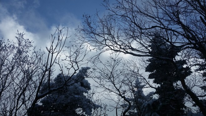
On the way down, I glance up through the trees and catch sight of what seems to be a marble tower standing atop a distant summit. It’s gleaming brilliant white in a cone of sunlight that’s broken through the clouds. As I move downhill, the mysterious white tower continues to float out there in the distance, glowing like some kind of beacon, surrounded by a ring of snowy fir and spruce also lit up by a narrow band of sunbeams. Eventually with the help of compass and topographic map, I conclude that this is the fire tower on Hunter Mountain’s summit, which is incidentally my next objective, but this is a view I’ve never caught before, for all the times I’ve descended Rusk. It’s as if the mountains were waving me along — come on Ken, here’s the summit, you can make it! (Maybe if you just opened your eyes, the landscape would always be trying to encourage you.)
Once back on the trail, I turn uphill for the long slog to Hunter’s summit. Both snowshoers and alpine skiiers have left tracks in the snow; this is an improvement over Rusk, but still it’s hard work. Now I’m counting steps in increments of 100 instead of 20, and in between glancing at GPS watch, hoping to see some progress in mileage and elevation, no matter how small the increment.
By the time I reach the summit, it’s become a dim place, ringed in with a gray walls of vapor that boil and churn and reach up high into the atmosphere. Gray mists blow past the tower, and I too keep moving.
The 2-mile trail to the Devil’s Acre lean-to is well-tramped and modestly downhill. My pace quickens, and instead of counting steps I’m debating whether to bag Southwest Hunter tonight or wait until the morning. Instead of making any decision, I just keep moving along and upon reaching the summit, I find that some friends have signed in here the day before. Thank you Mike, Mendy, and Chris for breaking the trail!
Back at the lean-to, I roll out the large sleeping bag on the snow-covered floor, heat a cup of tea, eat some food. During my last two visits to this lean-to, a porcupine was hiding in the corner. He’s not here now, but there are paw-prints in the snow. I wonder whether it would be prudent to stash my food somewhere out of reach — only to wake up suddenly an hour later — but it’s not the porcupine rummaging through my bag, just a pair of hikers arriving late.
The next morning is all downhill, a positive, but the snow is quite deep. Someone must have passed by several days ago, but all that’s left of the track is a faint groove on the surface of deep banks. Obstacles abound: fir and spruce branches are bowed down with huge loads, and as I brush by they dump on my head and the back of my neck. Moisture seeps down my wool undershirt.

Feeling hungry, tired, and somewhat grumpy, I stumble down the mountain and pull up at a bridge that crosses the Westkill stream. Time to munch on a bag of trail mix and wait here for Joe and friends. But I don’t want to sit around and get cold, so after a little while I lumber off toward the peak, reasoning that with my heavy pack and slow pace, they’ll catch up soon enough. There’s a single set of footsteps in the snow, which helps (thank you Tom), but the trail is steep, and I’m back to counting steps in increments of 20.
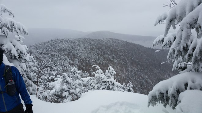
I peak at my watch frequently, the mileage barely changes, it ends up taking an unbelievably long time to reach the summit. Just as I’m turning back, Joe and the group arrive. We admire the gray snowy scene from Buck Ridge Lookout and make plans to regroup after the hike at a nearby brewery.
Thanks to Joe and friends, the trail is now exceptionally well trampled, and suddenly movement is freer and easier. However, I’m gradually discovering that my shoes (a new pair, which I’m wearing for the first time) are a little too tight. So one aggravation is traded for another. But I’m not the only one who’s struggling today. Many of the fir and spruce saplings along the side of the trail are so heavily burdened with snow that their slender trunks are bent over and their top branches pressed against the forest floor. Poor little creatures, it’s hard to tell they’re trees (they’re just waist-high white blobs) — so I give them a shake in passing, the snow falls away in big clumps, and the young trees rebound toward the vertical. It’s not like they needed my help, but surely they must appreciate it.
The brewery is a hit and a great chance to catch up with old friends and make new friends. On the drive back home, the thick gray cloud layer starts to break up. Having doused the Catskills with yet another round of precipitation, the atmosphere seems to be reorganizing for its next mission, whatever that might be. Patches of blue sky appear, and then the sun breaks through, its beams radiating diagonally through the misty layers.

March 14, 2018 — Four peaks down, twelve left for March, and today I’ve got an aggressive plan to bag another four. I’m driving north on the Thruway and strangely enough while the foothills sparkle in sunlight, the Catskills’ high peaks have vanished, there’s nothing but gray. Pulling into Phoenicia for lunch, I find big snowflakes hurtling through the air. I didn’t hear that another storm was coming — these flurries will probably blow through. But then I remember that the parking spot below Bearpen is signed as a snowplow turn-around; parking there during a snowstorm is a no-no. Will they call out the plows? After a few miles along winding rural roads, the snow’s starting to stick to the asphalt. Bearpen is a scratch.
Well, that leaves three peaks to climb, and maybe I’ll climb Eagle and Big Indian this evening before camping out. It’s still snowing when I pull into the Shandaken trailhead. Snowshoes get strapped on to light-weight boots, the heavy pack is shouldered, and I’m heading off toward the Shandaken lean-to, two miles distant, and the first mile goes relatively quickly, as a group of five was out this way earlier according to the trailhead register. But after the first mile, their tracks disappear, and now I’m facing four feet of fresh snow. Even with snowshoes I’m sinking up to my knees. This is very bad. Despite a level trail, it takes me one hour and twenty minutes to cover the second mile. By the time I reach the lean-to, I’m zapped. It’s straight to bed.
The next morning I pack up the big pack, which will stay in the lean-to until I return, while I’ll carry a small pack up to the top. There’s a single mile to the saddle between Eagle and Big Indian, and this is going to be a very tough slog, but hopefully up there the path will be beaten down.
The first mile is indeed a slog. Each footstep immediately plunges through 6-12″ of light fluffy powder, and then as I shift my weight forward, the foot crunches down another 6″ into thicker stuff. Where the trail’s steep, I have to kick away in waist-deep snow until there’s something firm enough to stand on. I try to stay matter-of-fact, county my twenty steps at a time, look up, check watch, and then do twenty more. The single mile takes two hours three minutes.
Finally a wooden sign comes into view. Here’s the intersection on top of the saddle, but bad news: no-one’s been here recently, or if they have, last night’s fresh snow and the winds that go howling across the saddle have obliterated any sign. Nothing to see but sculpted white mounds. The two peaks are each one-mile distant, but that’s too much — Big Indian is forgotten, the entire focus shifts to making Eagle, and if successful, surviving the return.
At least it’s more level up here on the ridge, with only 500 feet in rise over the next mile. But it’s knee-deep the whole way. My legs are getting tired. So I count steps. The sun is out, and a black-capped chickadee alights on a near-by branch and issues a long stream of cherps (not the “feee-beee” or “chick-a-dee-dee-dee” one typically hears). And then it’s back to counting steps. The one-mile distance to Eagle’s summit takes more than 2 hours.
I pause on Eagle to eat some trail mix. At least it’s all downhill from here, and for the first 1/2 mile, I keep up a pretty good pace, walking back in my own footsteps, sinking in only a few inches at a time, but legs tire, ankles and knees begin to ache.
Regaining the saddle, it’s time for the descent to the lean-to. It’s easier going down, of course, but not much faster, as the footing is unpredictable. And with the sun out, and temperatures warming up, the snow is getting wet and heavy. I try to sidestep a tiny rivulet running along the ground, step wrong, sink to my waist, flounder about trying to get back up. I feel like howling.
At the lean-to, finally, a chance to catch my breath and eat the last handful of trail mix. Snowshoes are coated with thick, wet snow, and each of them feels like ten pounds. Now it’s time to buckle on the big pack again, for the two mile walk back to the car.
Tracks from the day before are partially filled from last night’s snow. Tired legs, shifting pack, slippery footing — by the time I reach the car, I’m groaning out loud with fatigue, anxiety, and frustration.
The next day, driving back to the city: to the north there’s a wall of clouds luminescent and gray, to the south a mix of mist and clear sky. Suddenly large snowflakes are cascading against the windshield — while at the same time, strangely enough, sunlight beats down on the road.
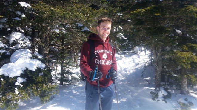
March 17, 2018 — Philip’s in town for spring break. After the dismal experience on Eagle, I take us to the Devil’s Path, a popular trail which is surely tramped down by now.
After parking at Mink Hollow, we follow tracks up the hill, and where the path crosses a stream, it’s Philip’s turn to stumble. I reach a hand to help him up, my foot slips, and I fall down, too. At least it’s not just me.
Soon enough we reach the saddle, turn toward Sugarloaf, and look around for a beaten trail, but there’s nothing but wind-sculpted mounds. If anything, this is worse than Eagle because it’s so steep: every step has to be kicked out of waist-high snowbanks, and when I lean on a trekking pole for balance, it sinks to the handle. Well, at least I know what I’ve gotten us into, and if we make it up only one mountain (instead of the three I was planning), so be it.

The first 1/2 mile is quite difficult, but then the grade moderates. The summit ends up taking one hour thirty minutes, so maybe it wasn’t quite as bad as Eagle after all. We take a few steps further along the trail, sinking into drifts, not sure whether to keep going or call it a day, when a dozen hikers comes marching in from the opposite direction. From now on we will enjoy a beautiful beaten track, just like I was expecting, almost as nice as walking on a sidewalk.
And so, on to Twin Mountain. Coming down the far side of Sugarloaf into the saddle between the two mountains, the trail turns to the southwest and gets the full brunt of the sun, and here the snow turns tacky: it’s the perfect consistency for making snowballs or snowmen, and it’s like walking on drying glue. Across the way, Twin’s two summits bulge out like the twin humps of a dromedary.
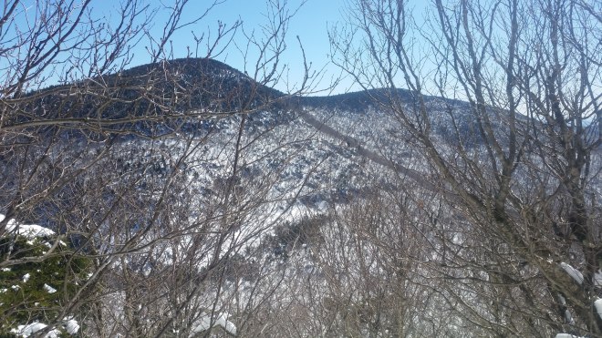
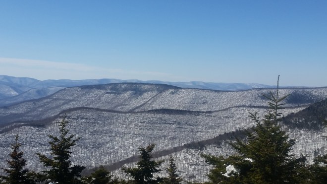
The climb to Twin is steep, but uneventful, we just take lots of little steps, like working out on a stairmaster. From the western summit, we admire an array of distant Catskill peaks, not only Slide, the area’s tallest mountain, but the less prominent western peaks, like Balsam, Eagle, Doubletop, Graham, and Balsam Lake. The March sun beams down, a little haze is smeared along the horizon, but otherwise the sky is clear.
On the descent the trail returns us to the north side of the ridge, and here the snow is still powdery: we hop and jump our way down, sometimes tilting back on heels and sliding for a few feet before snowshoe cleats snag on hidden root or rock — for someone with aging knees and ankles this isn’t the preferred mode of travel — but I’m cheered when we pass a hiker who’s elected to scoot down on her butt (which means I’m not the slowest person on the mountain today) — and a little later we’re doing the same.
On the drive out, sunlight floods the mountains, and for all the deep drifts on the mountain slopes, the valley floors are almost clear. I reflect on the fickleness of early March weather, and then consider the wide variability of my own experiences over the last two weeks. But why should I be surprised that my feelings churn and blow — am I not composed largely of water and animated by sun? How different is that from the clouds?
Running the Long Path is available on Amazon (Click on the image to check it out)

[…] March started out on a difficult note with four different snowstorms — which left me slogging through deep drifts, sinking up to the knees in fresh powder, toiling upwards one step at a time — just miserable hard work. On one hike, I’d set out to climb four peaks but completed only one, which put me behind schedule. As month-end began to draw near, there were seven peaks left — a feasible load — but then conference calls and meetings popped up unplanned for, and time started to get tight. Now there would be little room for error, especially when the longest, toughest hike was left for the last day of the month…. […]
LikeLike
[…] such as that surprising warm spell in February, which was followed by four snowstorms in March. A wave of warmth is poised to break upon the mountains, just not quite […]
LikeLike