The goal was to thru-hike all 35 of the Catskill Mountains’ high peaks, i.e., those at least 3500 feet in elevation, and if possible set a new fastest known time. The records were:
- 2 days 15 hours held by Ted “Cave Dog” Keizer on a supported basis
- 4 days 13 hours held by Jan Wellford and Cory Delavine on an unsupported basis
Based on data from Keizer’s website, the route is 133 miles long starting from the top of Peekamoose (or 137 from the base) and includes 37,000 feet of cumulative elevation gain (39,000 feet if you count the hike up Peekamoose).
I had heard about Keizer’s record two years ago. Ever since then, I’d been training for an attempt on the 35 thru-hike, and finally I felt ready to give it a go.
Smiley’s taxi of Tannersville, NY dropped me off at the Peekamoose trailhead at approximately 8 AM on Tuesday, August 23, 2016. Two and one-half days later, around midnight on Thursday, August 25, 2016, I ended the attempt, having completed 23 of the 35 high peaks.
The following is a summit-by-summit account.
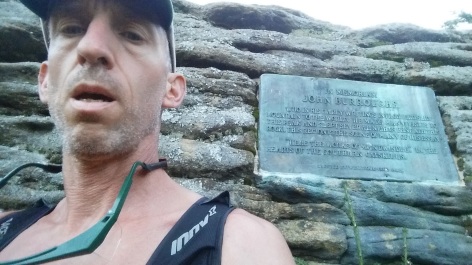
- Peekamoose
At 8:14 AM on Tuesday, August 26, 2016, I pushed the start button on my GPS watch and activated my SPOT personal locator beacon (which would broadcast my location for those tracking my progress online).
It felt auspicious to start this adventure at Peekamoose, a mountain I’ve climbed so many times I could almost tell you from memory every twist and turn in the trail.
There was a long way to go, so I started up the trail at an easy pace. The sun hung low on the horizon, and light streamed through the forest horizontally, painting stripes across the path and speckling the foliage. Large maple, ash, and cherry trees lined the path, or so I guessed from their bark, as the trunks soared so high into the forest canopy that the leaves could not be seen. A chipping sparrow twittered briefly, otherwise it was silent.
Half-way up, I passed an erratic boulder perched on a stone slab, flanked by yellow birch and black cherry; around the corner stood a solitary fir tree. Then it was up another 750 feet and into the boreal or northern forest environment, where fir and spruce dominate and everything is covered in moss and lichen.
The summit is marked by another erratic, a large triangular block of sandstone conglomerate. It was now 9:59 AM. So far, so good: I had covered 3.9 miles at an average pace of 2.2 miles per hour, while climbing 2,300 feet in elevation. I paused to write down the time in my notebook, push the lap button on my watch, and send a signal from the SPOT.
2. Table
Table lies just around the corner from Peekamoose, at roughly the same elevation, the two peaks forming a level ridge interrupted by a 200-foot notch. I descended into the notch down a dirt slope scattered with fragments of shale. At the low point in the notch, the path was covered with white pebbles and the endless debris of the boreal forest: dried fir needles, twigs, and broken branches.
Bounding up the notch’s far side, I arrived at the small cairn of rocks that marks the summit of Table at 10:21 AM.
3. Lone
Backtracking a quarter-mile on the path, I turned into the woods. Lone lay only a mile away, but now things would get interesting because there’s no trail to Lone’s summit.
I was angling for the saddle below Lone, which should be the best point from which to ascend the summit, and since the forest is too thick to see where you’re going, I’d plotted out the following magnetic azimuths: 47 degrees magnetic for 0.1 miles, then 356 degrees for 0.3 miles. Compass in hand, I dropped down a steep slope, stepping through a miniature forest of shining club moss and threading my way between close-growing fir trees.
After a few minutes, however, something didn’t feel right. My azimuths were supposed to keep me on top of the ridge, which would offer the best footing and take me straight down to the saddle. But instead of the ground dropping off in both directions, the defining topology of a ridge, the terrain was now rising above my right shoulder. Pausing to check location on my GPS, I saw I’d fallen off course and was at risk of missing the saddle and worse, dropping down into a very steep draw. To get back on course, I turned to the right and fought my way back uphill — not a huge mistake, but it cost me time and effort.
The leg from the saddle to Lone went more smoothly. Generally when aiming for the summit, you can put away compass and just keep moving upwards; the laws of geometry will guide you to the highest point. I arrived at 11:30 AM, my pace for this leg having slowed to 0.7 miles per hour.
4. Rocky
Rocky lies just a mile from Lone, and it would be the morning’s second bushwhack. However, as I stood on the summit of Lone with compass in hand, I noticed an unmarked path that seemed to lead in the right direction. As the popularity of hiking in the Catskills has soared in recent years, the passage of hikers along similar bushwhack routes has sometimes created “herd paths” or “social trails.” Sometimes the path is obvious from trodden dirt, while at other times your only clue might be a bent frond in a glade of ferns. But if you’ve found one, a social trail can save you a lot of time and effort compared to fighting your way through thick vegetation and constantly checking compass and GPS.
The only problem with social trails is that they don’t necessarily go where you want. I took off at a fast pace on the trail off Lone, delighted to be speeding along, but after a few minutes, pausing to check location on the GPS I found to my dismay the path was turning north into the Neversink river valley, not northeast toward Rocky. I had gone downhill about 0.1 miles too far, which may not sound like a lot, but once again I had to fight my way back uphill to the saddle. I imagined a race car driver entering a turn late, missing the apex, sliding wide, losing momentum, and exiting at a disappointingly slow speed.
Near the summit of Rocky, a number of trees had been flattened by high winds, and now staring down at me through the break was the face of Slide mountain, the Catskill’s highest peak. The mountain’s profile forms a large but asymmetric dome, with the east side sloping down at a steeper angle. Later this afternoon, I hoped to be inching my way up the scrambles, steps, and ladders on that steeper eastern side.
I made it to Rocky at 12:24 PM. Hanging from a tree was a trekking pole which someone must have lost.
5. Balsam Cap
Balsam Cap gets its name because the summit is covered by dense thickets of balsam fir, which can be nightmarish to move through. Where young trees grow close together, their interlacing branches block movement and make it difficult to see obstacles in the woods. There’s nothing worse than climbing over a pile of dead logs with fir branches slapping you in the face.
Henry David Thoreau encountered a similar boreal fir-spruce forest during his visit to Maine. Upon his arrival, he wrote he was “exhilarated by the sight of the wild fir and spruce tops, and those of other primitive evergreens, peering through the mist in the horizon.” Once he got into the forests, he discovered how difficult it is to move through the “shaggy demon vegetation.”
With practice, one learns to reach out and move the thickest branches out of the way. Fresh green fir branches are flexible and the needles are cool and soft. As you move by, it’s like the trees are reaching out to stroke you, as if they were curious to feel the visitor slinking through their midst. Often, however, the fresh green branches are high up in the sunlight, whereas down in the shadows the branches are dried and broken. These dead branches seemingly resent the presence of the living and reach out to scratch and poke you — you may be able to snap some of them off, but otherwise you move cautiously around them — especially if, like me, you don’t wear a shirt when it’s warm.
There were other obstacles in the woods. Spiders were busy spinning webs among the branches, and I was constant brushing their filaments off my hat and shoulders.
The forest floor was a sea of brown: broken branches, bark, twigs, dry needles — but breaking up the monotony were fresh fungi emerging from the ground in a variety of bright colors: yellow, orange, tan, red, brown, white.
I arrived at the summit at 1:24 PM, the 1.1 mile journey taking exactly an hour, a somewhat more respectable pace.

6. Friday
Bushwhacking is mentally demanding: you’ve got to continually scan ahead for obstacles, push branches out of the way, step carefully, follow your compass heading, constantly check the GPS. After awhile, it becomes wearisome. The hike to Friday would be the morning’s fourth bushwhack, and the fifth would be on to Cornell. I took a sip from one of my water bottles, my first drink since breakfast six hours earlier. There was a spring to resupply water near the summit of Slide, but that was still several miles away.
One of the keys to bushwhacking is avoiding traps. For example, violent weather may blow down several trees on top of each other, creating a V-shaped tangle of deadfall. Once you stumble into one of these traps, you’re faced with the choice of climbing over the downed trees, or backtracking. On the way to Friday, I got trapped, but while I was pondering which way to go, I noticed that the rotten logs were covered in British redcoats, a fruticose lichen in the cladonia family consisting of tiny green stalks about 1/4″ tall with bright red dots on the tips. They’re so small, you’d never notice them unless you knew what to look for.

Another common obstacle on the bushwhacks are rock outcroppings. The summit of Friday is ringed with a wall of cliffs; on past visits, I’d found a gap in the cliff walls with a climbable dirt slope. This time I looked at the rock wall and noticed a birch root just above my head. Grabbing on, I pulled myself up, feet scrambling for traction against the moss-covered rock face. It wasn’t graceful, but it was quicker than searching for the gap.
As I arrived at the summit, a rabbit hopped away through the woods. In the distance, a bird was making a nasal squawking call: yank yank yank. The sky was clear, and through an opening in the forest, the next two destinations, Cornell and Wittenberg, beckoned to the northeast.
7. Cornell
Descending from Friday, I walked over ground covered in grass and sphagnum moss, in the midst of which there lay moldering a NY Yankees baseball cap. Then it was into a surprisingly dense thicket of fir saplings, growing so closely together I couldn’t get through without breaking off dead branches. This tried my patience sorely, but after a few minutes I emerged into thickets that were somewhat less congested.
The navigation from Friday to Cornell isn’t difficult: you follow a line of precipices on the eastern side of the ridge until you get close to Cornell, at which point you stick to the compass heading and make a bee-line for the trail. The last few steps are demoralizing: you’re squeezing between fir trees, past boulders, over logs, wondering where is that trail?
And finally — there was the trail! What a relief to be done with the bushwhacking — at least for a little while. A steep scramble up and around a rock ledge led to the summit of Cornell. It was now 3:56 PM.
8. Wittenberg
Wittenberg is just a short 0.85-mile jaunt from Cornell along the spine of a narrow ridge. On the descent from Cornell, you pass through a fissure in a sandstone ledge called the “Cornell Crack.” You have to jam your feet into the crack and exercise care; while the exposure is only 5 or 10 feet, slipping and tumbling down to the base would be painful.
Wittenberg’s summit is graced with a broad ledge offering an expansive vista to the south. I arrived at 4:19 PM and immediately sat down and took off shoes and socks and shook out a bunch of fir needles. Then I sat back and started eating some of the home-made pemmican I had brought along as the primary source of nutrition.
There were two other hikers taking a break on Wittenberg. They were French, they told me, and this was their first time in the Catskills. They wanted to learn more about the 3500 club, which awards membership to those who summit all 35 high peaks (you can take as long as you want, you don’t have to thru-hike them at once).
A little bird hopped out on the rocks for a moment and then flitted off, but not before I noticed distinctive white and black stripes across its face. When I got back home, I discovered it was the red-breasted nuthatch, the bird whose call I had earlier heard echoing in the forest: yank yank yank.

9. Slide
From Wittenberg, I backtracked past Cornell on the way to Slide, and this meant I got to experience the Cornell Crack for a second time. It was great to be moving quickly along a trail, but having eaten a lot of pemmican, I felt drowsy.
Upon arriving at the base of Slide, I took off my pack to unstrap my trekking poles. I had used them on the hike up Peekamoose, but then put them away for the bushwhack, where I needed hands free to hold compass and push fir branches out of the way. With a 900-foot climb to the top of Slide, the poles would help me utilize a little upper body strength to supplement leg power. Unfortunately, one of the poles was missing. It must have come off on the Cornell Crack, I reasoned, or during the scramble down from Cornell.
Keep going with one pole, or turn back and fetch the missing one? I hated to waste time and energy backtracking, but at the same time, it wasn’t a good habit to abandon equipment. I dropped my pack by the side of the trail and rushed back to Cornell, keeping a sharp lookout for the missing pole, which might have fallen out anywhere.
I’d returned almost all the way to Wittenberg before it occurred to me that the pole had most likely fallen off during the bushwhacks. Maybe it was now lying on the ground next to the NY Yankees cap I’d seen, or maybe someone would find it and hang it up on a tree like the pole at the summit of Rocky.
I gave up, returned through the Cornell Crack (for the fourth time!), picked up my pack, and trudged on. The trail proceeded through a forest of yellow birch. I smelled smoke and then a little later caught a glimpse through the trees of some hikers standing around a campfire. Then it was up that steep eastern side of Slide, with the path taking me up four or five scrambles, a series of stone steps, and a pair of stout wooden ladders bolted to the side of the mountain. Just below the summit, I stopped at a spring by the side of the trail to filter fresh water, refill my bottles, and drink. I’d gotten by with a single liter of water all day, and that wasn’t enough.
I arrived at the summit of Slide at 7:26 PM.
10. Panther
The downhill path from Slide started smooth and then turned rocky. The sun set with a tinge of orange along the horizon. After a couple of miles and a 1,500-foot descent, a paved road was waiting to take me north, and I marched purposefully in the darkness, a solitary tree cricket calling on the left, and the waters of the Neversink cascading on the right.

I passed a group of cabins whose lights shone on the surface of a small lake, then turned off the pavement and back onto a path. The trail to Panther is covered for much of its length with large flat rocks that keep the hiker out of the mud, and I skipped along at a good pace until the final 700-foot ascent to the summit, where the path winds first along the western edge of the ridge and then crosses over to the eastern side, before finally reaching the top.
I arrived at the summit at 10:42 PM, having having covered 7.5 miles at an average 2.3 MPH pace, thanks to the downhill and road sections. I recalled how once I had found Tibetan prayer flags strung out on Panther’s summit. Now a soft wind stirred the trees, with a rhythm to the gusts like waves at the shore. Woodland Valley lay below me in the darkness devoid of even a single light.
11. Fir
It was going to take a long time to reach Fir. The first step was to backtrack a mile along the trail; then I’d bushwhack straight down the side of the mountain, walk along the paved road again, and enter the woods for another bushwhack to the top.
As I stepped off on the first bushwhack, I was happy to find the terrain relatively open. The beam of the flashlight played across huge trees, some four feet in diameter; this was likely first growth forest that has never been disturbed. At my feet, a mouse flung itself from rock to rock, desperate to get out of my way.
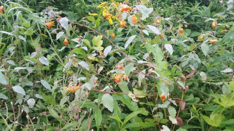
I heard a car passing along the road, and soon I was out of the woods and marching on the pavement once again. In the beam of the flashlight, certain of the plants along the side of the road seemed to glow in the dark. I believe this was the orange jewelweed, whose leaves have a water-repelling property that causes moisture to bead up producing a silvery effect.
It was time to turn off the paved road and begin the long bushwhack to the top of Fir, 1.7 miles away and almost 2,000 feet above me. After crossing the Esopus Creek and scrambling up the bank, I was relieved to find the forest was relatively open and the terrain was, at least initially, pretty level. The flashlight caught a large toad sitting motionless, a spider waiting in its web, and clumps of white coral-like fungus growing on the ground.

But soon enough, the grade steepened. At the worst point, there was a 500-foot climb in just over a quarter of a mile, equivalent to an average grade of 39%. The vegetation thickened, with endless tangles of hobblebush and beech saplings, the ground was covered with deadfall and loose stones, and slope was broken up with huge slabs of sandstone. I was veering a little bit right of the azimuth in order to avoid an even steeper section with an average grade in excess of 50%.
When I finally reached the top of the ridge, it led me straight to Fir’s summit, where I arrived at 4:02 AM, five hours after leaving Panther and almost 20 hours after starting out.
12. Big Indian
Coming down from Fir I struggled through a patch of monstrous hobble-bush that reached 8 feet high in places and was mixed with prickly berry canes. I was aiming for a narrow saddle that connects Fir to Big Indian, but ended up just a little south. It suddenly seemed like my light was shining onto a body of water. When I blinked and looked again, I saw that I was standing on top of a precipice and the light was shining off into space.

I picked my way down from the rock ledge, slow work in the dark, and then I needed to climb back up to the saddle. By the time I was back on course, it was dawn, and where the rising sun found its way through gaps in the forest, it speckled tree trunks and bushes with splotches of neon red.

13. Double Top
The bushwhack to Doubletop was uneventful. I had recently hiked this route barefoot (indeed, over the last year, I’d hiked all 35 high peaks barefoot) and found the route a straightforward walk along the ridgeline. To be sure, there are the ever-present beech thickets, whose stout, horizontally-spreading branches impede progress, but saplings are flexible and until the trees grow more substantial their branches are easily pushed out of the way. These thickets seem to result from beech bark disease, an affliction in which an insect penetrates the bark leaving wounds through which fungus enters and kill the tree. Sensing its impending doom, the tree sends out suckers in all directions, creating a thicket of saplings.
I pushed my way through thickets and passed a small bog, and then was struggling up the steep part of the ridge. The boreal environment on the top of Doubletop was drier than last time I was here, but the trees were still festooned with old man beard’s lichen and ghost antler lichen, and I found the top without issue at 6:27 am.
14. Graham
I was dreading the steep divide between Doubletop and Graham. When I saw what appeared to be a social trail leading in the right direction, I took the chance and followed it, but almost immediately the path veered to the west and then disappeared, leaving me stranded at the top of a 500-foot descent with a 50% grade. This was exactly what I’d hoped to avoid, but there was no way I was going to climb back up to the summit, so instead I started downwards one tentative step at a time. The loose rocks were untrustworthy: they slid down the slope under the slightest pressure, so I clung to one small tree and lowered myself down to the next, giving each one a test yank to make sure it’d hold my weight.
There was a second very steep section on the way down, and by the time I reached the saddle, my head was reeling, and the 700-foot climb to the top of Graham came almost as a relief. Graham’s summit was covered in a chest-high tangle of hobble-bush and prickly berry canes that threatened to catch clothing and scratch bare skin. Having taken off my shirt as the morning warmed up, I moved through these tangles gingerly, scanning for the old TV antenna that marks the top of the mountain, which I finally found at 10: 42 AM.
It was a beautiful clear morning, but there were a lot of flies on the summit and they took an interest in my presence. They didn’t bite, but they hounded me off the summit before I could eat, drink, or rest.
15. Balsam Lake
An old forest road leads down from Graham, and it was a huge relief to be done with the bushwhacking and heading downhill, too, but even so, my energy was fading. I’d now been on the move for more than 24 hours without any sleep, and eaten less than a pound of pemmican and a couple of chocolate bars. Suddenly feeling exhausted, I sat down on the trail. I nibbled on a chocolate bar and took a sip of water. My water bottles were once again almost empty, and the next stream was still several miles off.
As I sat on the ground, feeling tired and thirsty, I began for the first time to question my purpose in undertaking this quest. Why was I out here? My thoughts began to clarify: what I really enjoyed was running fast, spending time with friends, and exploring nature. Maybe the 35 thru-hike wasn’t such a good idea.
I was slouched over, trying to force down another square of chocolate, and feeling a little down in the dumps, when a runner appeared. We exchanged greetings, he gave me a funny look, and then went bounding up the trail towards Graham, trekking poles in hand (the same as mine, but he still had two). He looked familiar, but I couldn’t place him.
I struggled off toward Balsam Lake and when I reached the trail junction, the last 0.75 miles took forever. At the summit, I took off my pack and forced down some pemmican, but now I was also struggling with cramps, which bothered me when I sat down.
16. Eagle
On the way down from Balsam Lake, I met the same runner again, this time with his wife and a couple of friends. I introduced myself and now I recognized him as Mike Siudy, one of the most proficient mountain runners in the northeast. In addition to blistering fast times at local trail races like the Escarpment Trail Run, Mike also holds the fastest known time for the Catskills 9, which is a circuit consisting of the first nine peaks I had summitted the morning before. Not only is Mike much faster than I on the trails, his speed on the bushwhacks is nothing short of astonishing.
I told Mike I couldn’t understand how he moved so fast off trail. He replied that there are one or two good routes for each bushwhack, but a multitude of bad routes. And then he revealed that he’s spent a lot of time practicing, in fact, just today he was finishing up a special project during which he had run all 35 of the high peaks during every single month of the last year. In my eyes, Mike’s a master of his craft, a force of nature, a running spirit, and I was greatly cheered by this encounter. I would never be as fast as Mike, but that didn’t matter, I could take pleasure in recognizing his accomplishments.
I said goodbye to Mike and his friends and headed off in search of an unmaintained forest road that would take me down into the valley. I had been here once before and knew this road would be a challenge. There was no sign of it at first. Then it became visible only to the extent that it was a flat surface, but so overgrown by beech saplings as to be virtually impassable. A few steps later, it was washed out, a channel in the ground full of tumbled rocks and choked with downed trees. Eventually the road reached a grove of hemlocks, where it was easier going, and then left me by a stream and a paved road.
From here it was a short walk to the Seager trailhead and then 2 miles along the Shandaken creek to a lean-to in a clearing. Having run out of water, I stopped several times along the way to filter from the creek and drink up. And now what a joy to sit down in the lean-to and take off shoes and socks. I hooked up watch and phone to power chargers and turned the SPOT off to conserve batteries. I ate some more pemmican and lay down on the wooden floor, trying to avoid positions that would trigger cramps, and gave myself permission to sleep for an hour and a half.
An hour and a half later, I woke up and moved out. The climb to Eagle was uneventful. The sun sank in the sky, and as I rose in elevation the wind gusted more forcefully through the trees.
17. Balsam
The next leg was 3 miles along the trail. I recalled discovering knight’s plume moss on a prior visit here, and sure enough, I found the same spot and admired the distinctive diamond-shaped plumes, which look like feathers in a knight’s helmet. On the climb up to Balsam, there’s a large rock whose underside is spattered with a chrome-green crustose lichen that shines brightly when wet. I saw it again on the way up, but still haven’t been able to identify it.
I got to Balsam at 8:19 pm, sweating from the uphill climb.

18. Halcott
It was going to take a long time to get to Halcott. There were miles of trails, roads, and then a bushwhack to the top. The map showed another lean-to in about 3 miles, and I decided another break was warranted before taking on this journey. As I walked along the trail, the temperature was dropping, and I could see my breath in the headlamp’s light. When I reached the lean-to, I bundled up in long-sleeved shirt and goretex jacket and lay down for a few minutes of rest.
But now that I was no longer moving, it was cold. I tried curling up more tightly to conserve warmth, but the contorted position brought on cramps; then I pulled my arms out of shirt and jacket sleeves and wrapped them around my chest, which helped, but I couldn’t sleep, it was too cold. I moved out again.
It was a nice trail, broad and smooth, an old logging road, perhaps, but for once it wasn’t washed out and covered in loose rocks. It went downhill for a long time. The tiny hamlet of Pine Hill lies some 2,000 feet below Balsam’s peak, and as I came down off the mountain, I could feel the temperature dropping further and the air becoming dank. Windshields on parked cars were covered in dew. I could hear the waters of Birch Creek rushing through a channel in the middle of town.
A paved road followed Birch Creek up and out of town and to the base of Halcott, where once again it was time to enter the woods. The bushwhack went well. I knew of a dirt road that leads almost half-way to the summit. Moving through the woods, I marveled at toads, spider webs, and coral-like fungus gleaming in the flashlight’s beam. It was 4:42 AM when I arrived at the summit.

19. Bearpen
The bushwhack up Halcott may have gone smoothly, but getting down was an ordeal. I had meant to follow the top of the ridge, even if that meant going off of the magnetic azimuth, but in the darkness I found myself wandering back and forth from one side of the ridge to the other, whereupon I decided to follow the compass heading more closely. But this took me off one side of the ridge and left me exactly in the position I had hoped to avoid, that of moving laterally across the side of a hill. My feet and hips were soon aching from the slanted terrain, and of course there were plenty of beech thickets and rotten logs to cross, and each misstep risked plunging me further into the valley where the footing was likely to be even worse. I was starting to lose my cool.
But eventually the downhill came to an end at a stream where I quickly filled my water bottles. State land ended about 0.1 mile short of a paved road, and I peered around for access to the road that wouldn’t take me strolling through someone’s back yard.
And now it was time for several miles on paved roads, starting off on a steep downhill grade which soon had my thighs aching, but I kept up a steady march. Meanwhile, I was struck by the profusion of plants growing on the side of the road. There were blackberry canes full of ripe fruit, which I helped myself to every time I passed them. Mixed in with these were goldenrod, blue asters, more orange jewelweed, and lots of ferns, including shoulder-high clusters of interrupted fern and clumps of shorter sensitive fern, some of it fresh green and others already turning black from the cold.
The climb up Bearpen was uneventful. There’s a shortcut to the summit and this narrow path took me through a profusion of blackberries, the canes arching across the trail, the fruits dancing in front of my face. The home-made pemmican and dark chocolate bars were high in fat, with virtually no carbohydrates, and while that mix of nutrients was by design, perhaps it was a little too extreme, as I was finding the blackberries really hit the spot, and I kept stopping to eat more.


I arrived at the summit of Bearpen, which is marked by a small pile of rocks, at 10:01 AM.
So surely as we stepped out of the canoe and stretched our legs we found ourselves in a blueberry and raspberry garden, each side of our rocky trail around the falls being lined with one or both. There was not a carry on the main East Branch where we did not find an abundance of both these berries, for these were the rockiest places, and partially cleared, such as these plants prefer, and there had been none to gather the finest before us. In our three journeys over the carries, — for we were obliged to go over the ground three times whenever the canoe was taken out, — we did full justice to the berries, and they were just what we wanted to correct the effect of our hard bread and pork diet. Another name for making a portage would have been going a-berrying.
— Henry David Thoreau, The Maine Woods
20. Vly
Back down the trail toward Vly, I encountered a couple hiking with a clean white dog. When the dog saw me, he came running up and then abruptly lay down and rolled in the mud.
Arriving at the saddle below Vly, I felt tired, which was excusable, as I’d been on the move now for over 48 hours, with a total of only 2 hours or so of sleep. Sitting down, I ate a little bit of pemmican, and as I chewed, I visualized my favorite meats: bone-in ribeye, chicken thighs, grilled salmon steaks. This helped a little, but the fact is my home-made pemmican is unappetizing even in the best of times (perhaps I mix in too much fat), and now my stomach was indicating it’d had enough. I lay down on a rock and closed my eyes for ten minutes, then began struggling up the unofficial but well-marked path to Vly.
The summit of Vly was covered by the most extraordinary profusion of blackberries I had seen yet. I ate another handful before moving on.
21. Sherrill
From Vly to the next mountain was another long route consisting of multiple bushwhacks linked by paved roads. I started out moving east across the summit and then turned south and dropped down a spur where I knew from a previous visit that a forest path was waiting. In fact, I’d marked on my GPS the full extent of the route down to the paved road, which was going to save me a lot of time compared to moving straight through the forest.
For the first mile, the path was wide and grassy. I came upon a black bear, who looked up at me and then moved off into the woods. Then the path disappeared. I followed the marks on my GPS and it reappeared, but now it was in bad shape, eroded, choked with fallen trees, overgrown with saplings. I struggled to stay on course in a couple of places, but eventually found a grassy forest road dotted with waist-high queen anne’s lace. Then I was on the pavement once again, walking downhill, legs aching, while spread out before me lay the West Kill valley with the next set of mountains on my route looming in the distance, shrouded in clouds. A flock of wild turkeys was picking their way across an immense field, and then a bald eagle dropped from a tree limb and flew off to the south.

Passing through the small collection of houses and post office that constitutes West Kill, I reached DEC land and turned into the woods for the ascent of Sherrill. My route-finding went exactly according to plan: I moved uphill through a grove of hemlocks and then followed the ridge to the summit, avoiding the worst sections of steep and slanted terrain. It was 3:54 PM.
22. North Dome
A well-trodden social trail took me from Sherrill’s summit down into to the saddle before North Dome, at which point I lost it. But the climb wasn’t problematic. As I reached the summit, it started to rain. The sprinkle of cool drops across my face and chest felt good after climbing — although I knew if the rain kept up, I’d get drenched and cold.
23. West Kill
I followed a compass heading down from North Dome, aiming to intersect the Devil’s Path, which would take me to the summit of West Kill. The slope was very steep, with rows of rock ledges, some 30 feet high, painted with green, brown, grey, and white lichen. As the rain continued, moss-covered rocks and rotting logs became even more slippery.

After the rock ledges, the slope leveled out and the forest was relatively open, but the ground was covered with an ocean of stinging nettles that spread in every direction as far as I could see. But for an occasional tingle on the legs, my pants did a good job protecting me, but I stepped very carefully, as the nettle hid slippery rocks and logs, and I didn’t want to slip and fall and land in the nettles with bare arms and chest exposed to the needle-like toxin-filled hairs covering their leaves and stems. I did slip once and caught myself, but my hand went straight into a nettle and stung for a few minutes after.

With great relief, I finally reached the trail and turned my back on the sea of nettles, and for the first few minutes, I felt energetic, practically rocketing up to the top of West Kill, only to discover that this wasn’t the summit, but only a bump in the ridge called St. Anne’s Peak about half-way there. Things immediately became difficult. It was dark, everything was wet, and the trail had morphed into a demonic roller coaster of ups and downs. As I marched along, my single trekking pole clutched in one hand, I thought I heard music playing in the background. This was, I think, my tired brain doing the best it could to interpret the forest noises.
I reached West Kill at 9:37 PM. I had now been on the move for 61 hours.
24. The end
From West Kill, the trail drops down into the Spruceton trailhead. I moved along slowly, assessing the situation. My energy was low. I needed food and sleep. There was a lean-to half-way up Hunter Mountain, but before I’d get there, I needed to climb Rusk Mountain, the last bushwhack of the high peaks. I stopped on the trail to give this some thought. Bushwhacking in the dark is always a challenge, but now it was wet and could get cold. Rusk wasn’t a long bushwhack, but there was a 1,500-foot climb and it was steep in places.
For now, I decided, there was nothing to do but stay on the trail to Spruceton, so long as the fellow with the single trekking pole could keep moving — and then with a start I realized that fellow was I.
I tried to eat some more pemmican, but my stomach wouldn’t listen to me, no matter how much I pretended it was steak or salmon. No mas, it commanded, and there was no arguing.
I stumbled around a large rock ledge and momentarily lost the trail. Backtracking, I found the trail again, but became concerned that I might’ve gotten turned-around. Consulting the GPS, I found this was the case. I turned around once again and kept moving, that part of myself that felt in charge taking the lead, and the fellow with the single pole keeping up as best he could, while weird music played in the background.
When I finally reached Spruceton, the decision was made. I was not feeling up to a cold, dark, wet bushwhack. I needed rest and nutrition. I looked around for a place to lie down, but the parking lot was covered in gravel, and the bushes didn’t look inviting. My options seemed to be to walk to West Kill and sleep on the porch of the Post Office, or head back on the trail to Hunter Mountain and sleep in one of the lean-to’s. This seemed like a better option, as it would put me close to Devil’s Tombstone campground, where the caretaker could call a taxi (there being no cell service in any of these locations).
When I reached the lean-to, it was occupied. I continued on, making a wrong turn at one trail junction, which I caught after almost a mile, then stumbling downhill along a devilishly steep trail, taking breaks every few minutes to close my eyes. I arrived at Devil’s Tombstone campground around dawn and tried sleeping on a picnic table, but was discovered by mosquitoes. When my watch finally showed 8:00 AM, I went off in search of the caretaker and got my ride out, exactly three days after my start.
Looking back, there are several lessons, but the most important one, I think, was that I was trying to go too light.
During one of his trips to Maine, Thoreau was impressed by his guide Joe Polis, a native Penobscot Indian. When he first met Polis, Thoreau noticed that “all the baggage he had, beside his axe and gun, was a blanket, which he brought loose in his hand.” At the end of their week-long trip. Thoreau summed up his respect for the Indian’s woodcraft by citing this question and answer:
I asked Polis if he was not glad to get home again; but there was no relenting to his wildness, and he said, “It makes no difference to me where I am.”
— Henry David Thoreau, The Maine Woods
This quotation had inspired me during the attempted thru-hike. At several points during the quest, I had told myself, “it makes no difference where I am,” by which I meant that being out on the trail, no matter how far I had to go, was just as good a place to be as anywhere else.
But the reality is, I wasn’t prepared to lie down on the wet ground and sleep in the cold. Arriving at Spruceton was in some ways like getting caught in a V-shaped tangle in the thickets — I had to go to great lengths to extract myself. If I’d been able to rest and refuel in place, I’d have been able to keep moving and probably would’ve had a shot at completing the remaining 12 within a reasonable time.
The next window for me to attempt the 35 thru-hike will be May 2017, and if I make another go at it, I’ll include the following modifications to my plan:
- My nutrition will include some carbohydrates as well as fat, and a greater variety of items
- I’ll carry a light-weight tarp and ground cloth so that I can rest in place almost anywhere, without needing to hold out for the next available lean-to
- Additional warm gear will help me get rest even if it’s cold and wet
- With an understanding of which bushwhacks gave me trouble, I’ll do some additional reconnaissance to figure out better routes

Thanks for the excellent accounting of your ambitious adventure, Ken. It was a tremendous undertaking, and you accomplished a lot of it.
LikeLike
[…] bushwhack from Peekamoose to Lone Mountain, so that I can improve my time when I next attempt the Catskill 35, as well as experience the sights and sounds of a beautiful late summer […]
LikeLike
[…] pass the parking lot where my attempt to thru-hike all 35 high peaks ended prematurely last August, then head up the long dirt road toward Hunter Mountain’s peak. […]
LikeLike
[…] Soon we were at the summit. Three cheers for Amy and Ken! We’d successfully completed our first winter bushwhack. But the day was still young, and we had a long way to go. The next objective, Big Indian, would require precision navigation: any misstep and we’d miss the turn onto a narrow ridge and risk getting sucked down into deep valleys on either side, a costly error I’d made last summer when attempting to thru-hike all 35 of the Catskill high peaks. […]
LikeLike
[…] 35 high peaks last August. I’d made it two days, covered ninety miles, and climbed 23 of the 35 peaks on very little food, water, or sleep, before running out of steam. But today everything was […]
LikeLike
[…] Which brings me back to the Grid, which is the goal of climbing all 35 of the Catskills’ high peaks in every calendar month. Heading into August, I was in pretty good shape, with 27 done and only 8 left to go, thanks in large part to my August 2016 attempt to thru-hike the entire 35. […]
LikeLike
[…] entails a difficult bushwhack across a steep divide; most recently in August 2016 as part of an aborted attempt to thru-hike the 35, and once the year […]
LikeLike
[…] off course, and from which escape is difficult. I know this because I missed the turn during my attempt at thru-hiking the Catskills 35, and as a result it took me all night to get from Fir to Big […]
LikeLike
[…] canes sticking out of the snow (but how many berries I’d eaten in August 2016 when trying to thru-hike the 35!). I also recall my first barefoot hike on Bearpen, when I’d gotten confused about the […]
LikeLike
[…] list and then its neighbor Table. (This would leave 33 more peaks to climb, since my goal was to thru-run all 35 of the Catskill High Peaks in one circuit.) I paused for just a moment and jotted down an observation about the zebra […]
LikeLike